Hacking on mobile apps with the London crowd

posted in: Observations | 0

The OpenStreetMap London hack weekend also saw Jo Walsh working on the first stage of a building details editor for Android.

Jo, who goes by the OSM user name zool, has written up her experience of working with Android:

I worked on a mobile app which I was pleased to get into a basically working state. It is called osmbi3, which stands for OpenStreetMap Building Information and/or Zombies. The aim was to geolocate the user and find nearby buildings using an Overpass query. This could then be linked to building management information or form the basis for some location-based game.

Read the rest of Jo’s article here. Want to catch up in person? How about a return visit, and whilst you’re there you can always attend State of the Map Scotland!

Hacking on Taginfo

posted in: Observations | 0

We recently blogged about the OpenStreetMap hack weekend in London. In that post we wrote about how Jochen Topf & Harry Wood worked on integrating TagInfo into the OpenStreetMap Wiki. They built a solution to auto-populate the wiki with data from TagInfo based on a Taglists template.

Over to Jochen to explain more:

The recent London OSM hack weekend gave me the incentive to work on taginfo once more and we got quite a few things done on the weekend and the days after. Taginfo now works better on mobile, is faster and we have a very cool tag list feature for the wiki. Lets look at these in turn…

You can continue to read this over on Jochen’s blog.

It was great chatting to Jochen and Harry about the potential of this to help keep our wiki up to date and accurate. If you have any comments or suggested improvements feel free to post them below and we will ensure they get passed on.

A visit to view one of the Sheldon Tapestry Maps

posted in: Observations | 1

Friday saw me on a family visit to Oxford to view the Sheldon Tapestry Map of Worcestershire hanging in the Weston Library (part of the Bodleian Library). It is a magnificent spectacle, being woven in silk and wool, and standing some 4m tall by 6m wide. Although it is assumed that it was woven in Warwickshire at Barcheston, current research throws doubt on this.

The Bodleian Library Map Room is the second largest in the UK and is one of the world’s top ten map collections – so it’s a must-visit for any map  lover.

The tapestry on display is one of  four tapestry-woven maps commissioned in the sixteenth century by Ralph Sheldon, a prominent Midlands landowner, based on the county surveys of Christopher Saxton. Each  tapestry illustrates one of the counties of  Gloucestershire, Worcestershire, Warwickshire and Oxfordshire.  They would have formed a panoramic view of Sheldon’s land when hung in his home in Weston near Long Compton, Warwickshire. The maps are an  important stage in the evolution of cartography.

This tapestry survives in parts only: in fact the only complete one is that of Warwickshire which hangs in the Market Hall Museum in Warwick. You can see what was involved in restoring the tapestry here.

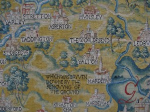
There is an intriguing reference to  an area “whych was dryven downe by the removying of the land” close to a placename of The Worldes End.  The Guardian had a good piece about the tapestry , although the mystery of the “removying of the ground” seems to have been solved – apparently it was a massive landslide.

IMG_0941

If  you want an in-depth view of the tapestries see this scholarly article.

It’s good to know that mappa mercia is following an ancient tradition of local map-making although I don’t think OpenStreetMap will ever come close to the beauty and craft of the Sheldon Tapestry Maps.

“We need to think about smartphone editors”

posted in: Observations, Participate | 3

During the cold, wet days of a UK winter it is tempting to contribute to OpenStreetMap via the comfort of your own living room. Unlike when OpenStreetMap started in 2004 this is actually now a reasonable way to contribute to the map – we have high quality aerial imagery (including that from Warwickshire County Council), a licence compatible version of ‘StreetView’ courtesy of Mappillary, and numerous OpenData data sources.

Despite this we do still encourage contributors to get out and map ‘on the ground’. The benefit of an on the ground map survey is that you are always seeing up to date data (what is there now, rather than months/years ago when imagery was recorded) and you get to learn many of the intricacies of the environment around us. It can also really fun!

So how easy is it to be a mapper ‘on the ground’? According to seasoned mapper, keen cyclist, and Potlatch developer, Richard Fairhurst, it’s not easy enough. In this fascinating talk at State of the Map US last weekend Richard makes a plea for OpenStreetMap apps for iPhone and Android. A lot has changed in the last 10 years and OpenStreetMap needs to keep it’s tools up to date whilst continuing to make it easier to contibute to OpenStreetMap.

Introducing smart editors…

Fixthatroadname! reveals a surprise discovery

What makes contributing to OSM so enjoyable is the unexpected discoveries it throws at you. Today I went surveying in West Bromwich to resolve two OS Locator road name issues. Neither was in any remarkable and apart from adding a few addresses and POIs not very productive. In mitigation the weather was rather foul and not conducive either to writing notes or taking photos.

But once home and conducting some web research on the area I came across this Daily Mail article concerning the misnaming of a road named in honour of a local WWI hero, winner of the VC (Britain’s highest award for bravery).

The soldier’s name was Robert Edwin Phillips and the council had mistakenly named the road Edwin Phillips Drive . Rather than re-name the road correctly, mainly because residents objected according to the Daily Mail article, the council decided to add a supplementary plate reading ‘Commemorating West Bromwich-born Capt. Robert Edwin Phillips V.C., 1895-1968. Awarded the Victoria Cross during the First World War.’

Only three more names road names to resolve in Sandwell ( the council in whose area West Bromwich is located): I wonder what surprises are in store?

Surprise yourself – go out and survey some OS Locator name mismatches!

Change: How mature is OpenStreetMap?

posted in: Observations | 21

There have been a couple of threads on OpenStreetMap’s mailing list this month to do with change. The first, entitled “Request for feedback: new building colours in openstreetmap-carto”, is all to do with a change to the way the default map style looks on openstreetmap.org. The second, “MEP – pipelines”, refers to a mechanical edit of the OpenStreetMap data. Both have been met with some level of resistance – but is this proportionate?

Change: For and Against

Failure to adapt and change can result in obsolescence and opens the door for new innovative competitors. The same is true for OpenStreetMap. We rely on an army of mappers to continue to contribute data and many of these mappers are motivated by the idea that the map data is being used and not just sitting idle. As our users’ needs change, so do our contributors’ – we are faced by a constant requirement to adapt. Fulfilling these requests for change in a timely manner is great for the long term success of OpenStreetMap.

Take tags for example: we don’t have a rigid set of tagging rules and as such contributors can come up with their own tags for new, never mapped before features. Over time preferred tags become more populous and gradually more contributors adapt to use the common tag – old tags may even get updated. If our contributors didn’t change then our data would be a miss-match of ‘stuff’ and would be difficult to add to and problematic for our end users.

But change is not always a good thing. Those same users who require us to adapt, are also likely to want us to provide a stable product. Our users have products and services that rely on our data and when we change something they may also need to update something on their side. As such unrequested change, or change with insufficient notice, may cause as much problems as a failure to adapt when desired.

“As OpenStreetMap matures the amount of prior notice of changes we will be expected to give will increase and we will be expected to announce planned changes to some of the smaller things”

Change in OpenStreetMap is often done in small evolutionary steps, however we’ve seen big changes too, such as the licence change and the introduction of new editing software. As OpenStreetMap matures the amount of prior notice of changes we will be expected to give will increase and we will be expected to announce planned changes to some of the smaller things, not just the big ones.

So lets look at the two changes currently being discussed on the mailing list.

Case 1: “Building colours in openstreetmap-carto”

This first change is to do with how the default map style on openstreetmap.org looks. It forms part of a larger piece of work to bring some standardisation to our default style. The changes come after a period of stagnation a few years ago during which it was often commented that our map style was a hotchpotch of colours, line styles and widths. The current changes bring standardisation and set the foundations for us to add new POIs (another often requested change). The general lightening of the style also makes it more suitable as a background layer to display overlaid data (again, often requested).

But who are the affected users? Well, OpenStreetMap is a data project – we create data and we distribute data – its right there on the wiki home page. The default map style, on the other hand, is provided as an additional extra: a bonus. We specifically limit the use of our default map through our ‘Tile Usage Policy’.

If you are an end user and are not happy with the change then you have an alternative. Simply grab our underlying data and render your own map using any style you wish. You could even use a previous openstreetmap.org default style!

Case 2: MEP – pipelines

This second change is a data change. It follows my example above where some work has been done to try to improve the tagging of a certain feature – in this case pipelines. The aim here is to create new use cases for our data. Although it hard to be certain, I would imagine that very few users are currently using our pipeline data. As such a notification of change, followed by a reasonable period of time for people to adapt is probably appropriate.

But was change even needed? Possibly yes – the aim is to improve both the quality and quantity of our data and to avoid potential conflicts with other tags. On the other hand, these conflicts are minor and most data users could work around them. So change may not be needed.

In this case I tend to look at the bigger picture. We have a group of contributors who are trying to help, and we probably don’t have many users of the pipeline data right now. If we block the change we won’t cause problems for our users (until they come to us and tell us that we’re not adapting to their needs!) but we risk putting a group of dedicated contributors off OpenStreetMap for good. In this case I believe the best solution is to support the change.

Your thoughts?

I’d love to hear your thoughts on this – where is OpenStreetMap in its maturity and what level of change is appropriate? Is there anything you would like to see changed? And is there anything that must stay the same?
Tell us: Where is the Midlands most unusual listed building?

posted in: Observations, Participate | 1

Here in England we are lucky to be surrounded by many historic buildings , and indeed our heritage is a big attraction for local and overseas tourists alike. To ensure that the most significant of our historic buildings are protected for future generations to enjoy, a building may designated as a “Listed Building”. Once on this register a building has statutory protection and  may not be demolished, extended, or altered without special permission from the local planning authority. The register, which is maintained by English Heritage, is published online and we’ve also produced our own heritage map for the West Midlands using this data.

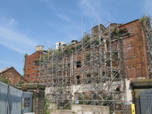
It’s very expensive to own and maintain a listed building, so unfortunately a  significant proportion of them fall into serious states of decay. This is the Old Steam Mill in Wolverhampton not far from the station:

IMG_7299
Wolverhampton’s Old Steam Mill – a Grade II listed building in need of some urgent attention

Many buildings and structures do not make it through the rigorous selection procedure to become listed, but still have some architectural or historical interest, so local authorities maintain “local lists”.  Locally-listed buildings do not have statutory protection so developers can do what they like with them, often demolishing them; but local planners will use all their powers of persuasion to preserve them. For example, Coventry’s local list can be found here.

“It has six wide ‘zebra’ stripes painted in white onto the Tarmac road surface, flanked by two lines of dashed marks either side…”

“Buildings” is perhaps a poor description, for the register can contain any historic structure. In the Midlands for example we have listed bridges, milestones, canal locks, telephone boxes, sewer ventilation pipes, tunnel entrances, fountains, bandstands, statues and monuments. Meanwhile in north London the Abbey Road zebra crossing  – made famous after appearing on a Beatles album cover – was added to the register of listed buildings and structure in late 2010.

Abbey Road zebra crossing – a Grade II listed ‘building’ getting plenty of attention

There are also some very interesting structures to be found in local lists. Wolverhampton City Council has locally listed  “Margery Cabinets”: these are electricity distribution cabinets designed by T.A.G Margery, the then Borough Electrical Engineer about 1930.

Today we’re asking you – where is the Midlands most unusual listed building structure? We’re not limiting it to just Birmingham, or just the West Midlands; feel free to explore the outer edges of the Midlands. If you think it counts, we want to hear about it. Drop us a message using the comment section below, or contact us @mappamercia on twitter.  A picture would help enormously.

An unusual find- in more ways than one!

On 31st July the mappa-mercia gang of mappers descended on Shenstone for our monthly pub meeting. It was a glorious summer’s evening which confirmed our strategy of getting out and about around the region during the summer months to take advantage of the late evenings to combine some mapping with our usual meeting . For Shenstone we had a set ourselves the challenge to see if we could map a complete village in one evening. We did cheat slightly by pre-populating the buildings from armchair Bing aerial imagery tracing. We almost got there but not quite!

To the North of the village we came across a small memorial commemorating “Shenstone Lammas Land”. Now we all believe we know what Common Land is, it being a familiar presence in rural England, but Lammas Land had us all guessing. So a quick Google search soon informed us.

Lammas land’ is land with ‘common grazing rights’, which are grazing rights belonging to those commoners who had registered the right to graze their animals on the land.

Lammas rights go back to the middle ages, but only existed between August 1st (Lammas Day) and February 1st (Candlemas), when the animals were removed to allow crops (usually hay) to be grown for harvesting in mid summer. Then on Lammas day the animals were returned to graze off the stubble.

You can read about the villagers’ 25 year legal campaign to preserve their rights here, which successfully concluded as recently as 1998.

What a coincidence to come across this piece of Lammas Land on the eve of Lammas Day!

Musings on tag historic=memorial

Following on from my blog recently about the tile in Birmingham Snow Hill Station to an unknown cat,  I received a lovely email from the Press Office of London Midland, the railway company that manages the station.

“I believe the old Snow Hill station (before closure in the 1960s) had a real station cat (like many railway stations) to help keep mice at bay!! When the station re-opened in the 1980s, a tile was installed in memory of the former role of the station cat.  I understand the staff at the station were keen to see it retained and this was supported by the station manager – hence the tile will be staying after the refit.”

I subsequently asked the obvious question “Did the cat have a name?” but the Press Office didn’t know. So any Midlands readers out there – do you know anyone who worked at Snow Hill station in the 1960s who might know?  The Press Office suggested tongue in cheek that “Snowy” might be a good posthumous name.

There is a Wikipedia entry for anyone interested in the history of the station.

So – on to my musings. How unusual is it for there to be memorials to animals? I know the rest of the world thinks Brits are hyper-sentimental about animals, but even here in the UK I can think of few public (civic) memorials to animals. So would anyone like to contribute about memorials to animals they’ve mapped? I’m expecting a few about famous racehorses; famous warhorses and heroic actions by rescue dogs, but I’m prepared to be surpised.

Mysterious Objects: No 6 in an occasional series

posted in: Observations | 2

Cat Tile Snowhill Station

Snowhill station in Birmingham is undergoing a major refurbishment at the moment. This tile which is curiously situated about 6 inches off the floor opposite the automatic ticket barriers ( well they’re designed to be automatic for everyone with a normal ticket but still need to be manned for travellers with passes – even those with smartcard capability – that is when the rail company bothers to staff the barriers, other wise they’re just left open)

But back to the tile of the cat. I’ve been meaning to find out its significance which is obviously high because before the tiles were stripped from the concourse the cat had the ignominy to be covered up with a  large sign reading “DO NOT REMOVE THIS TILE” so that the contractors could leave it in place. It will be interesting to see how the tile is presented when the wall gets its final treatment.

I’m always meaning to stop and ask someone in authority on the station to explain but I’m always in a rush to get somewhere so I never do. So I rely on the power of the web for somebody to let me know what it is.  Then I can tag it appropriately. This is real micro-mapping

Any offers?