Improve OSM – Traffic flow direction

posted in: Uncategorized | 0

At the end of October Telenav released a tool to help identify incorrectly tagged, or missing, one way streets in OpenStreetMap. The tool makes use of the data they collect through their Scout Navigation app and compares this against OpenStreetMap data. If the scout data shows that drivers only travel in one direction down a street it the tool checks for a corresponding oneway=yes tag in OpenStreetMap. If it doesn’t find it then it flags up a potential error.

The potential errors can be viewed at the Improve OSM website, but the best way to use it is with the “trafficFlowDirection” plugin for the JOSM map editor:

  • Download the “trafficFlowDirection” plugin for JOSM.
  • After restarting JOSM add the Bing background via the Imagery menu. The Traffic Flow Direction layer should add itself to the list of visible layers automatically.
  • Zoom to a potential oneway error as identified by the orange circles (when zoomed out) and the orange arrows (when zoomed in).
  • Download and fix the OpenStreetMap data if appropriate.
  • So others know the error has been fixed (or marked as invalid if appropriate) mark the issue as Closed (or Invalid). Do this by first making the TrafficFlowDirection layer active and selecting the issue you just solved:activate

    Then click the green lock in the plugin panel, add a comment, and close the issue.

  • Don’t forget to upload the improved OpenStreetMap data when you have finished.

Full instructions can be found here.

Map of Hill Close Gardens

posted in: Map Improvements | 1

It wasn’t just Hadrian’s Wall that I mapped in OpenStreetMap as part of our third UK quarterly project – “all things tourism”.  Closer to home I visited and mapped the wonderful Hill Close Gardens in Warwick. The gardens are a “very rare example of detached Victorian leisure gardens which were found on the outskirts of many towns in Victorian times”. They comprise 16 individual plots, numerous summer houses and the larger visitor centre building. It was therefore no small task to add this to OpenStreetMap – in fact I still have a couple of plots left to map as I ran out of time on the day I visited the gardens!

Map of Hill Close Gardens, Warwick

In addition to my visit to the gardens (and the numerous photos I took), I made use of the Warwickshire County Council aerial imagery to help add in all the detail and paths. As a reminder to other OpenStreetMappers this aerial imagery is free to use to assist with your mapping efforts. It was fascinating to see how the area had changed over the years thanks to historical maps – this time from Warwickshire County Council’s mapping portal, although I’m sure there are some great maps on the National Library of Scotland’s site too.

Next steps are to finish off the last two plots in the north section of the garden. The gardens also provide lots of information about the history of each plot. It may be good to add this to the gardens’ entry on wikipedia. And of course, I need to add the wikipedia article details to OpenStreetMap so that we continue to build links between these two crowd-sourced projects.

View the map here.

Birmingham New Street Station

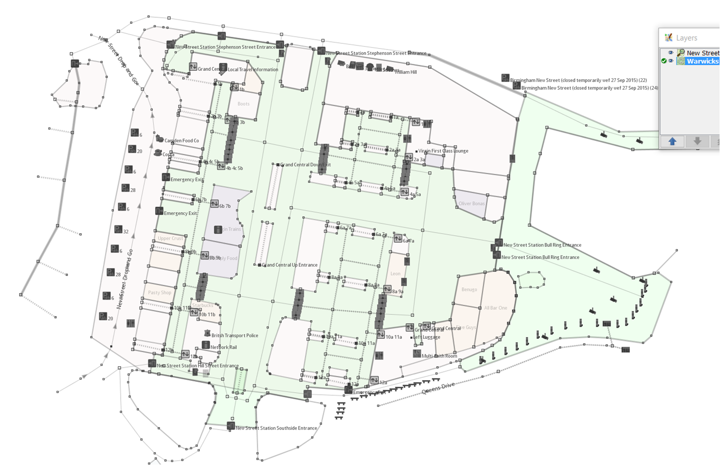
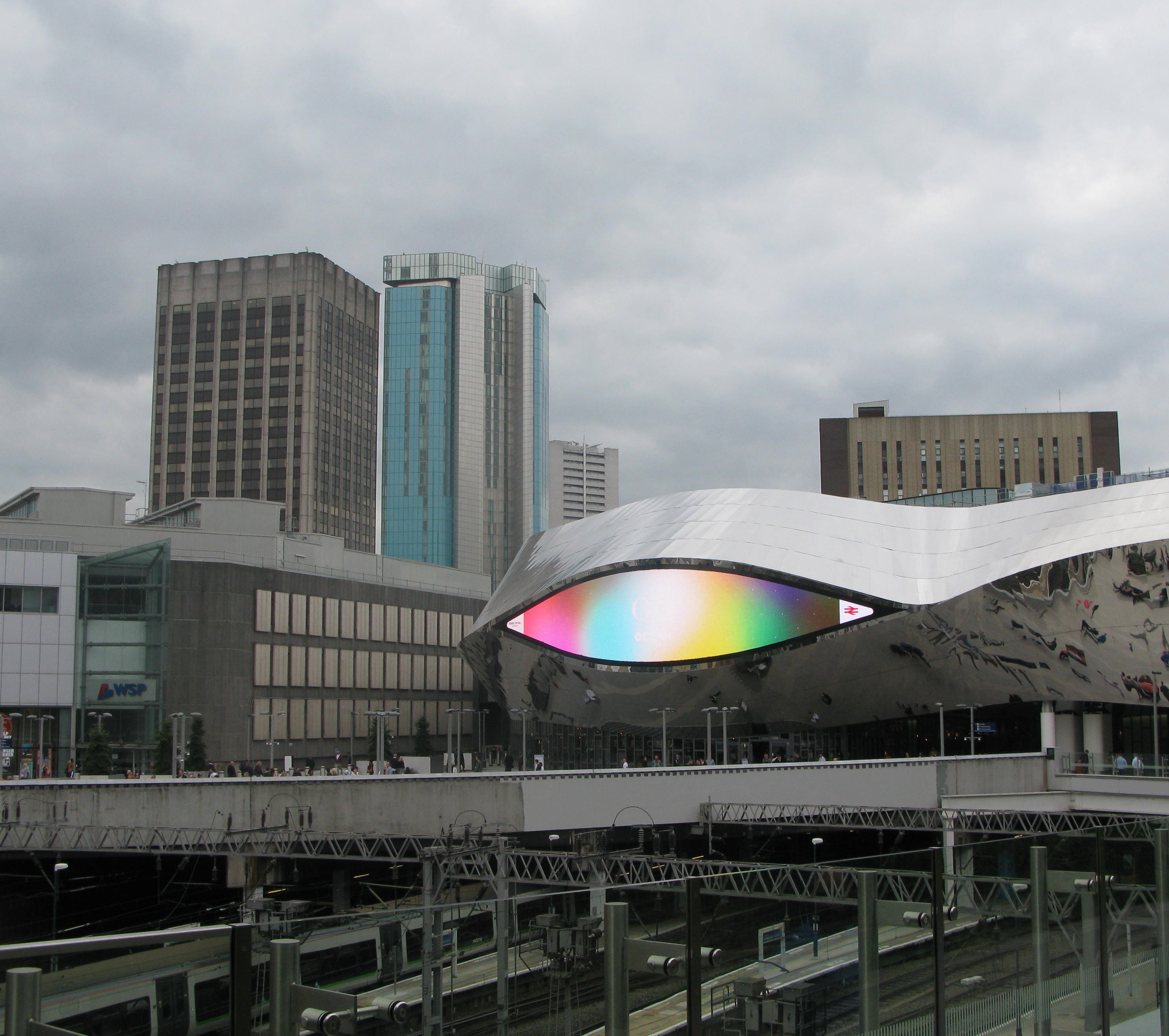
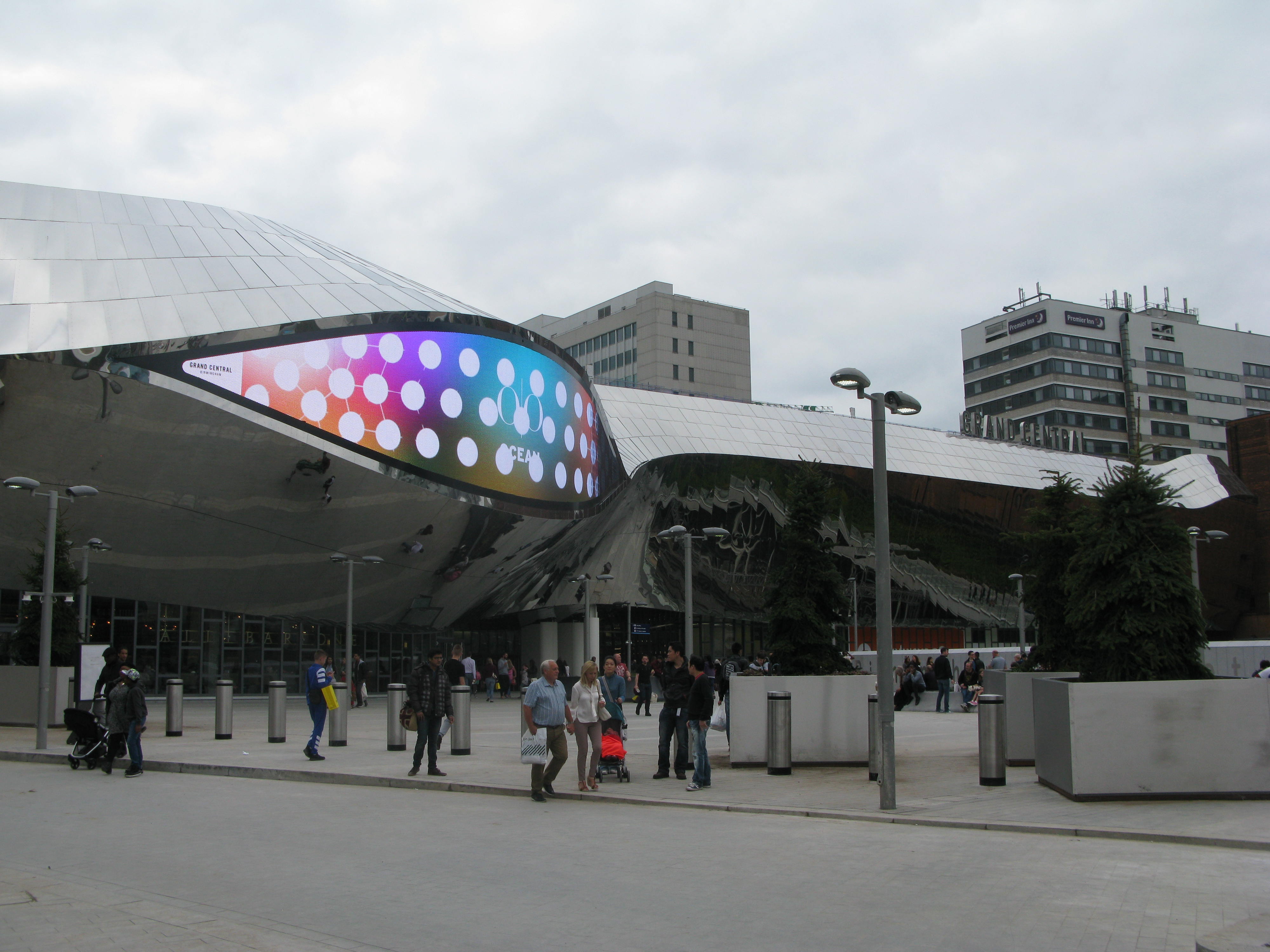
Surveying and editing the new  mainline multilevel station in Birmingham proved to be a mapping challenge; involving as it did keeping a lot of the existing edits, modifying most of them and then layering on the new developments. Very similar in mapping terms  to the physical work in actually renovating the stations whilst keeping it running.

The mapping is complete apart from a few pernickety errors, omissions and problems like the late completions of the taxi rank to the South of the station and the Metro Station to the North. The main improvement needed is  smoothing the curves of the platforms and  tracks. Getting them aligned to the lifts, escalators and stairs from the concourse above was bad enough!

One thing I haven’t been able to address is the  goods delivery access to the shopping mall above the station. Previously there was a service road on the roof  for delivery which was accessed via the ramp to the multistorey car park, but most of the roof is now a huge glassed dome. If anyone knows how it’s done please let me know.

The rendering limitations of OpenStreetMap meant some compromises were in order: mainly the prominence given to the pedestrian way for the Grand Central shopping mall as opposed to the pedestrian concourse underneath for the station concourse. Tagging the mall pedestrian ways as bridges was a possibility but that was really too much mapping for the renderer and not what’s on the ground.

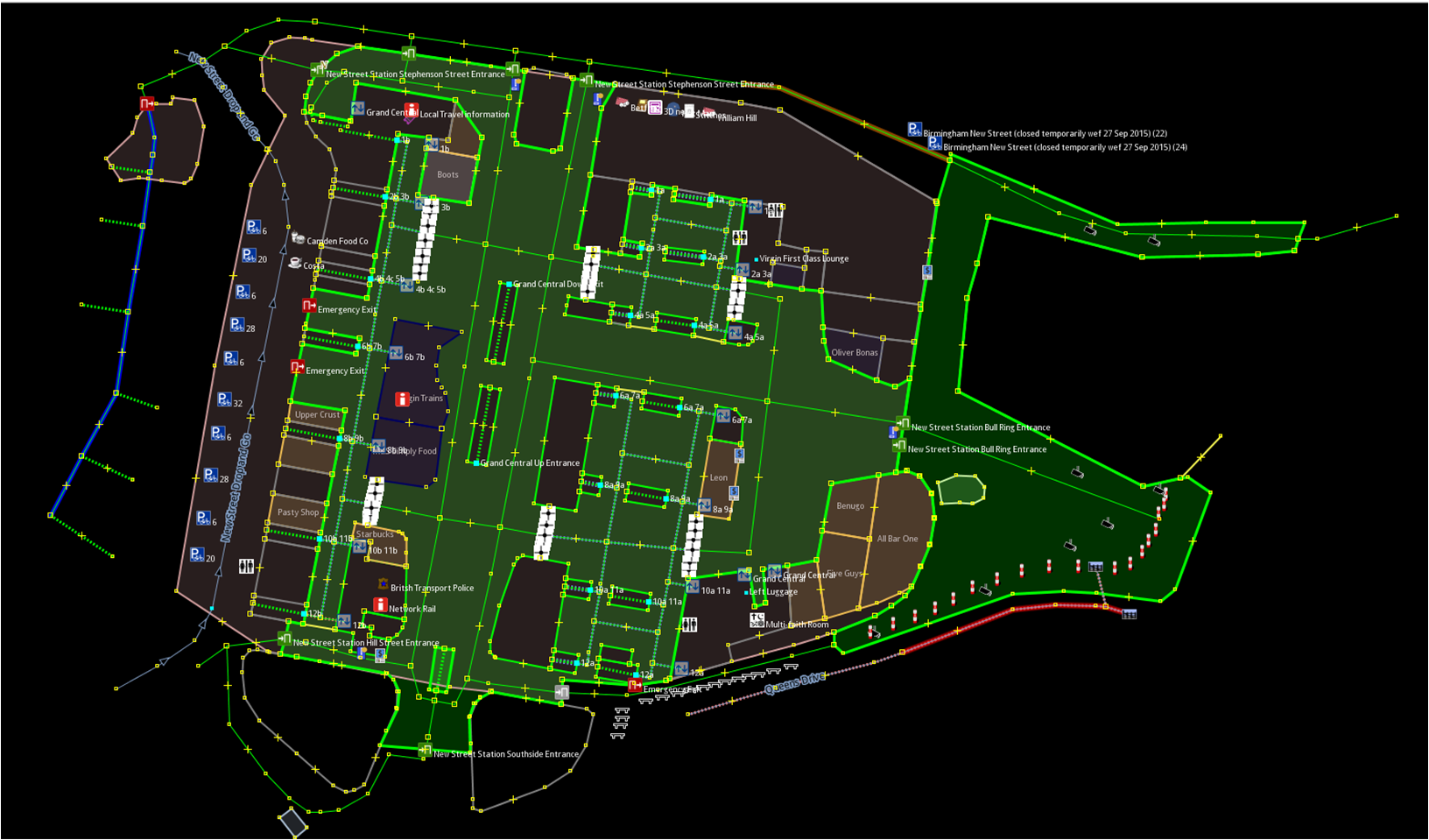
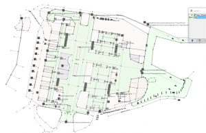
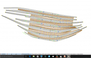
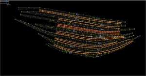
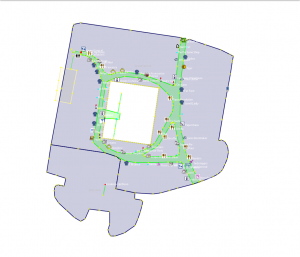
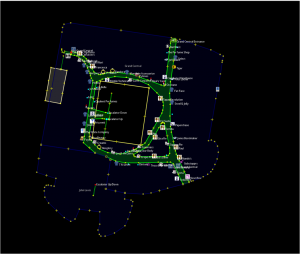
To rectify this inability to render multiple layers, I thought I’d produce some floor plans of each level, selecting in JOSM layers various tagged levels. They’re only screenshots from JOSM as my  mapping skills don’t extend to taking the data and rendering as a map- and it would just take too long to learn. If anyone else wants to have a go then please feel free! I’ve produced two versions of each, one with a dark background and one with a light background. I have done some post-editing to make the concourse more prominent rather than relying solely on the footways in the original OSM data. The plans  may prove to be more useful separated like this than trying to interpret the complexity of the standard OSM map.

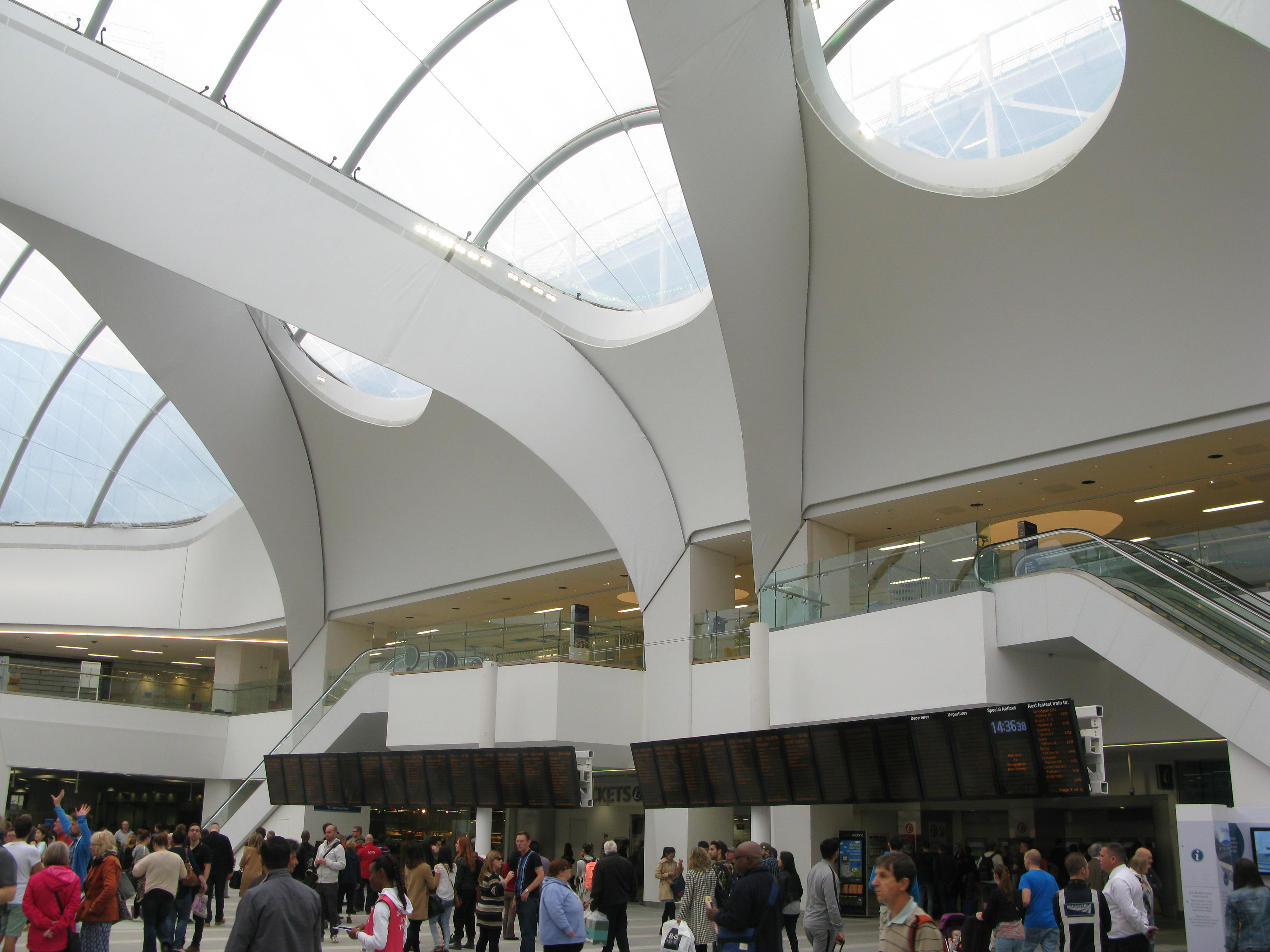
First New Street Station Concourse (at level 0)

New Street Station Concourse 4 New Street Station Concourse 3

Next the platforms underneath (at level -1)

New Street platforms 2New Street Platforms 1

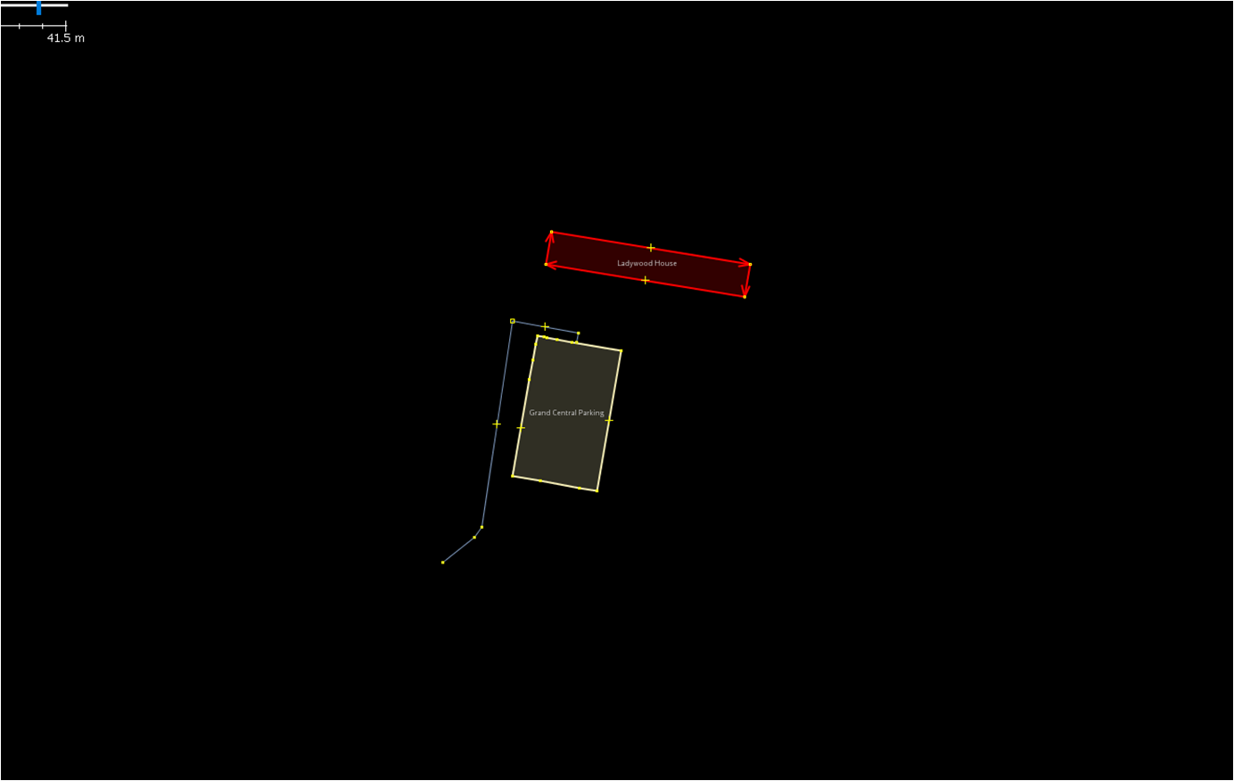
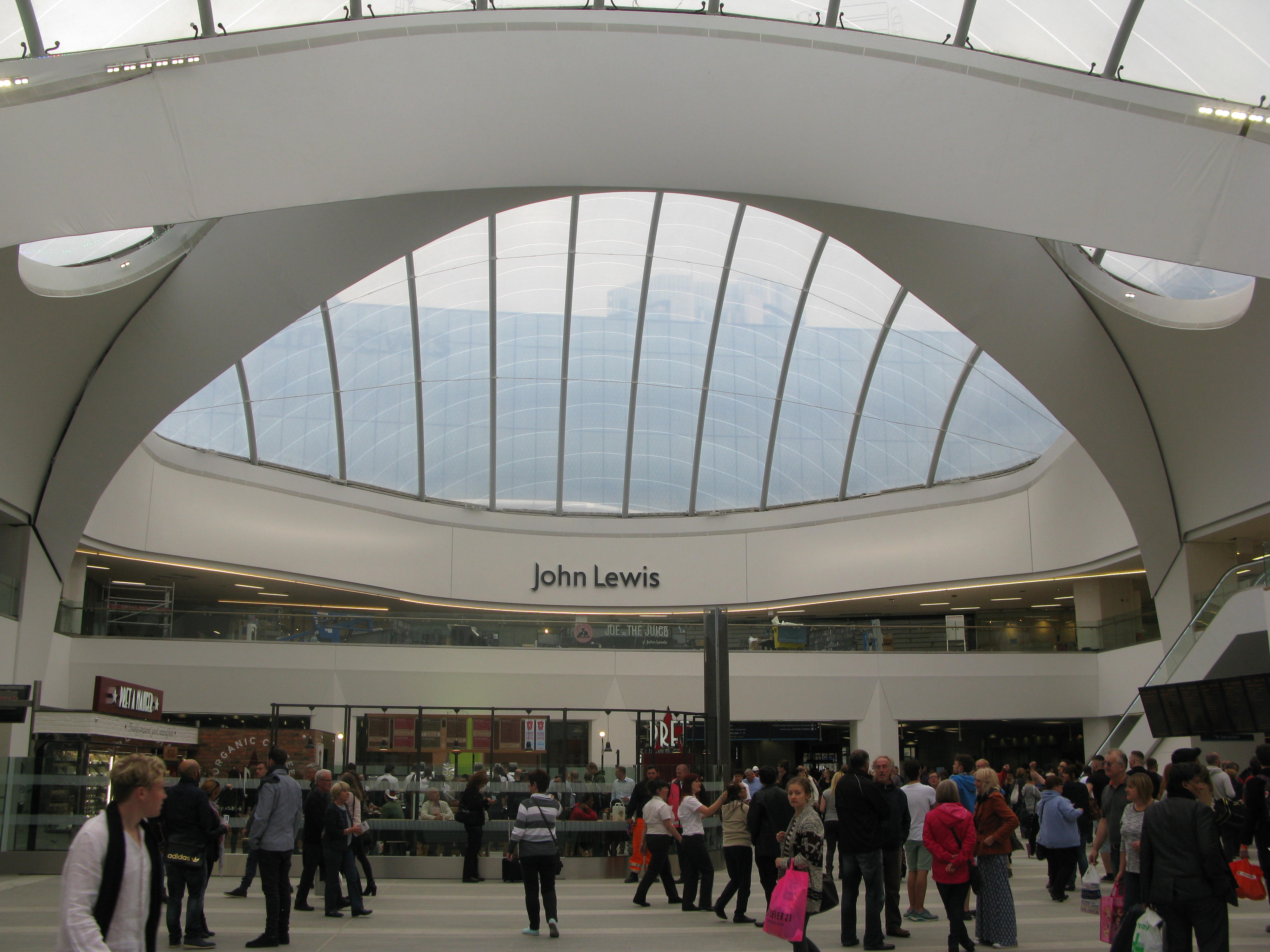
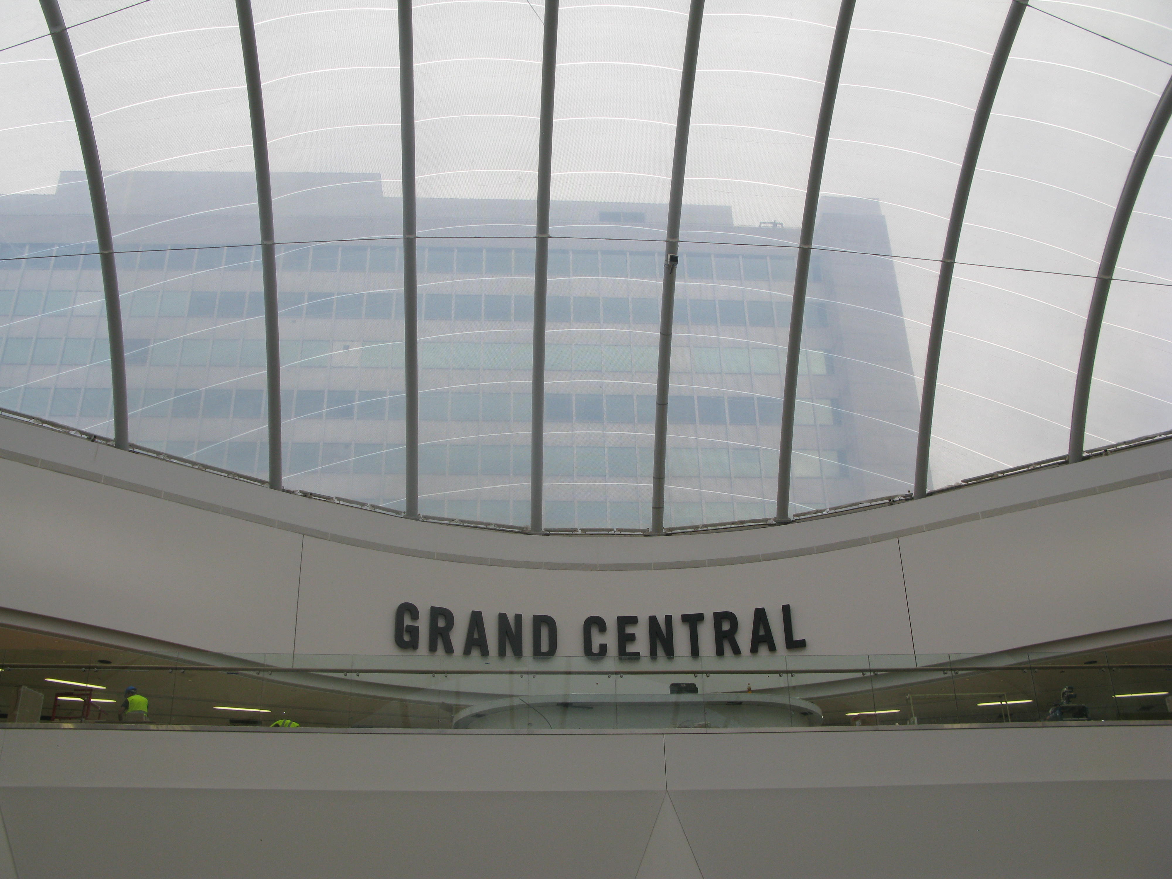
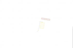
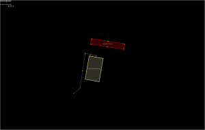
Grand Central shopping mall (above the Concourse at Level 1)

Grand Central 2 Grand Central 1

And finally Level 2

New Street Sation Level 2 2 New Street Station Level 2

Some of these plans might make it to our mappa-mercia maps section, as a regional resource.

A few suggestions for improvements  in rendering complex public buildings like this:

  1. Display an icon and name for the entrances
  2. Display an icon for emergency exits
  3. Differentiate rendering for stairs and escalators
  4. Show direction of travel for escalators and stairs
  5. Display an icon for ticket barriers (turnstiles)
  6. Tagging schema for internal concourses and thoroughfares (maybe just add indoors=yes to highway=pedestrian and area=yes)
  7.  Opacity differentiation for multiple concourse/thoroughfare levels (even  just two would be useful)
  8. Specifically for railway stations – get the platform rendering to behave as if it understood OSM layers!

And apologies to anyone involved in indoor mapping – I found the documentation just too complex and confusing, but I’d like to learn. If anyone can review the data and demonstrate how to make a complete 3-D multilayer model I’d be very appreciative.

Mapping Hadrian’s Wall

posted in: Map Improvements | 0

Our third quarterly project for UK OpenStreetMappers saw us focus on all things tourism. A walking holiday along Hadrian’s Wall gave me a great opportunity to map one of the UK’s oldest, and definitely longest, tourist spots. Of course it was in no way a tourist site when it was first built in AD122, but just as maps have changed function from a military tool to an aid for tourists, so has Hadrian’s Wall.

IMG_20150905_160651525_HDR
A milecastle on Hadrian’s Wall

Along with other borders of the Roman Empire, Hadrian’s Wall is a World Heritage Site. Given this, and the prominence of site on the landscape, I was surprised to find that it wasn’t well mapped. The fortification comprises, from north to south, a ditch/cliff edge, the wall, the old military road, and finally another series of ditches know as the Vallum (to keep ordinary folk in the south out of the military zone). In places the Vallum had been mapped as the wall and big swaths of the wall were missing from OpenStreetMap.

Using my collection of photos, GPS traces, and the wonderful historical maps provided by the National Library of Scotland, it didn’t take long to improve the representation of the wall within OpenStreetMap. Now the wall (or wall-route where little of the original wall remains) is correctly mapped and gathered in a relation. The mapping of the vallum is also much improved.

The wall in OpenStreetMap. The gap in the left is Burgh Marsh - was the wall built here?
The wall in OpenStreetMap. The gap in the west is Burgh Marsh – was the wall built here?

There is however still plenty to do, including mapping other parts of the world heritage site such as the milecastles and the turrets that were built along the wall. A full record of what is included as part of the world heritage site is available on the UNESCO website, with mapped features added to an parent relation in OpenStreetMap.

Happy mapping!

Birmingham: A top 10 city by the number of POI

posted in: Map Improvements, Observations | 0

Have you ever wondered which cities have the most points of interest (POI) mapped in OpenStreetMap? That’s exactly the question that one user, baditaflorin, pondered over. With 65,093 features on the map, we are delighted that Birmingham ranks as number 9 in the count of most POI.

Head over to baditaflorin’s write-up to find out which city tops the list.

Image from DAKItrack.


Birmingham New Street Station re-opens

posted in: Map Improvements | 2

20 September saw the re-opening of Birmingham’s New Street Station after 5 years of redevelopment costing £750m. The  project involved the demolition of Stephenson Tower, a residential tower block; and the removal of 6,000 tonnes of concrete in order to increase the station’s capacity; whilst keeping the station undernaeath operational. A new shopping mall, Grand Central, was also constucted on top of the station, with John Lewis as the flagship tenant. Grand Central is due to open 24 September. A new metro line from Snow Hill station to New Street station is also underway and scheduled to open at the end of October.

New St 4

  • 170,000 passengers a day use Birmingham New Street, nearly triple the 60,000 a day it was designed for when it was last rebuilt in the 1960s
  • The new station can now handle 300,000 passengers per day
  • New Street is the busiest station outside London, with a train leaving every 37 seconds
  • 36 new escalators and 15 lifts, serving every platform, have been installed
  • About 60% of rainwater “harvested” from the new-look building’s facade will be used to flush the station’s toilets
  • About 1,000 workers were on site, 24 hours a day, seven days a week during the five-year revamp – increasing to 3,500 in its final months

Source: Network Rail

New St 2

Needless to say OpenStreetMap was there on opening day and our map is now updated to show the new layout as far as pedestrian entrances and approaches is concerned. But there’s lots more to do yet. And the contractors (as always) haven’t quite finished so some detail can’t be mapped yet.

New Street station has a complex layout which will challenge us in representing its multiple layers.

Starting from the bottom layer we have

1.railway lines and platforms

2.Station concourse

(multiple lifts,stairs and escalators joining 1 and 2 above)

3.Shopping mall

(multiple lifts,stairs and escalators joining 2 and 3 above)

4. Car Park

In addition there is a 10 storey office block on part of the building and the North and South entrances are at different levels.

New St Atrium 2

So we need to do some head scratching and planning to get it right: so PLEASE can  non-local mappers  offer your advice  and not just enthusiastically start adding multiple POIs and footways otherwise we’ll end up with an undecipherable jumble.

There’ll be a discussion thread up soon on talkgb where contributions can be planned. Help from public transport, railway and 3D mappers will be greatly appreciated.

New St Atrium3  New St Atrium 1

Hacking on mobile apps with the London crowd

posted in: Observations | 0

The OpenStreetMap London hack weekend also saw Jo Walsh working on the first stage of a building details editor for Android.

Jo, who goes by the OSM user name zool, has written up her experience of working with Android:

I worked on a mobile app which I was pleased to get into a basically working state. It is called osmbi3, which stands for OpenStreetMap Building Information and/or Zombies. The aim was to geolocate the user and find nearby buildings using an Overpass query. This could then be linked to building management information or form the basis for some location-based game.

Read the rest of Jo’s article here. Want to catch up in person? How about a return visit, and whilst you’re there you can always attend State of the Map Scotland!

Hacking on Taginfo

posted in: Observations | 0

We recently blogged about the OpenStreetMap hack weekend in London. In that post we wrote about how Jochen Topf & Harry Wood worked on integrating TagInfo into the OpenStreetMap Wiki. They built a solution to auto-populate the wiki with data from TagInfo based on a Taglists template.

Over to Jochen to explain more:

The recent London OSM hack weekend gave me the incentive to work on taginfo once more and we got quite a few things done on the weekend and the days after. Taginfo now works better on mobile, is faster and we have a very cool tag list feature for the wiki. Lets look at these in turn…

You can continue to read this over on Jochen’s blog.

It was great chatting to Jochen and Harry about the potential of this to help keep our wiki up to date and accurate. If you have any comments or suggested improvements feel free to post them below and we will ensure they get passed on.

OSM London Hack Weekend

posted in: Participate | 2

Last weekend I attended the OSM London hack weekend. The theme of the event was mobile, a key area where OpenStreetMap can grow it’s current offering. Timing couldn’t have been any better – just 2 days earlier the press was reporting that smartphone use surpassed the use of laptops in the UK.

Our hosts for the weekend were Geovation Hub which is part of the Ordnance Survey but feels very different. It felt much more like a swanky up-start focussed on innovation and not tied down with years of history and layers of bureaucracy. Geovation describe themselves as a “co-working space for individuals, businesses and aspiring entrepreneurs to collaborate, exchange ideas and innovate around ventures that are underpinned by geospatial data“.

First day of the OpenStreetMap hack weekend at Geovation Hub, London.

The weekend was well attended with 25 developers working to make OpenStreetMap better on mobile. Many of the names will be recognisable to avid OpenStreetMappers and it was great to catch up with those who I hadn’t seen since State of the Map 2013 in Birmingham.

We were kept supplied with tea and coffee at the Geovation Hub, whilst PIE Mapping provided pizza to keep the energy levels up. This helped to keep us going – some of the things we worked on (not an exhaustive list and sorry if I have missed your particular project off):

  • Jochen Topf & Harry Wood worked on integrating TagInfo into the OpenStreetMap Wiki. by building a solution to auto-populate the wiki with data from TagInfo based on a Taglists template.
  • Harry then continued to work on TweetFellows – an Open Source tool that will enable multiple people to send tweets from the @OpenStreetMap twitter account.
  • TagInfo also saw some improvements to the way it is displayed on mobile devices thanks to Christopher Baines, whilst Marc T made the nominatim web page better on small screens (not live yet).
  • Sarah Hoffmann was also working on nominatim and implemented lots of bug fixes before starting work on a new feature that provides additional information such as opening hours and accessibility with each nominatim search.
  • Jo Walsh (aka zool) built the first stage of a building details editor for Android. It currently downloads the data around you based on your GPS location, with editing functionality the next stage of development.
  • The OpenStreetMap editor Vespucci also saw some development as Mick Orridge added the ability to view GPS traces as a new layer.
  • Nick Whitelegg added support for GeoJSON to MapsForge. This will help to ensure that the data can be easily kept up to date and could replace the current MAP files that tend to only get updated once a year.
  • Serge W started work on a really novel app idea – a wifi scanner that looks for wifi networks associated with well known stores (e.g. McDonalds) and then asks whether a node should be added to OpenStreetMap.
  • Finally, Robert Scott was working on porting OS Musical Chairs to the new OS OpenNames data – perfect given our location.

For more see also the GeoVation blog post. I’m already looking forward to seeing what the next event can do!