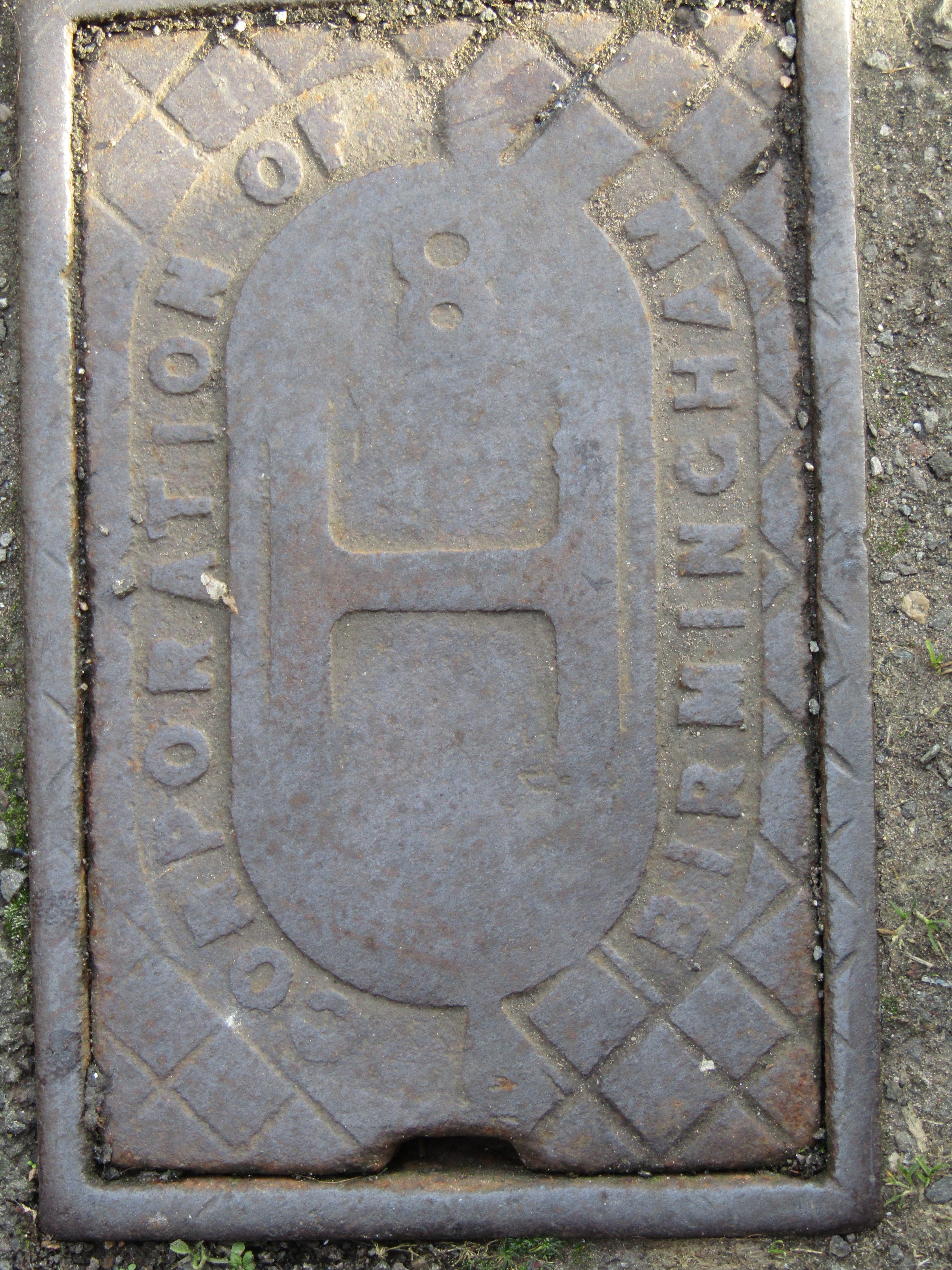
In the West Midlands our fire hydrant signs are generally placed on lamp posts:
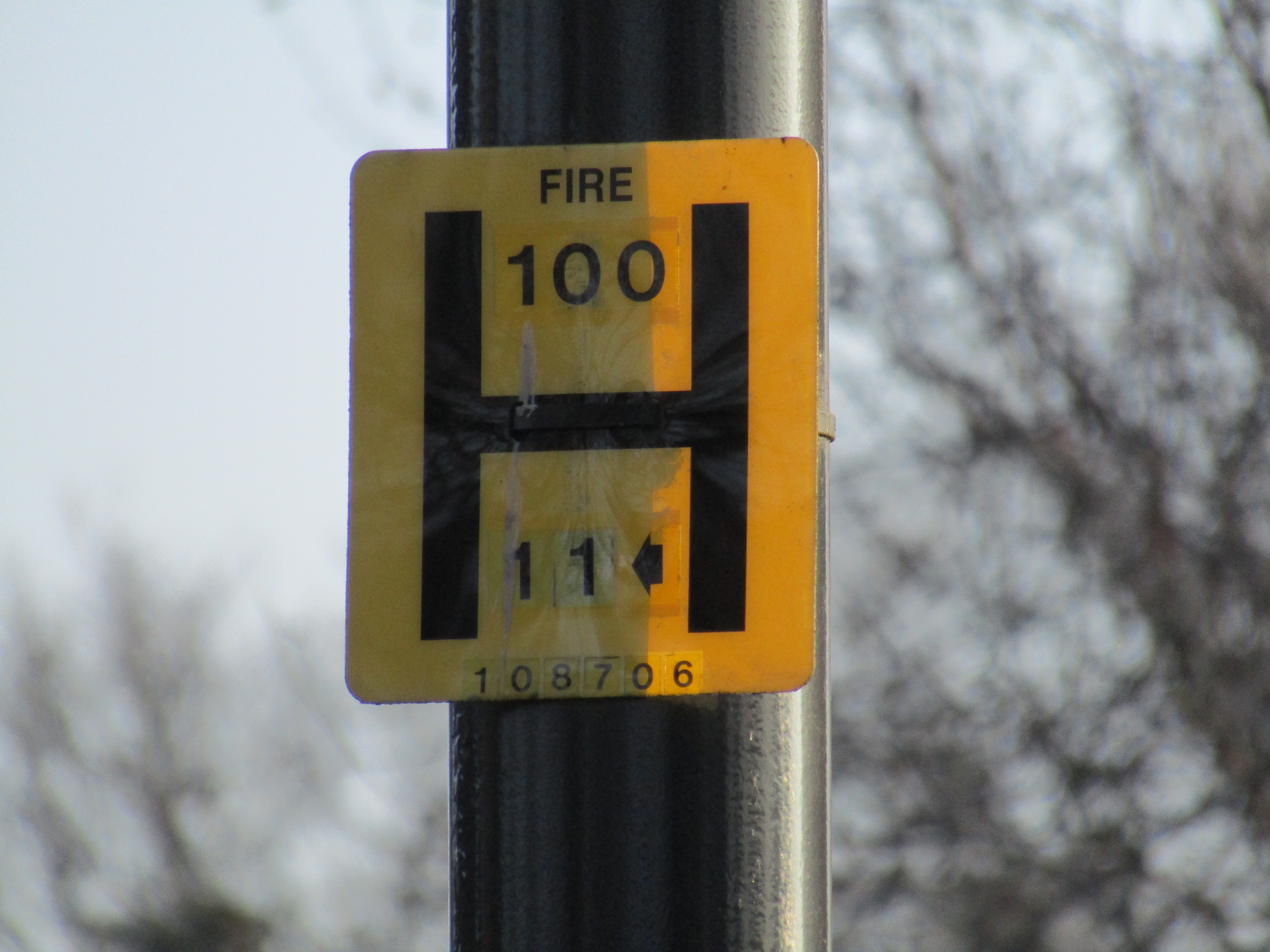
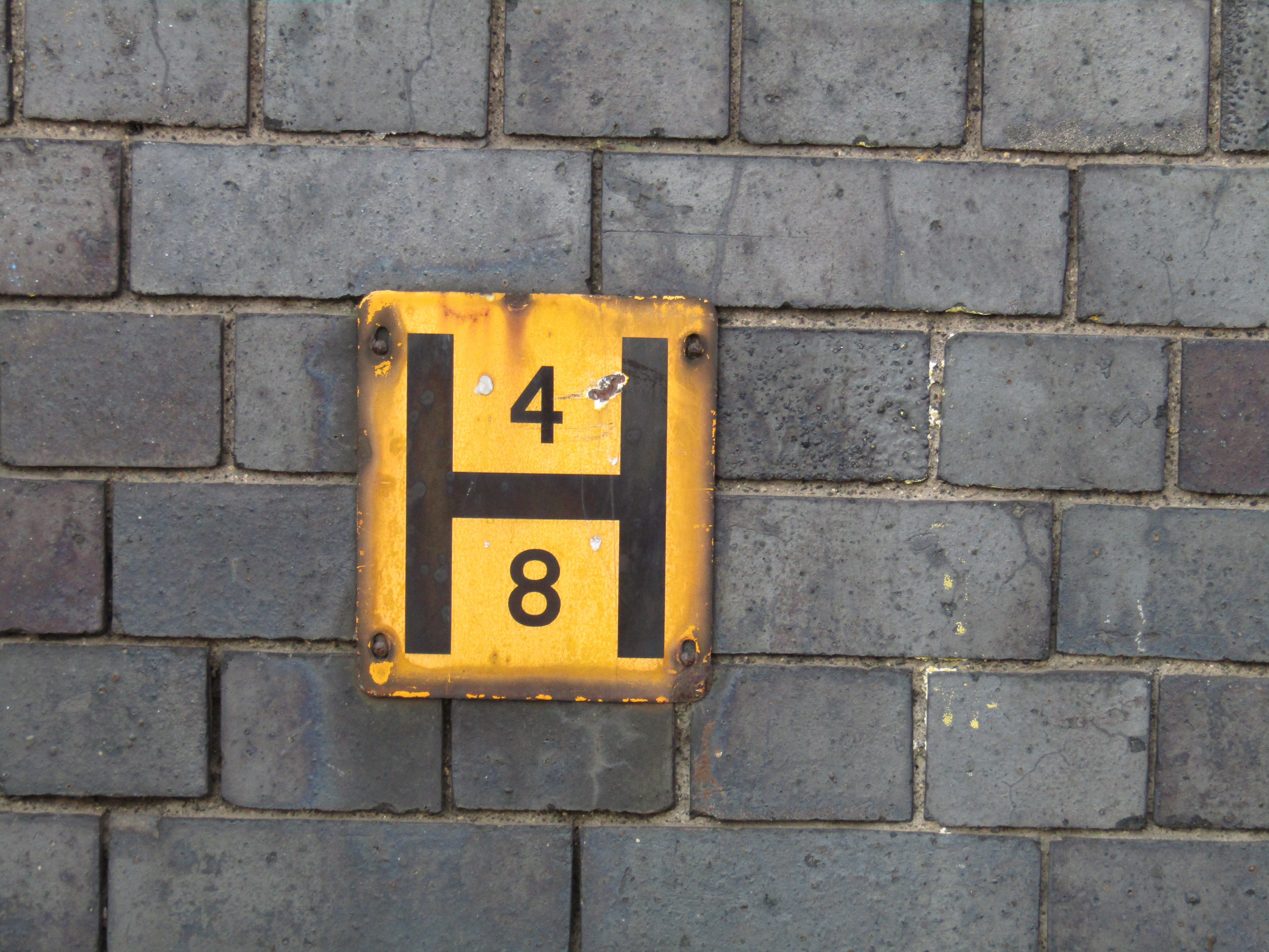
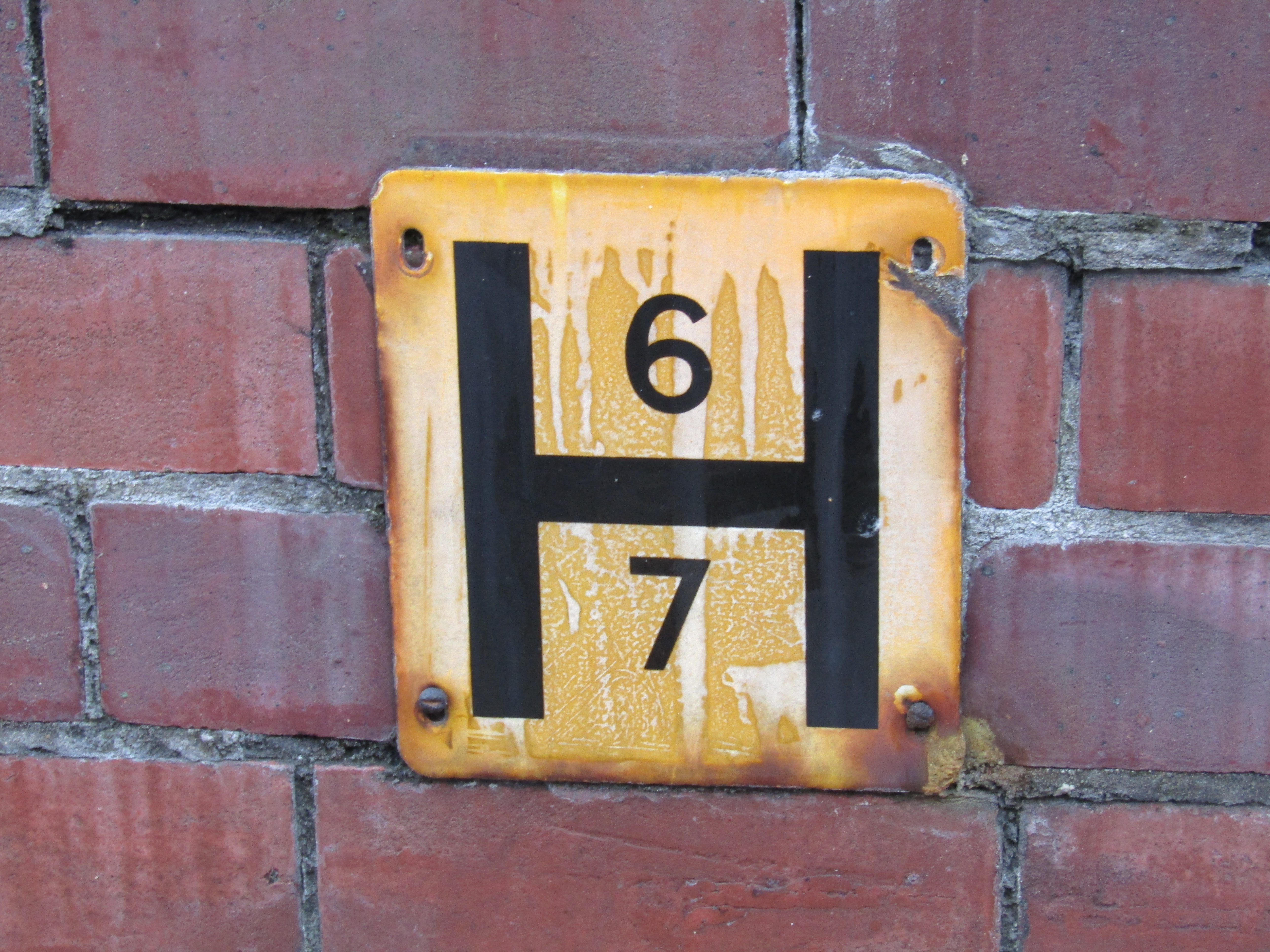
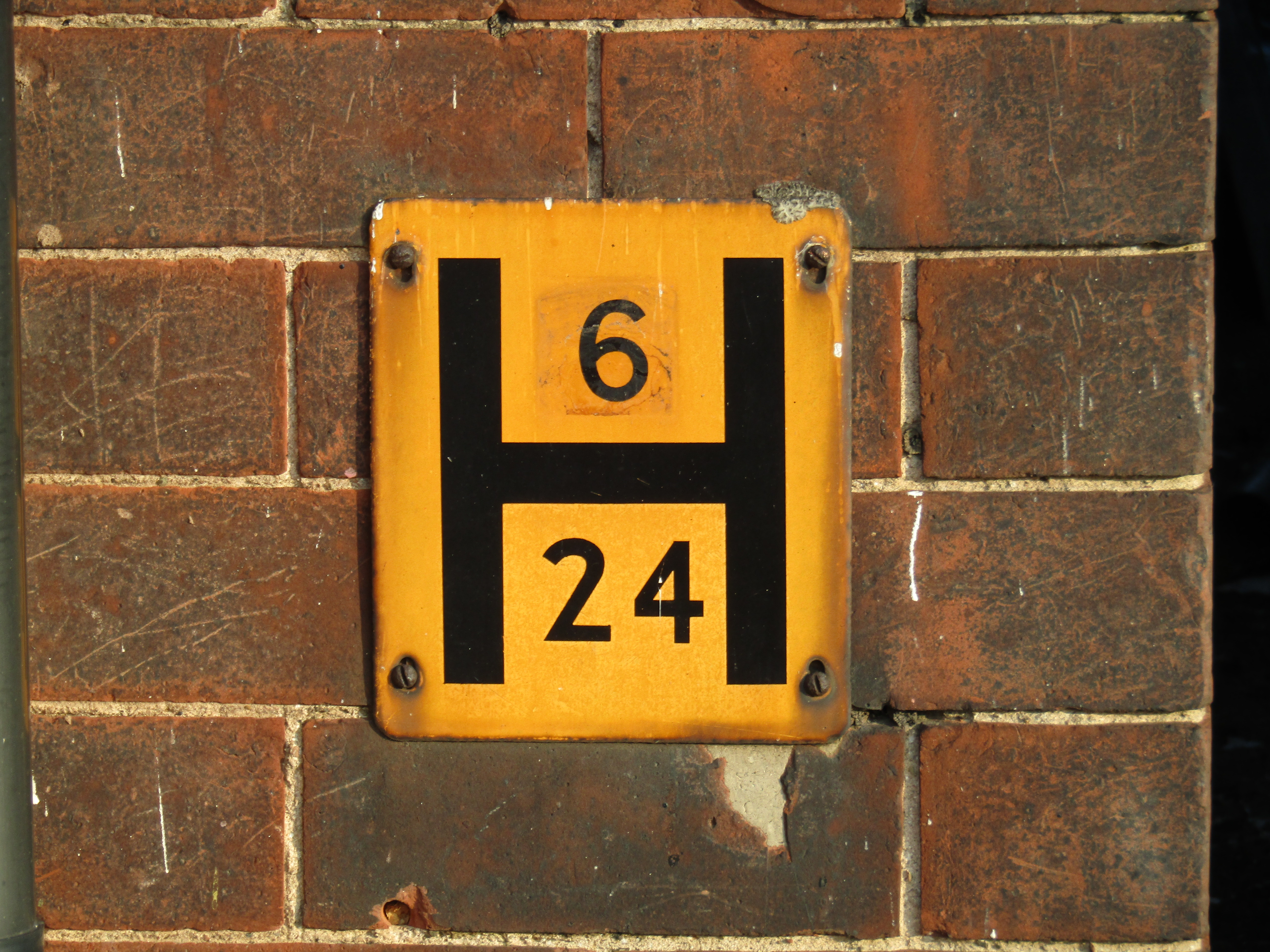
The black H on a yellow background I believe to be a UK standard. The upper number is the diameter of the underlying water main in mm. The lower number is the distance in feet to the fire hydrant from the sign with the arrow showing the direction to the actual hydrant. There is also a reference number at the foot of the sign. So, having spotted the sign, the actual fire hydrant has to be found. The signs can get swivelled on the lamposts through maintenance interventions or general neglect and the arrows point in the wrong direction!
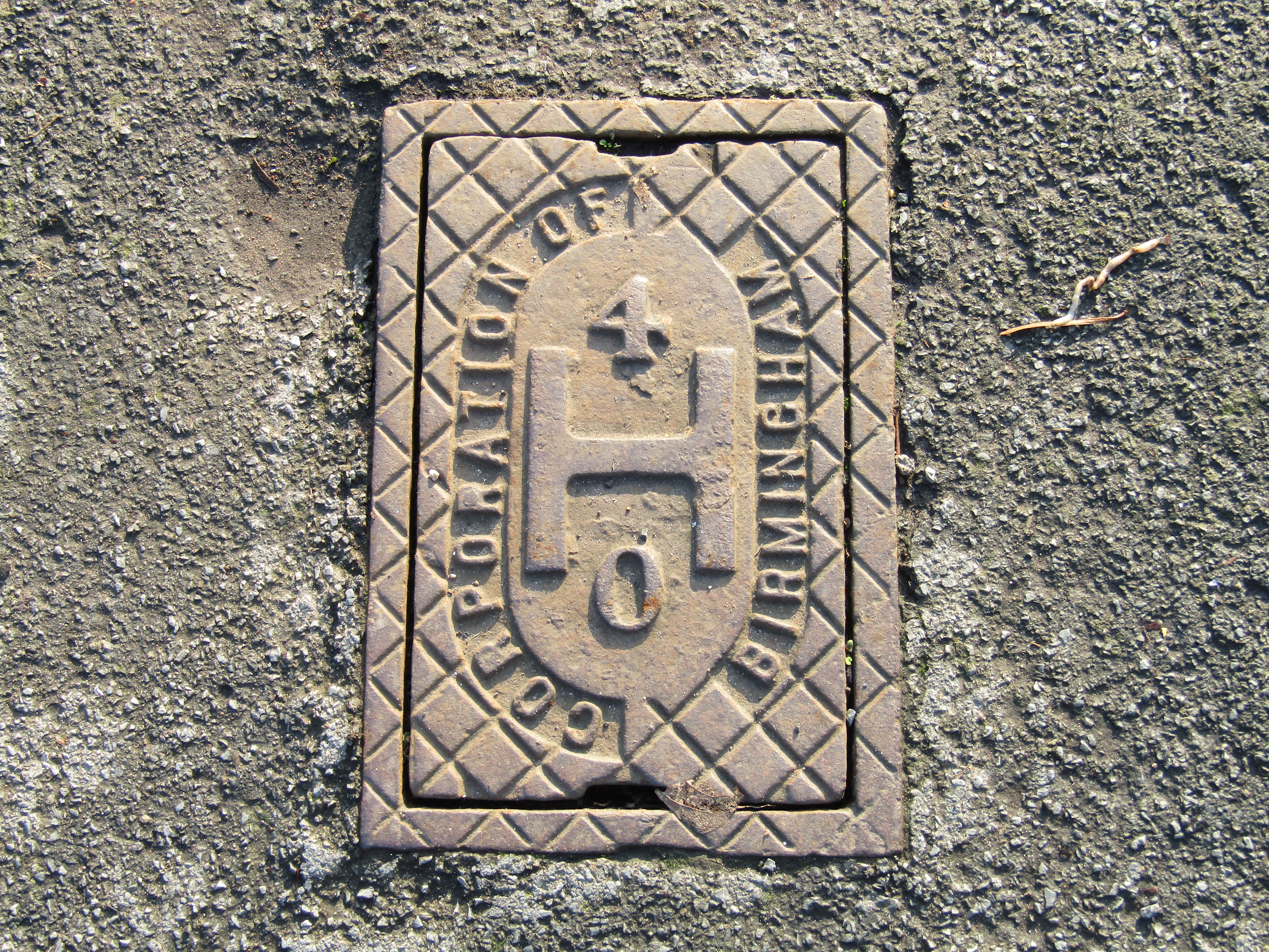
To complicate matters further, there are some fire hydrants that do not have a sign, and some older variants of the signs. These older signs tend to be attached to buildings or walls and I have no idea what the numbers refer to.
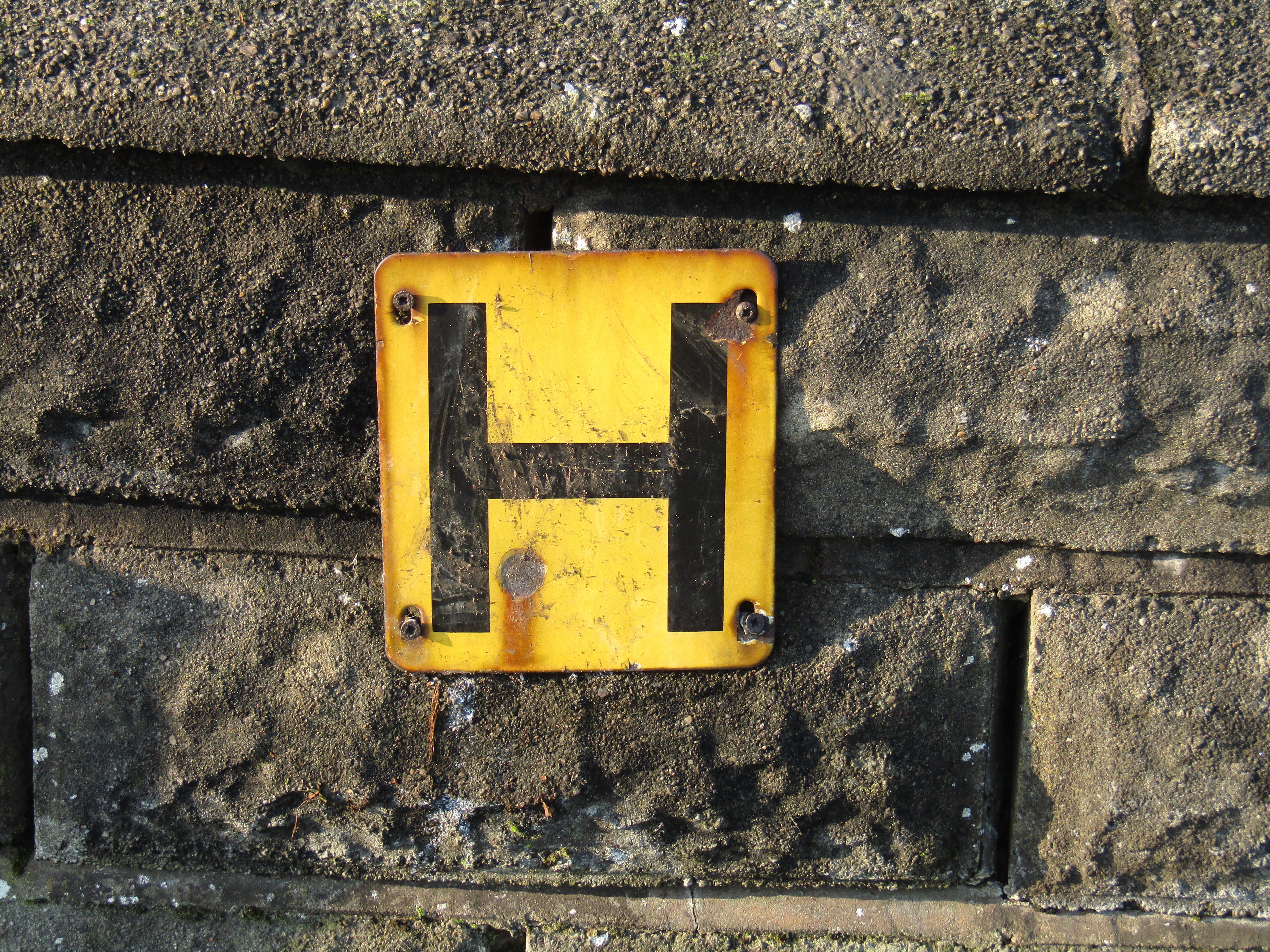
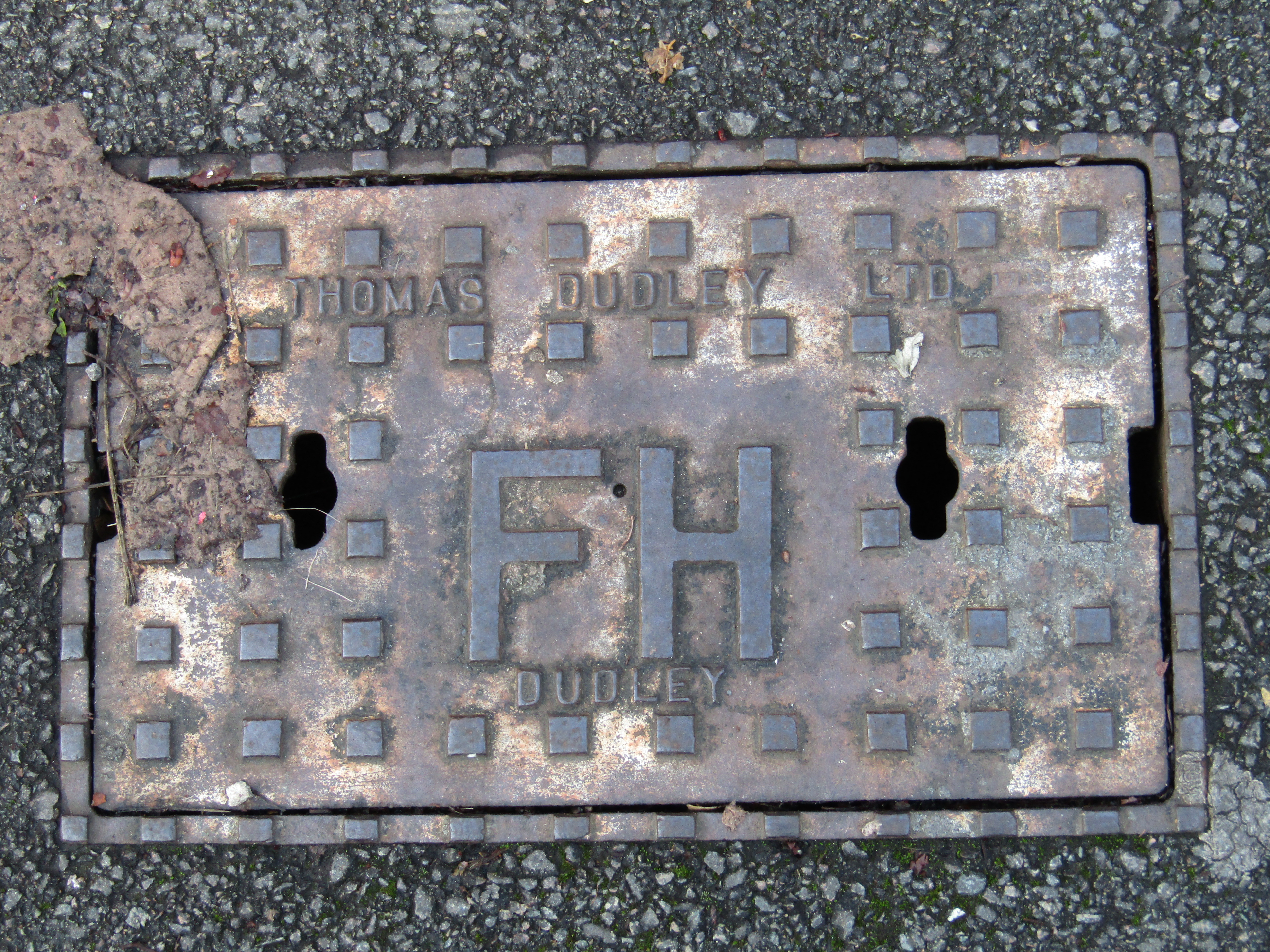
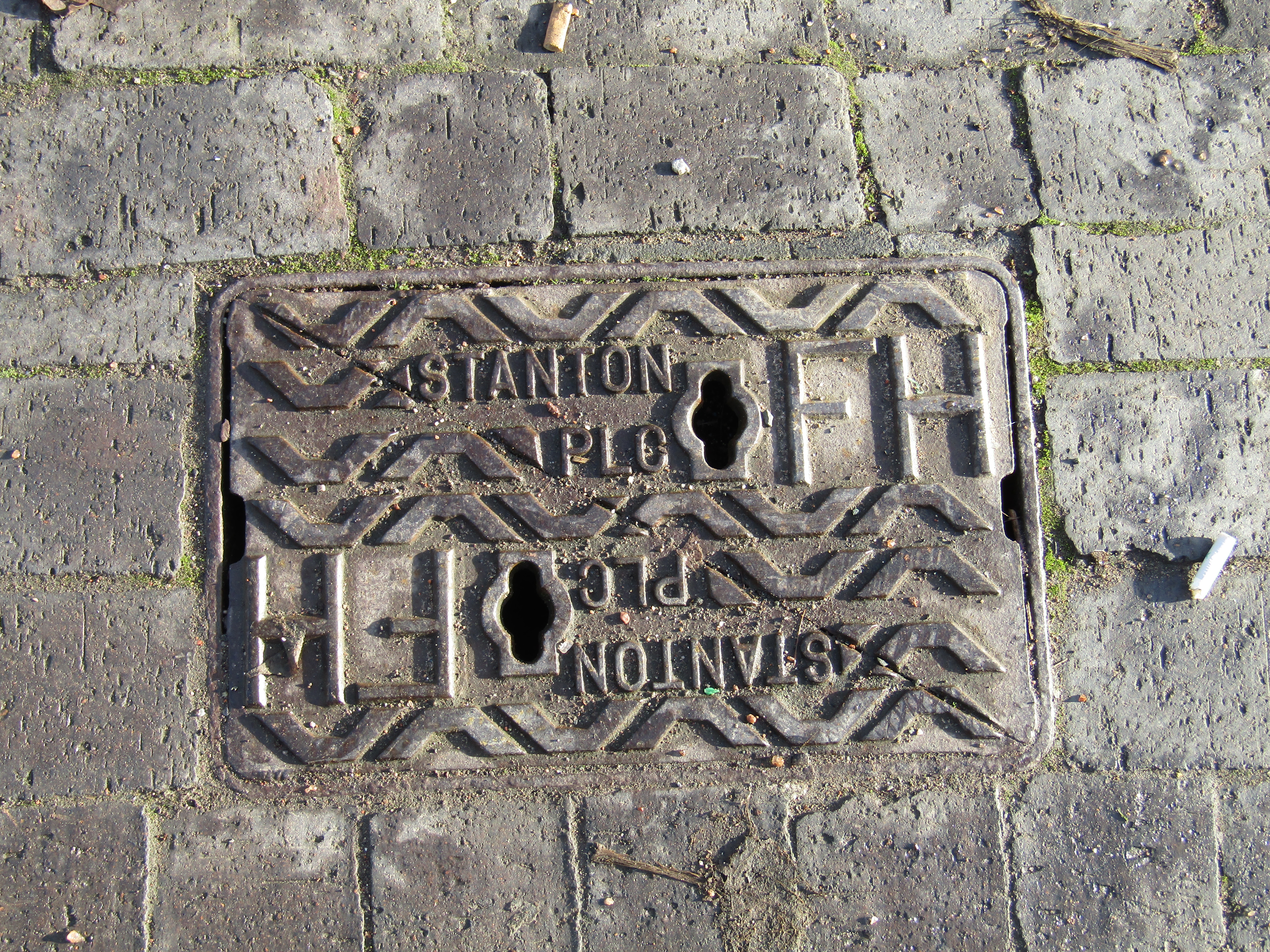
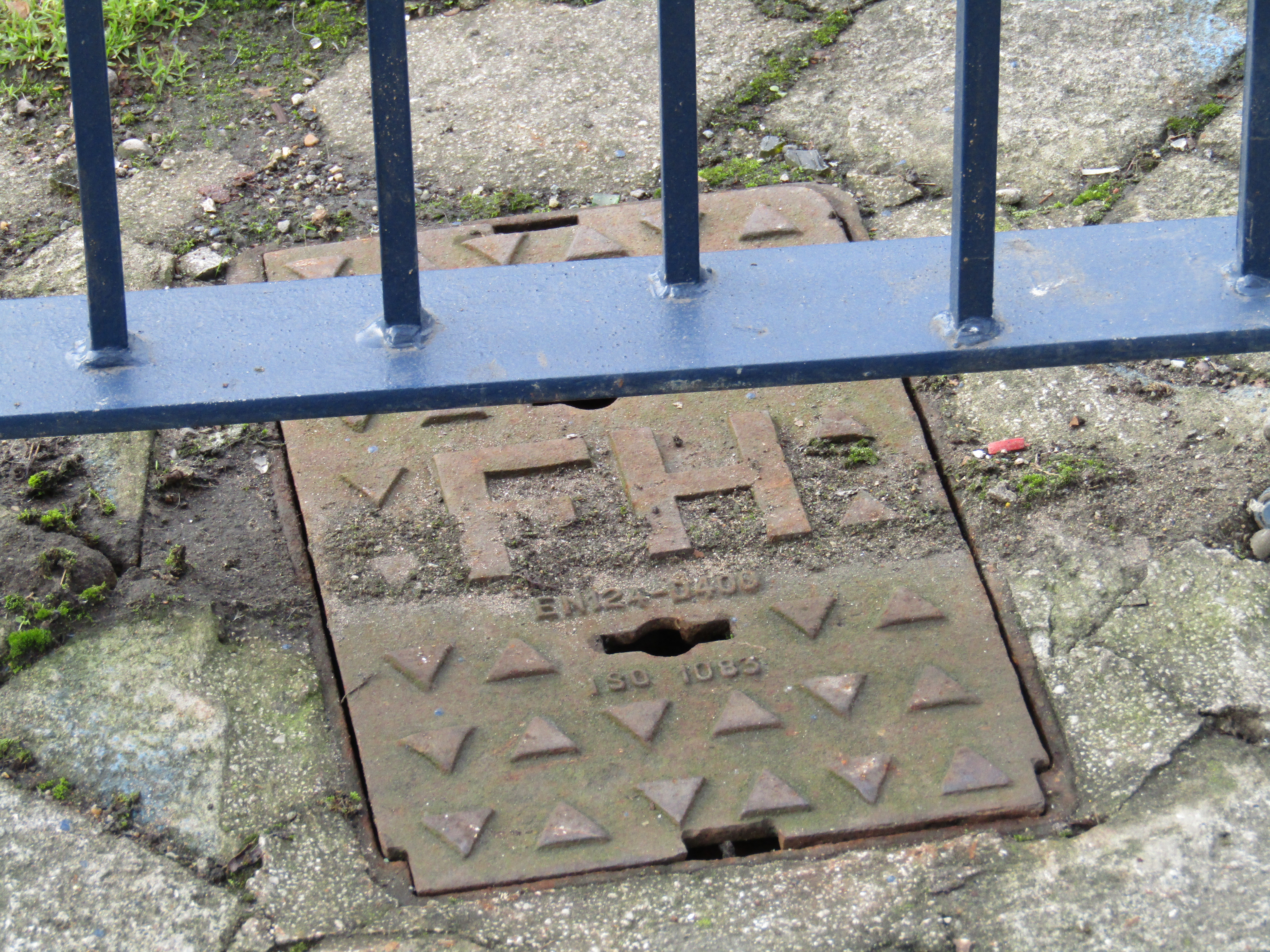
So you have to on the lookout on the ground as well as spotting yellow H signs.Fire hydrant covers generally have FH on them to identify them, although some older ones can have just H only. Whether the older style ones are still operational I don’t know, but they get mapped anyway.
And of course it’s always good to see public organisations collaborating successfully with each other!
The basic tag is emergency=fire_hydrant with more details on the OSM wiki
Why the sudden interest in fire hydrants? In the UK, they’ve languished as an item that gets mapped.
At our last mappamercia pub meeting Andy Mabbett regaled us with his saga of trying to get West Midlands Fire Service to release the locations of fire hydrants under Freedom of Information legislation.
The full saga can be found here
WMFS refused to release the information on the grounds of national security viz: “publishing information about water networks and other parts of the critical national infrastructure could expose vulnerabilities in the network and pose a serious risk to public health either through non availability of water resource or
contamination of supplies. There does not have to be any evidence that this is being planned but it is a possibility given the current threat level in the United Kingdom.”
An appeal by Andy against WMFS to the first-tier information rights tribunal mainly on the grounds that other Fire Services in the UK had already released their information on fire hydrants was rejected. The judges agreed with the Information Commissioner’s Office (ICO) assessment:
“The ICO concluded that the withholding of the information was reasonably necessary for national security and a listing of hydrants and their locations would assist in the planning of an attack by poisoning on water supply infrastructure by identifying access points. Such an attack on the infrastructure would be in the domain of national security. While hydrants are visible a comprehensive list of the precise location of every hydrant would place in the public domain more information than is available through hydrants being visible. WMFS supplied a list of attacks and attempted attacks on water supplies.The ICO considered that such an attack was plausible.”
There is a method for contaminating the water supply known as backflow contamination, which is considered to be reasonably easy according to an excellent paper here which quotes extensively from US military and homeland security sources. Fire hydrants are one possible source to generate backflow.
My limited understanding of water networks is that backflow is a general problem for the water supply industry, which can mitigate the effects with backflow prevention devices. Just how extensive and successful this mitigation is in the UK (and thus how safe we are from backflow attacks) will remain a commercial mystery, as our water supply is in the hands of private companies who are under no obligation to reveal such information. ( I have another story about water networks and open information which will be the subject of a later blog)
Given the cult of secrecy that exists at all levels of official Britain, it also seems unlikely there will be any disclosure of the risk levels of such an attack vector so that we might make up our own minds based on the data. We will have to make do with the assurances of “those that know best”. The public’s role seems to be limited primarily to that of potential or actual victims.
This issue does raise some interesting ethical challenges for OpenStreetMap as it seems to be sending us back several centuries when accurate maps were regarded as military secrets. Or to the days of the Cold War when our national mapping agency the Ordnance Survey would obligingly leave blank spaces on their maps at the sites of military installations. Would a map of fire hydrants in the West Midlands be construed as offence under ss57&58 of the Terrorism Act 2000: collecting, possessing or making a record of information of a kind likely to be useful to a person committing or preparing an act of terrorism? Should we be standing up for opendata, one of the founding principles of OpenStreetMap, or protecting (supposedly) national security? What is the position in other jurisdictions where there are more draconian restrictions about identifying and mapping military installations and “national critical infrastructure”? Are mappers more circumspect there? What’s the legal postion- is the OSMF liable for prosecution or just the contributing mapper or both? Should OSMF comply with a demand to remove information on the grounds of national security? Or to refrain from collecting it in the first instance?
According to taginfo there are only 1786 fire hydrants mapped in the UK, of which there are now about 300 in the West Midlands. Prior to my interest being piqued by this sorry tale there were only about 5 fire hydrants mapped in the West Midlands. Judging by the density of fire hydrants I’ve discovered so far, there are probably thousands in the West Midlands so I seriously doubt whether we’ll ever crowdsource the location of all of them,(or even many more than we have already).
Nonetheless, it’s been an education in another aspect of urban infrastructure I wasn’t really aware of, and a confirmation of the patrician “you don’t need to know about that” attitude of much of British officialdom.
(all of the images are my own and are published here as public domain)
Ilya Zverev
In some regions of Russia, firefighters maintain a map of fire hydrants in OpenStreetMap data, so they could use OsmAnd during fire emergencies: http://karta01.ru/#zoom=14&lat=5404552.90614&lon=4422837.83374&layers=BTT
Chris Hill
I tried to get a list of hydrants from Humberside Fire & Rescue in 2012. I drew a blank too.
https://chris-osm.blogspot.co.uk/2012/05/fire-hydrant-locations-are-confidential.html
Mark L
It appears things have moved on since the original discussion and this site https://dataservices.riscauthority.co.uk/map/index shows the location of 1000s of fire hydrants. Surely there must be a way of connecting this data to OSM.
https://dataservices.riscauthority.co.uk/map/index
RobJN
Brian, you are mixing metric and imperial! Here’s a quote from wikipedia explaining the numbers:
“The two numbers indicate the diameter of the water main (top number) and the distance from the sign (lower number). Modern signs show these measurements in millimetres and metres, whereas older signs use inches and feet. Because the orders of magnitude are so different (6 inches versus 150 mm) there is no ambiguity whichever measuring system is used.”
Brian
I thought about this, but the distance from the sign to the actual hydrant doesn’t seem to be in metres, I estimated it in feet, but it does seem more sensible for it all to be metric
Steve Hill
Watch this old school programme Stop Look and Listen (link below) on the fire service and you will hear that the old pre-metric fire hydrant signs told you the number of paces to the fire hydrant nearby, https://youtu.be/A1An0YYlY7k
weeklyOSM 337 | weekly – semanario – hebdo – săptămânal – haftalık – 週刊 – týdeník – edisi
[…] Prangle has written a guide to help with the collection and mapping of fire hydrants in UK. This mapping effort was prompted by […]
EdLoach
I’ve toyed with the idea of mapping fire hydrants in the past but couldn’t work out where best to place the node for hydrants in the road, when the OSM way only represents the centreline. I see since I last looked the wiki mentions a fire_hydrant:position=lane/parking_lot/sidewalk/green (optional) tag which might or might not be relevant but the wiki proposal and documentation that mention it are incredibly lacking in detail about its intended usage.
G
Just so you are aware and probably are anyway the fire brigade have a detailed electronic mapping system showing hydrants and reservoirs etc
Martin Dale
For my sins, I have to produce Fire Prevention Plans for my clients to submit to the Environment Agency. Part of the information I have to send is the location of nearby fire hydrants.
For two years now I’ve been able to get information from the relevant Fire Service. Today I get “After discussions with the water companies we are unable to pass on this information and are advised that anyone requesting such information should contact the water company through their enquiry process.” I’ve mailed Severn Trent – so far no reply.
Martin Dale
PS.
I have a collection of fire hydrant locations from previous work if any-one wants to map them
Brian
Hi Martin
If your data is unencumbered by any licence restrictions that prevents its use in OSM then we’d love to have it!
Russ Jones
Hi Martin
We are in the same position as you! The EA insist on hydrant flow rates and we can’t supply them – from the FS or ST. Try UK Fire Hydrant Regs. BS750 – but there doesn’t seem to be a laid down minimum flow rate for a hydrant (the hydrant needs to be capable of 2000l/m but the main does not . . .)
Let us know if you crack this!
Cheers
Russ
Andy Mabbett
I made a follow-up FoI request in April 2017:
https://www.whatdotheyknow.com/request/number_of_fire_hydrants#incoming-970626
and was told that there are (rather, were at that time) 42302 water-company hydrants in West Midlands Fire Service’s administrative area.
Bob
The arguments for not disclosing information seem pretty reasonable to me. Why on Earth are you trying to expose this information after the potential for malicious attack has been explained to you!? Why do your needs come above Nation security? Are you 6?
Andy Mabbett
“Why on Earth are you trying to expose this information after the potential for malicious attack has been explained to you!?”
Because the locations of most if not all hydrants are not secret – as you can see above, many are marked with luridly-visible, bright yellow signs.
Asking for the location of hydrants doesn’t imply the revealing of secret or secure information, it just saves leg work and volunteer time, and enables us to be more thorough.
Not being 6, we were able to work this out for ourselves. Why couldn’t you?
JohnM
I know of two occasions where the Fire Brigade were unable to find hydrants near to a fire. In the first in Devon people died in a hotel fire possibly exaserbate by the inability to find the nearest Hydrant or get sufficient water when it was located. In the second occasion it was on a large private premise and the fire hydrants were in an unusual location in the wall of a building and were apparently not shown on the fire brigade plans.
Lucy Best
As a homeowner and mum in a rural location, I would like to know where my nearest hydrant is just in case we have a fire. It might save time for the firefighters to scabble about in the undergrowth looking.
xc
The top number refers to the main diameter in inches,the lower number is distance from sign in feet
Mark L
It appears things have moved on since the original discussion and this site https://dataservices.riscauthority.co.uk/map/index shows the location of 1000s of fire hydrants. Surely there must be a way of connecting this data to OSM.
https://dataservices.riscauthority.co.uk/map/index
Andy Mabbett
The riscauthority website now appears to be password protected.