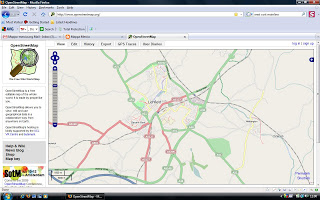
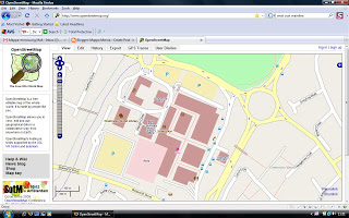
On a glorious summer’s evening we altered our regular monthly social meeting venue to the city of Lichfield. For the first hour we mapped and then spent the rest of the evening through dusk sitting in the pub garden eating, drinking, making merry and talking maps, maps, maps. We had our best turnout, with Paul, Peter, Andy, Christophe, Mike and Brian making the journey.
Chelmsley Wood
Public Transport Map of Birmingham
I added a tram relationship to the Midland Metro line today so hopefully the opnvkarte renderer will show this on the public transport map in a few days.
Birmingham Outer Circular Bus Route 11
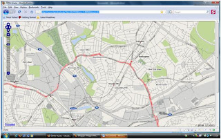
Well I’m well and truly hooked on entering bus routes as relations now I’ve discovered a cool German website that renders bus routes (and all other forms of surface public transport routes). Click here for a browse around.
Two minor problems so far – one, the site’s in German for the map legend but the rendering is great; and two, new edits only appear at zoom level 13 so you look at a bigger map and you only see older edits (don’t know yet what frequency these levels are rendered at, but at level 13 it’s done on a daily basis). The only bus stops that currently get rendered are those with a name tag.
So… I’ve entered lots in SE Birmingham, but avoided the City Centre terminations so far. I’d appreciate some help from the folks in Coventry to get route 900 completed. Anyway the big achievement is to get the whole of the route 11 completed. And no, I haven’t entered two relations one for the clockwise 11C and one for the anticlockwise 11A! It was enough work just doing it once.
Why can’t signmakers get it right?
More Fun at the West Bromwich Mapping Party
It wasn’t all mapping and editing at West Bromwich this weekend. Our party coincided with a Beer Festival complete with live music. Our party was held in the West Bromwich’s major new architectural land mark The Public, and was arranged for us by the local MP Tom Watson, who as Minister for Digital Engagement is keen to see community involvement such as ours and is also a keen advocate of freeing up government data.
We had 12 people out on the Saturday, some of them new to mapping and 7 on the Sunday. Saturday evening saw us sampling West Brom’s finest curries
No doubt there’ll be other pictures up here soon – I wasn’t the only one snapping away!
NaPTAN bus stop data – fun at the West Bromwich Mapping Party
The Bus Station was just too tempting, given the sparse nature of the the NaPTAN data on import, which you can see on the right. The blue vertical line represents the collection of bus stop nodes for the bus station.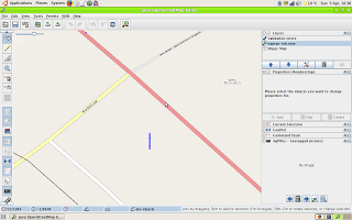
After a morning’s effort walking round the bus station with a camera and GPS ( couldn’t cycle round – everything except buses is banned for obvious reasons in the roadways) I got the following result after an afternoon’s editing.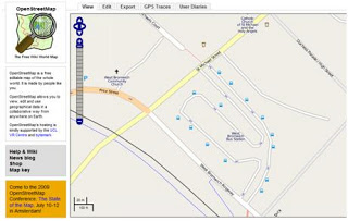 ,
,
You might say this is a bit slow but bus stops have an awful lot of information attached to them, like all the routes, which aren’t in the NaPTAN data. I also found two nodes that are in NapTAN, Stands W and X that no longer exist on the ground.
Just for comparison this is what Google does with the NapTAN data: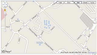
Microsoft Virtual Earth doesn’t show the NaPTAN data for bus stops at all, preferring to think that the bus station is maybe a railway station and a tram (Metro) stop!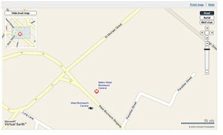
And Multimap plays it safe by ignoring everything public transport-based.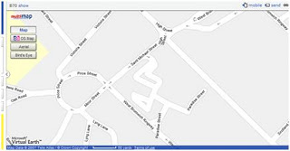
Birmingham gets NaPTANed
Import of the NaPTAN data for Birmingham has been completed as a trial and we can now start the job of bus stop verification and adding all the bus route information which is not available in the NaPTAN dataset.
Here’s an example of the NaPTAN data merged with our own surveyed data:
Node: #367691014 |
|||||||||||||||||||||
|
Birmingham & Solihull map now in print
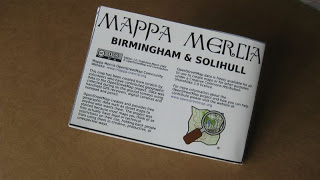
Today we received our batch of 50 limited edition prints of the new Mappa Mercia Birmingham and Solihull map built from the ground up by the OpenStreetMap community in the West Midlands. This is the first edition printed on A0 poster paper and then folded to create a traditional folded map. Coverage is the whole of Birmingham and Solihull right out to the Motorways.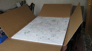
Matt Amos at Cloudmade kindly created one large PDF from Mapnik. The level of detail is basically that seen on the OpenStreetMap zoom 14 Mapnik layer. However the printers needed it in CYKM and our PDF was RGB so we rasterised the map at 300dpi to create a compressed TIFF without loosing any resolution at the printed size.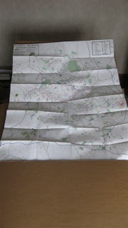
The maps will be folded and numbered. Some will be given to the main contributors in Birmingham and the plan is that the rest will be sold to cover the cost of printing or in some cases used for promotional purposes.
