Happy 10th birthday OSM!

posted in: Mapping Party | 1

Appropriately 10 of us gathered at 6/8Kafé to celebrate 10 years of OSM. It was satisfying to see that our email campaign of contacting most users who had contributed to OSM in the midlands brought along six people to their first OSM meeting in the Midlands. We had users from Oxford,Worcester, Coventry and Stafford as well as the usual crowd from Birmingham (well….  minus a few notable examples who had very good excuses!) Thanks to everyone who gave up their time to come along,  I think we all gained something from swapping experiences  and tips and tricks for editing and tagging and data sources. Apologies to Steve Coast, our founder, who still has 12 ways in our region showing him as the last editor – we didn’t have the time or resources to invite contributors with this number of edits.

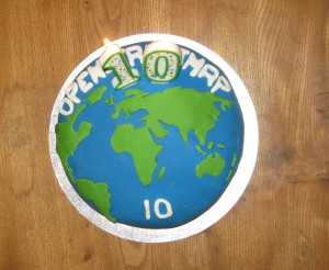
Naturally we had a cake, baked and decorated by Liz. Here’s  a Level 1 aerial image:

OSM10 Level1

I hope people remember which slice they were allocated- we’ll be expecting some edits!

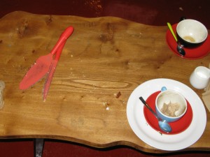
In true OSM Mapping Party tradition there has to be an image of AFTER:

OSM10after

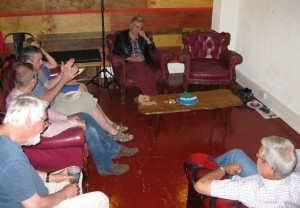
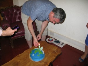
And of course we need to see who turned up:

OSM10Group OSM10 Andy

And finally thanks to Sal and her crew at 6/8Kafé  on Temple Row who generously donated a venue for us in their basement. Any OSMers visiting Birmingham, pop in for coffee and cake, you won’t be disappointed – beats the corporate coffee chains hand down.

IF YOU’RE ORGANISING YOUR OWN PARTY –  HAVE FUN

An unusual find- in more ways than one!

On 31st July the mappa-mercia gang of mappers descended on Shenstone for our monthly pub meeting. It was a glorious summer’s evening which confirmed our strategy of getting out and about around the region during the summer months to take advantage of the late evenings to combine some mapping with our usual meeting . For Shenstone we had a set ourselves the challenge to see if we could map a complete village in one evening. We did cheat slightly by pre-populating the buildings from armchair Bing aerial imagery tracing. We almost got there but not quite!

To the North of the village we came across a small memorial commemorating “Shenstone Lammas Land”. Now we all believe we know what Common Land is, it being a familiar presence in rural England, but Lammas Land had us all guessing. So a quick Google search soon informed us.

Lammas land’ is land with ‘common grazing rights’, which are grazing rights belonging to those commoners who had registered the right to graze their animals on the land.

Lammas rights go back to the middle ages, but only existed between August 1st (Lammas Day) and February 1st (Candlemas), when the animals were removed to allow crops (usually hay) to be grown for harvesting in mid summer. Then on Lammas day the animals were returned to graze off the stubble.

You can read about the villagers’ 25 year legal campaign to preserve their rights here, which successfully concluded as recently as 1998.

What a coincidence to come across this piece of Lammas Land on the eve of Lammas Day!

OpenStreetMap 10th Birthday Party Saturday August 9th

posted in: Mapping Party, Participate | 1

OpenStreetMap’s 10th birthday party is on Saturday Aug 9th. We’ll be celebrating here in the West Midlands complete with birthday cake alongside scores of other cities and communities around the globe.

It’s hard to believe just how much we’ve developed our map and community in 10 years.

Anyone who has ever contributed to OpenStreetMap in the West Midlands or adjoining counties is welcome to come along and chat about the past 10 years of mapping and probe into the future of the next 10 years. That’s about 1,000 of you! Or indeed anyone who has ever registered as a user and not been able to make an edit – see how you can get started! Or anyone who’s just interested in maps and wants to find out what we’re about.

Our venue is very central. We’ll be located in the basement of 6/8 Kafé on Temple Row B2 5HG from about 12noon until about 2pm. Being mappers we have to provide a map on how to get there: it’s here.

Get there early or there may not be any birthday cake left (only crumbs, smiles and photos).

Birthday cake will be provided by Andy Robinson’s partner Liz and judging by the food we got at past  planning meeting at Andy and Liz’s house – its an event not to be missed!

6/8 Kafé are generously providing the space free to us so come along and sample some of their coffee and food. The venue has been voted as one of the top 50 coffee shops in the UK by readers of The Independent newspaper. Google Reviews opines: “ Relaxed cafe where coffee-mad baristas serve up artisan brews, home-baked cakes and deli fodder.”

Join us for your first global birthday party. Pop in and stay for as long or short a time as you like.

Tysoe Mapping Party May 31st 2013

posted in: Mapping Party | 2

On Saturday we held a mapping party in the Warwickshire village of Tysoe (it’s really Upper, Middle and Lower Tysoe) strung out along the foot of Edge Hill. Edge Hill was the site of a Civil War battle in 1642 – fought just to the North of Tysoe, close to the village of  Radway. We were based in the Village Hall  to take advantage of its wifi.

Thanks are due to Mike and Sue Sanderson for organising the event, the local WI for providing the refreshments and the 55 residents who turned up to contribute. Contributions ranged from long walks along unmapped footpaths, geo-tagged photos, addresses and postcodes along with a wealth of local knowledge and history that only residents can provide.

We had a screen displaying OpenStreetMap live edits and people were engrossed to see themselves as part of a much wider mapping community, watching what was going on around the world and seeing their local contributions making an appearance.

Rob and I were hard-pressed entering the data provided, answering questions and demonstrating various editing techniques. We were both exhausted at the end of the day!

The map is considerably improved and will continue to evolve as the local community and Parish Council evolve a Neigbourhood Plan. Several people expressed an interest  in developing their editing skills and we look forward to helping the good people of Tysoe develop their map.

We were so busy during the day that we forgot to take any photos of the event!

For readers not based in the UK the WI is the Women’s Institute – a venerable UK voluntary body set up in 1915 to revitalise rural communities by encouraging women to join the war effort in food production. Its aims have since broadened and it now the largest women’s voluntary body in the UK with over 200,000 members. You can find out  more here.

Mappa Mercia’s May meetings

posted in: Mapping Party, Participate | 0

We are holding two meet-ups this month and to celebrate I’ve rehashed the alliteration in the title of this blog post from our from our March meetings post. I promise the meetings will be more exciting than my writing!

Our two meetings are on the first and last day of the month:

  • Thursday, 1st May: The Edward Rutland, Stourbridge at 7:00pm for our regular pub meet; and
  • Saturday, 31st May 2014: Mapping day in Tysoe (at request of Parish Council – details to follow).

As always newcomers are very welcome to join us and find out more about OpenStreetMap and Mappa Mercia. Try to let us know beforehand so that we can look out for you. Details on the contact page.

You can also view our full Summer 2014 schedule on our wiki page.

OpenStreetMap recognised by Free Software Foundation Europe with Document Freedom Day Award 2014

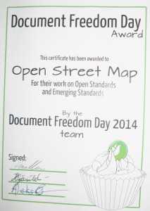
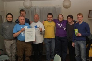
On Saturday evening 22nd March at the Warehouse Café in Digbeth Birmingham members of mappa mercia received the annual Document Freedom Day Award 2014 on behalf of the OpenStreetMap Foundation from the Free Software Foundation Europe, whose members travelled down from Manchester for the event.

DFD certificate


Document Freedom Day is organised every year by the Free Software Foundation on the last Wednesday of March “ for celebrating and raising awareness of Open Standards and formats . On this day people who believe in fair access to communications technology teach, perform, and demonstrate.”  So watch out for events all round the world this Wednesday 26th March.

Last year’s award went to  Die Tageszeitung  for using  five Open Standards in publishing  their daily newspaper.

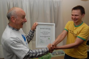
Receiving the award Brian Prangle long time OSM contributor and local mappa mercia community co-ordinator said: “It’s always great to have your work recognised, so thank you, on behalf of all the hundreds of thousands of contributors to OpenStreetMap, to FSFE for their award. We’re thrilled that you see OpenStreetMap as making such an effort towards open standards and it’s especially pleasing that you position us as an ‘emerging standard’”

DFD award


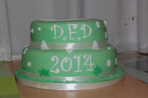
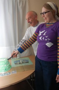
A celebration is nothing without a cake, so apart from the mandatory certificate which we can share with the whole of OSM, FSFE generously provided a superb cake which we ate so unfortunately we can’t share it! But rest assured we worked hard on behalf of OSM and devoured as much as we could before heading off to a nearby pub.

 DFD Cake

“This was a wonderful opportunity to learn about the achievements and problems faced by a sister movement” said Anna Morris from the Document Freedom Day campaign. “We found that we have many common goals and ample opportunity to share skills and resources.”

DFD cake cut

We had such a good time with a lovely bunch of people from FSFE and as Anna said we share many goals and ideals so we are planning to keep the contact and collaboration going to see how we can assist each other.

DFD group

Images   Andy Mabbett,
CC-by-SA 3.0

Mappa Mercia’s March meetings

posted in: Mapping Party, Participate | 0

[Update 2014-03-13: The plans for Saturday’s mapping event in Worcester are confirmed as an afternoon mapping followed by a meet-up at about 5pm in The Crown pub in the city centre.]

Firstly an apology. Inspired by Andy’s recent mailing list email I simply couldn’t resist in adding to the alliteration in the title of this blog post! Sorry folks.

There are two mappa-mercia meetings organised for March. Our regular first Thursday of the month evening meet-up and a Saturday mapping party in Worcester. As always newcomers are very welcome to join us and find out more about OpenStreetMap and Mappa Mercia. Try to let us know beforehand so that we can look out for you. Details on the contact page.

  • Thursday, 6th March 2014: The Bull, Birmingham at 7:30pm for our regular pub meet; and
  • Saturday, 15th March 2014: Mapping day in Worcester (details to follow).

 See you there!

Conference: State of the Map 2013

posted in: Mapping Party, Participate, Use The Map | 0

Many of you will have already heard the great news, but for those who haven’t, I am pleased to announce that OpenStreetMap’s annual conference will be held in Birmingham, from 6th – 8th September 2013.

The conference, known as State of the Map 2013 (SotM 2013), will see 300 users converge on Birmingham to discuss everything OpenStreetMap. It’s been 6 years since the conference was last held in the UK and in that time OpenStreetMap has developed from a project with 10,000 contributors, to one of 1.05 million registered users. To reflect on this huge growth, this years theme is “Change”.

Simon Poole, Chairman of the OpenStreetMap Foundation reflects:

“Change is a constant in OpenStreetMap. Not only does the world around us change and require resurveying all the time, the OpenStreetMap project itself continues to evolve very rapidly in every aspect. The organisation that is returning to the UK with its main public event after 6 years, has grown from a small, fun project, to an undertaking that is competing with multi-billion dollar corporations but still is fun for everybody involved. In that vein I’m looking forward to SOTM in Birmingham and expect that we will all have a great and interesting time.”

Being such a big event, we are delighted that we are not alone in organising the conference. In addition to regular Mappa Mercia members, we also have the support of many other OSMers from both inside the UK and around the world. Thank-you for all your input.

For more info see: stateofthemap.org

November Pub Meeting

posted in: Mapping Party | 0

We had a good turnout last night in the Spon Gate in Coventry – nine people, including  three new faces. A special welcome to Florian who’s just arrived from France for a long stay, working in Coventry. It was a good choice of pub with some excellent choices of beer made tastier by their low cost – well done Wetherspoons!

Our discussions ranged widely and randomly as usual, including: aerial photography, postcodes, quadrocopters, bridge relations, postcodes, listed buildings, footpaths, blue plaques, postcodes, SOTM, memorials in cemeteries and parks, postcodes, tagging businesses, public bodies’ open data, plans to improve our building definition inside the Ring Road in Coventry, Natural England open spaces and all the other topics at the other end of the table I couldn’t hear.

We didn’t just idly chat, we also made some plans:

  1. To keep the momentum going from the completion of tracing buildings in Birmingham we decided on collaborative armchair mapping of the buildings in Balsall Common – a large dormitory village midway between Coventry and Birmingham.  Maybe it will motivate some of us to travel there to do some surveying. We’ll have to remember to get off the train at Berkswell ( named after the next village to Balsall Common, even though the station is not in Berkswell  but Balsall Common – such is the logic of naming of stations!)
  2. Next month we all felt we’d like a curry rather than a pub meet , which soon progressed into “Let’s map the Balti Triangle in Birmingham”. Now the Balti Triangle can probably be surveyed relatively speedily, so we soon expanded the mapping objective to the Bus Route 37 which can be boarded outside Moor Street Station and will take us to the edge of the Balti Triangle. So the party will be dubbed “Mappa Mercia 37” and will take place on Saturday December 1st with mapping for as long as the weather and stamina allows until it gets dark – say 4:30 where we’ll meet in a pub (bit of a challenge since the area is mostly muslim and most of the pubs have closed!) and then proceed for an early evening curry. Cake based on No 37 bus stops will be up shortly.
  3. SOTM 2013 bid – numerous decisions based on keeping up the momentum which will be communicated separately to Talk-GB.

If I’ve missed anything apologies and let me know so I can add it.

A exercise in micro-mapping: The National Memorial Arboretum

posted in: Map Improvements, Mapping Party | 1

The National Memorial Arboretum had been nagging at us for months, being a cultural resource of national significance situated within  our mapping “domain”, and having only the sketchiest of coverage in OSM (thanks to those who had got it to at least that level). So one evening in the pub we decided to tackle mapping its 150 acres (0.405 ha).

The National Memorial Arboretum sits on a piece of reclaimed gravel pit alongside the River Tame. Inaugurated in 1997, it was designed to rival the Arlington National Cemetery in Washington DC. Its obvious military bias is now being somewhat softened by the appearance of  memorials to any event – for instance there is a grove of trees where those reaching their diamond wedding anniversary (60 years) can plant a tree and have it dedicated to them.

Given the horrendously wet summer Britain has been experiencing, the three day survey carried out by mappa-mercia volunteers (all of two of us) spread out over a couple of weeks was a squelchy affair – a reclaimed gravel pit adjacent to a river has a pretty high water table!

There are over 200 memorials ranging from the simplest plaque; large gardens; benches; flagpoles; ornate sculptures on plinths; relics from battlefields and campaigns (for example pieces of the Burma Railway from WWII) to the elaborate centrepiece of the Armed Forces Memorial. And of course the 50,000 trees which are either arranged into named groves or are individually dedicated.

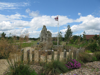
Here’s an example of a memorial – this one is for the Royal National Lifeboat Institution which has benches, a sculpture,pathways and a flagpole all contained within a garden designed to recreate the feel of a shingle beach:
We concentrated on the memorials, gardens and groves and we think we’ve got about 95% of them. The hundreds of benches and trees that have individual dedications overwhelmed us and will take someone more dedicated than us several months of surveying.  Of course memorials are being constructed constantly so periodic resurveys will be necessary. The day after our final survey a new memorial to the Parachute Regiment was due to be dedicated and there were feverish preparations underway for the ceremony.

In any case a resurvey will be required as the Visitor Centre is due to be expanded (reconstructed would be a better description judging by the plans on display) to cope with the visitor numbers- currently at 300,000 annually. Many visitors are grieving comrades or relatives, and there are of course the regular annual anniversary ceremonies by many veterans’ associations and military units; but as the site is such a fantastic educational resource for British history I guess it attracts many school visits also.

The problem with micro-surveying at this level was that the POIs to be recorded (memorials,benches,trees, flagpoles etc) were often closer together than the accuracy of our GPS units (sub 5 metre), so that interpreting GPS data could only take place with the help of a huge number of photographs to show proximity and orientation.  So the usual rule of thumb that one hour of surveying translates to one hour of editing  became more like 2- 3 hours of editing as GPS traces, notes and photos all had to be cross-referenced for accurate placement. Also most names of memorials were long and complex and needed careful attention to spelling.

The resulting map can be viewed here. As can be seen the current default rendering has problems with so many names being so close together that it’s difficult to display them all. Anybody want to have a go at solving this? Is it soluble?

There remains one other major mapping problem. The National Memorial Arboretum is part of the National Forest : an ambitious project to plant 200 square miles of central England with trees to recreate the original forested landscape. 7.8 million trees have already been planted and the tree cover increased from 6% to 18%.  How to map this? It’s not a national park. It’s not contiguous, but a patchwork. It’s not all forest but has open spaces also. Most of the tree-planting is not mature. It’s run by a private company created by Act of Parliament under the auspices of a government department DEFRA (Department for the Environment Food and Rural Affairs) – so is it leisure=park? Should its whole outline be mapped and named as a region with a ceremonial administrative boundary? Should the planted areas be mapped as a multipolygon and added to as new areas are acquired and planted? How should the constituent parts be named: as National Forest from the multipolygon, or for each area where it has a separate name? Any comments are welcome.

Next national resource in our region to tackle: the recently-opened National Football Centre at St George’s Park near Burton-on-Trent.