OSM Wiki pages: tablets of stone or beacons lighting the way?

posted in: Uncategorized | 3

A long and as usual heated debate took place recently amongst the UK OSM community about the status of place nodes within large cities, prompted by a mapper changing a large number of place names to a blanket tag of place=suburb in London and Birmingham. The defence was that an OSM wiki reference that said this was the proper way to do things. Naturally, the situation on the ground is more complicated than this and the upshot was a revert. The heat and light generated by the debate and the nuances of the various threads of the argument needn’t concern us here, interesting though they were

What is more important is to concentrate on just what status the content of an OSM wiki page has.

In my opinion the content of a wiki page is:

1. as close to authoritative as possible but NOT AUTHORITATIVE

2. for guidance only: it is NOT MANDATORY

3. reflects only  the collective opinion of the editors of the page (and there may be very few editors, or very many but still not representative) and not the collective opinion of the wider community.

4.subject to local knowledge and ground surveys which ALWAYS TAKE PRIORITY OVER WIKI CONTENT

5. to be ignored only after careful thought and suitable tagging with a note= xxx tag to explain the exceptional circumstance

6.not to be used as a basis for routine automated edits: see OSM policy on automated edits which requires discussion with the community affected and the reaching of a consensus before proceeding

As ever OSM mapping is all about mapping truthfully what you see on the ground and reflecting any local knowledge you either have personally or have gathered from local residents. (Copyright-free authoritative sources can also be used – how else are we to add boundaries?)

One good suggestion made to me was that if you are in doubt about how to tag an object and the wiki isn’t clear or doesn’t fit your situation, a quick search of taginfo will let you discover how other mappers have tagged it. Or you can discuss your problem with your national OSM talk email list.

Don’t just assume the wiki is the ONLY way to do things and must be adopted whatever the circumstances.

Probably for 99% of the time the wiki can be relied on – it’s just the other 1% has so much potential for causing mayhem.

“Mapping for the renderer” is frowned upon. Should we also frown on “mapping for the wiki?”

To those who spend considerable energy and expertise editing wiki pages: thankyou. This is not to belittle your efforts, just adding a cautionary note. And I know that improving wiki pages is down to everyone but as ever it’s much more fun to be doing than documenting.
There’s only ONE Royal Oak

posted in: Uncategorized | 1

I’ve meaning to visit Boscobel House and the Royal Oak for some time. Rationale: it’s relatively nearby and it’s an essential visit for anyone interested in in English History. Boscobel House sits on a 615 mile long distance path known as  the Monarch’s Way. The Monarch’s Way attempts to match the route of the flight of Prince Charles ( later to become King Charles II) after his defeat at the Battle of Worcester in 1651, which marked the decisive end of the Royalist campaign in the English Civil War and the ascendancy of Oliver Cromwell and Parliament.

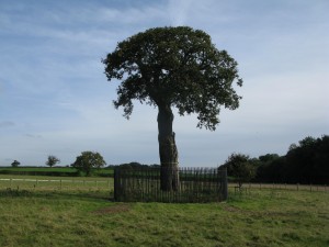
Boscobel marks the furthest point North on Charles’s flight to France and exile.   Initially, Charles was led to White Ladies Priory  just a mile down the road; and after a failed attempt to cross the River Severn he ended up at Boscobel, aided and abetted by the tenants, the Penderel family. Charles had to spend a day hiding in the branches of the tree before spending the night in a priest hole in the nearby Boscobel House.  Hence the name: Royal Oak.

IMG_8893

There’s a great summary of the adventures at Boscobel House here.  Upon the restoration of the monarchy, Charles II awarded the Penderels a pension in perpetuity, which their descendants still receive today.

So famous did the tree become in the folklore of England that Royal Oak became a favourite name for pubs and ships of the navy.  Using taginfo I found over 500 pubs named Royal Oak and over 100 roads/streets also named Royal Oak.

Souvenir hunters gradually wore away the original tree  down the centuries, so what you see today is a sapling which is a direct descendant of the original. The original eighteenth century iron railings have also been supplemented with another fence some 20 metres out from the tree to make sure this one survives.

There is a backup tree which was planted from an acorn of the original tree in the year of Queen Victoria’s  Golden Jubilee, 1887, which stands in the gardens of Boscobel House. Needless to say, both house and tree are protected by statute

The house and site are managed by English Heritage and are open to visitors

October Joint Social Meeting with Beacon Roads Cycling Club

posted in: Uncategorized | 2

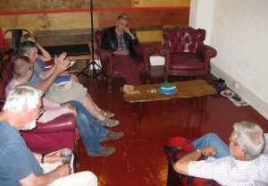
This month on Thursday October 2nd we were lucky to be invited to present the local work of OpenStreetMap to the Beacon Roads Cycling Club at Rednal Social Club. BRCC is active in South Birmingham and Worcestershire, with about 150 members and is a long-established club.

Andy (Blackadder) gave a thorough presentation both on OSM and reviewing the tracking/navigation tools available to cyclists. Most BRCC members currently use Strava and there was a great appreciation of the  value of OpenStreetMap which powers many of the cycling tools. Andy’s estimation of his presentation time was blown out of the window as he had to answer so many questions and comments!

Beacon RCC Presentation

BRCC members generally felt that the cycling-specific tagging schema for entering OSM data seemed to be more orientated to urban cycling and they’d like to see tagging that was more orientated towards rural club cycling that didn’t confine itself to NCN routes.

They were very concerned that there was currently no way to alert cyclists to  hazards.  There is alocal stretch of NCN Regional route 55 , Icknield Street, that they  always avoids on club rides so dangerous do they consider it to be.  There and then we edited the stretch with two new tags: cycle_hazard=yes  and paving_quality=poor.

Thanks to the Beacon Roads Cycling Club for their hospitality and interest. Hopefully in the coming months BRCC members will add their considerable knowledge of the area to OpenStreetMap.

Happy 10th birthday OSM!

posted in: Mapping Party | 1

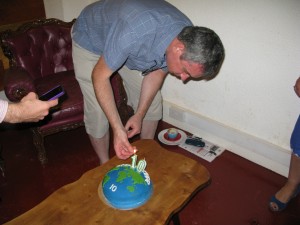
Appropriately 10 of us gathered at 6/8Kafé to celebrate 10 years of OSM. It was satisfying to see that our email campaign of contacting most users who had contributed to OSM in the midlands brought along six people to their first OSM meeting in the Midlands. We had users from Oxford,Worcester, Coventry and Stafford as well as the usual crowd from Birmingham (well….  minus a few notable examples who had very good excuses!) Thanks to everyone who gave up their time to come along,  I think we all gained something from swapping experiences  and tips and tricks for editing and tagging and data sources. Apologies to Steve Coast, our founder, who still has 12 ways in our region showing him as the last editor – we didn’t have the time or resources to invite contributors with this number of edits.

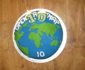
Naturally we had a cake, baked and decorated by Liz. Here’s  a Level 1 aerial image:

OSM10 Level1

I hope people remember which slice they were allocated- we’ll be expecting some edits!

In true OSM Mapping Party tradition there has to be an image of AFTER:

OSM10after

And of course we need to see who turned up:

OSM10Group OSM10 Andy

And finally thanks to Sal and her crew at 6/8Kafé  on Temple Row who generously donated a venue for us in their basement. Any OSMers visiting Birmingham, pop in for coffee and cake, you won’t be disappointed – beats the corporate coffee chains hand down.

IF YOU’RE ORGANISING YOUR OWN PARTY –  HAVE FUN

An unusual find- in more ways than one!

On 31st July the mappa-mercia gang of mappers descended on Shenstone for our monthly pub meeting. It was a glorious summer’s evening which confirmed our strategy of getting out and about around the region during the summer months to take advantage of the late evenings to combine some mapping with our usual meeting . For Shenstone we had a set ourselves the challenge to see if we could map a complete village in one evening. We did cheat slightly by pre-populating the buildings from armchair Bing aerial imagery tracing. We almost got there but not quite!

To the North of the village we came across a small memorial commemorating “Shenstone Lammas Land”. Now we all believe we know what Common Land is, it being a familiar presence in rural England, but Lammas Land had us all guessing. So a quick Google search soon informed us.

Lammas land’ is land with ‘common grazing rights’, which are grazing rights belonging to those commoners who had registered the right to graze their animals on the land.

Lammas rights go back to the middle ages, but only existed between August 1st (Lammas Day) and February 1st (Candlemas), when the animals were removed to allow crops (usually hay) to be grown for harvesting in mid summer. Then on Lammas day the animals were returned to graze off the stubble.

You can read about the villagers’ 25 year legal campaign to preserve their rights here, which successfully concluded as recently as 1998.

What a coincidence to come across this piece of Lammas Land on the eve of Lammas Day!

Local Usage of OpenStreetMap: blackcountryhistory.org

posted in: Uncategorized | 0

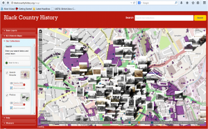
It’s always good to see the hard work you’ve put in surveying and editing being put to good use. I came across www.blackcountryhistory.org recently whilst researching listed buildings in Wolverhampton. As you can see it uses OpenStreetMap as the default map base layer – correctly attributed as well! The website is a collaboration of the museum and archive departments of all the councils in the Black Country – that’s Wolverhampton, Dudley, Walsall and Sandwell. It’s aim is broadly to provide a digital gateway into their vast reserves of historical material.

The website introduces the Black Country as:  “an area located just to the west of Birmingham right at the heart of the UK. It lies between the towns of Dudley, Walsall and Wolverhampton and is noted for its industrial past. It is so named because of the concentration of coal mining and metalworking in the area. It has no agreed borders and no two Black Country men or women will agree on where its starts or ends. American visitor, Elihu Burritt was impressed with what he saw and said in 1869 ‘ The Black County, black by day and red by night, cannot be matched for vast and varied production by any other space of equal radius on the surface of the globe.’ ”

It’s no longer like that of course. It now provides a rich source of  industrial heritage and searching out particular sites or buildings associated with past industrial powerhouses provides a great incentive to getting out and surveying. It’s just very sad  that the major preservation body in the UK, the National Trust, ignores all this and concentrates on preserving the country houses of the aristocracy and nineteenth century factory owners, i.e where the wealth got spent by the few rather than where it got created by the many.

blackcountryhistory

OpenStreetMap 10th Birthday Party Saturday August 9th

posted in: Mapping Party, Participate | 1

OpenStreetMap’s 10th birthday party is on Saturday Aug 9th. We’ll be celebrating here in the West Midlands complete with birthday cake alongside scores of other cities and communities around the globe.

It’s hard to believe just how much we’ve developed our map and community in 10 years.

Anyone who has ever contributed to OpenStreetMap in the West Midlands or adjoining counties is welcome to come along and chat about the past 10 years of mapping and probe into the future of the next 10 years. That’s about 1,000 of you! Or indeed anyone who has ever registered as a user and not been able to make an edit – see how you can get started! Or anyone who’s just interested in maps and wants to find out what we’re about.

Our venue is very central. We’ll be located in the basement of 6/8 Kafé on Temple Row B2 5HG from about 12noon until about 2pm. Being mappers we have to provide a map on how to get there: it’s here.

Get there early or there may not be any birthday cake left (only crumbs, smiles and photos).

Birthday cake will be provided by Andy Robinson’s partner Liz and judging by the food we got at past  planning meeting at Andy and Liz’s house – its an event not to be missed!

6/8 Kafé are generously providing the space free to us so come along and sample some of their coffee and food. The venue has been voted as one of the top 50 coffee shops in the UK by readers of The Independent newspaper. Google Reviews opines: “ Relaxed cafe where coffee-mad baristas serve up artisan brews, home-baked cakes and deli fodder.”

Join us for your first global birthday party. Pop in and stay for as long or short a time as you like.

Tysoe Mapping Party May 31st 2013

posted in: Mapping Party | 2

On Saturday we held a mapping party in the Warwickshire village of Tysoe (it’s really Upper, Middle and Lower Tysoe) strung out along the foot of Edge Hill. Edge Hill was the site of a Civil War battle in 1642 – fought just to the North of Tysoe, close to the village of  Radway. We were based in the Village Hall  to take advantage of its wifi.

Thanks are due to Mike and Sue Sanderson for organising the event, the local WI for providing the refreshments and the 55 residents who turned up to contribute. Contributions ranged from long walks along unmapped footpaths, geo-tagged photos, addresses and postcodes along with a wealth of local knowledge and history that only residents can provide.

We had a screen displaying OpenStreetMap live edits and people were engrossed to see themselves as part of a much wider mapping community, watching what was going on around the world and seeing their local contributions making an appearance.

Rob and I were hard-pressed entering the data provided, answering questions and demonstrating various editing techniques. We were both exhausted at the end of the day!

The map is considerably improved and will continue to evolve as the local community and Parish Council evolve a Neigbourhood Plan. Several people expressed an interest  in developing their editing skills and we look forward to helping the good people of Tysoe develop their map.

We were so busy during the day that we forgot to take any photos of the event!

For readers not based in the UK the WI is the Women’s Institute – a venerable UK voluntary body set up in 1915 to revitalise rural communities by encouraging women to join the war effort in food production. Its aims have since broadened and it now the largest women’s voluntary body in the UK with over 200,000 members. You can find out  more here.

Mike Duffy (OSM username Miked29)

posted in: Uncategorized | 0

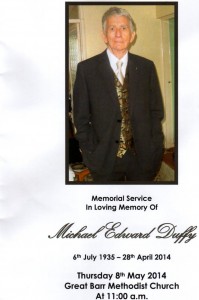
It was the sad duty today for Andy Robinson and I to pay tribute to Mike’s contribution to OpenStreetMap at his memorial service, for Mike died on 28th April 2014, aged 78.

File0003

Mike was a stalwart of the local OSM community and had mapped large swathes of the Black Country and North Birmingham. He was a regular attendee at our social meetings and although his mobility was limited he did his share of walking streets to gather data in surveys  when we had our mini-mapping parties. Sometimes Mike might have to catch 3 buses to get to an event, but he’d always be there. Mike compensated for his limited surveycoverage on the ground by spending hundreds of fruitful hours armchair mapping from aerial imagery and Ordnance Survey OpenData.

If you’d like to see just how significant Mike’s contributions were, a summary can be found here

Those of you attended SotM 2013 at Aston University in September 2013 may well remember Mike in his orange volunteer T-shirt (a much prized item of apparel according to his daughter Julie). He might well have issued you your delegate credentials, and if you bought a spare T-shirt you will almost certainly have bought it from Mike.

Our personal condolences from local mappa-mercia OSMers and organisational condolences from the wider OpenStreetMap community go to Mike’s children John and Julie and to his wider family and circle of friends.

Wherever Mike is now I’m sure he’s trying to map it!


Musings on tag historic=memorial

Following on from my blog recently about the tile in Birmingham Snow Hill Station to an unknown cat,  I received a lovely email from the Press Office of London Midland, the railway company that manages the station.

“I believe the old Snow Hill station (before closure in the 1960s) had a real station cat (like many railway stations) to help keep mice at bay!! When the station re-opened in the 1980s, a tile was installed in memory of the former role of the station cat.  I understand the staff at the station were keen to see it retained and this was supported by the station manager – hence the tile will be staying after the refit.”

I subsequently asked the obvious question “Did the cat have a name?” but the Press Office didn’t know. So any Midlands readers out there – do you know anyone who worked at Snow Hill station in the 1960s who might know?  The Press Office suggested tongue in cheek that “Snowy” might be a good posthumous name.

There is a Wikipedia entry for anyone interested in the history of the station.

So – on to my musings. How unusual is it for there to be memorials to animals? I know the rest of the world thinks Brits are hyper-sentimental about animals, but even here in the UK I can think of few public (civic) memorials to animals. So would anyone like to contribute about memorials to animals they’ve mapped? I’m expecting a few about famous racehorses; famous warhorses and heroic actions by rescue dogs, but I’m prepared to be surpised.