Mysterious Objects: No 6 in an occasional series

posted in: Observations | 3

Cat Tile Snowhill Station

Snowhill station in Birmingham is undergoing a major refurbishment at the moment. This tile which is curiously situated about 6 inches off the floor opposite the automatic ticket barriers ( well they’re designed to be automatic for everyone with a normal ticket but still need to be manned for travellers with passes – even those with smartcard capability – that is when the rail company bothers to staff the barriers, other wise they’re just left open)

But back to the tile of the cat. I’ve been meaning to find out its significance which is obviously high because before the tiles were stripped from the concourse the cat had the ignominy to be covered up with a  large sign reading “DO NOT REMOVE THIS TILE” so that the contractors could leave it in place. It will be interesting to see how the tile is presented when the wall gets its final treatment.

I’m always meaning to stop and ask someone in authority on the station to explain but I’m always in a rush to get somewhere so I never do. So I rely on the power of the web for somebody to let me know what it is.  Then I can tag it appropriately. This is real micro-mapping

Any offers?


OpenStreetMap recognised by Free Software Foundation Europe with Document Freedom Day Award 2014

On Saturday evening 22nd March at the Warehouse Café in Digbeth Birmingham members of mappa mercia received the annual Document Freedom Day Award 2014 on behalf of the OpenStreetMap Foundation from the Free Software Foundation Europe, whose members travelled down from Manchester for the event.

DFD certificate


Document Freedom Day is organised every year by the Free Software Foundation on the last Wednesday of March “ for celebrating and raising awareness of Open Standards and formats . On this day people who believe in fair access to communications technology teach, perform, and demonstrate.”  So watch out for events all round the world this Wednesday 26th March.

Last year’s award went to  Die Tageszeitung  for using  five Open Standards in publishing  their daily newspaper.

Receiving the award Brian Prangle long time OSM contributor and local mappa mercia community co-ordinator said: “It’s always great to have your work recognised, so thank you, on behalf of all the hundreds of thousands of contributors to OpenStreetMap, to FSFE for their award. We’re thrilled that you see OpenStreetMap as making such an effort towards open standards and it’s especially pleasing that you position us as an ‘emerging standard’”

DFD award


A celebration is nothing without a cake, so apart from the mandatory certificate which we can share with the whole of OSM, FSFE generously provided a superb cake which we ate so unfortunately we can’t share it! But rest assured we worked hard on behalf of OSM and devoured as much as we could before heading off to a nearby pub.

 DFD Cake

“This was a wonderful opportunity to learn about the achievements and problems faced by a sister movement” said Anna Morris from the Document Freedom Day campaign. “We found that we have many common goals and ample opportunity to share skills and resources.”

DFD cake cut

We had such a good time with a lovely bunch of people from FSFE and as Anna said we share many goals and ideals so we are planning to keep the contact and collaboration going to see how we can assist each other.

DFD group

Images   Andy Mabbett,
CC-by-SA 3.0

Not all Notes are equal

The Notes feature available on the OSM home page is a great way to encourage non-mappers to add comments and point our errors and omissions (it’s also a great method for mappers too!)

BUT …. now all the extant OpenStreetBugs Notes have migrated over , some of which are YEARS old, it’s all getting a bit crowded and hard to differentiate new notes.

I like to view new notes and try to encourage those who have added them to add more by either amending the map where it’s obvious what’s needed or I know the area; doing a ground survey if it’s close or adding a comment where the note is not clear. The encouragement only works if the note is acted on quickly.

So I have a proposal whereby notes are differentiated by age, gradually fading in colour as they age until they turn white , (much like us really!)

 So for example new notes get a bright colour on the day they’re created, then fade at week, month, 3 month, 6 month old until they become white after a year. I’m sure that to those who code such things this is not a major task

Re-mapping industrial wastelands

posted in: Uncategorized | 1

For most of the twentieth century Birmingham was dominated by car production, centred at the Longbridge site to the South of the city. Originally Austin Motors, it went through many changes of name before settling on Rover. At its height the factory employed tens of thousands of workers and covered several hundred acres. It was the birthplace of the Mini and at one time Rover had 40% of the UK market.

Birmingham City Council have a good history of the company and site here.

At its collapse in 2005, the company and site were  shadows of their former selves, but the closure was still a devastating blow to the local economy. The Nanjing Automotive Group purchased the rights to MG Rover and resumed production in 2010 on a fraction of the original site and with a fraction of the workforce.

The remainder of the site was levelled and stood empty as a stark reminder of Birmingham’s past.  The empty space was quickly subject to ambitious plans for  massive regeneration. Led by the developer St Modwen Group, a complete new urban centre has been envisaged.   It includes a new town centre with retail space, residential areas, a new park, the relocation of Bournville College, a new transport interchange and large industrial and office parks for local employment.

So lots of work for mappers as the site development rolls forward!   Bournville College  relocated there in 2011, there’s a Technology Park (opened 2007), an Industrial Park (opened 2008), hotel, bars, cafés and a Sainsbury’s supermarket (opened August 2013) already open. A new park aptly named Austin Park runs through the centre of the development. Housing is going up at a rapid rate.

Luckily local mappers have the co-operation of St Modwen Group which  makes it easy for us to gain access and stay abreast of the development schedule. It also gives us an insight into the issues associated with assigning new road names and new postcodes and the ensuing mayhem for delivery drivers waiting for satnav systems to catch up.

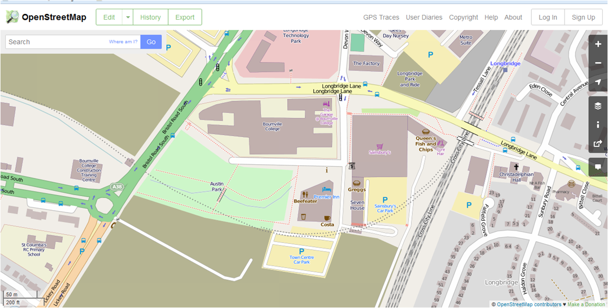
Naturally we’ve been busy and have the most detailed and up-to-date maps of the new town centre, and we are able to keep pace with the development as it progresses. Needless to say we have NOT  used any copyrighted plans or maps – we’ve done it all by survey and observation.

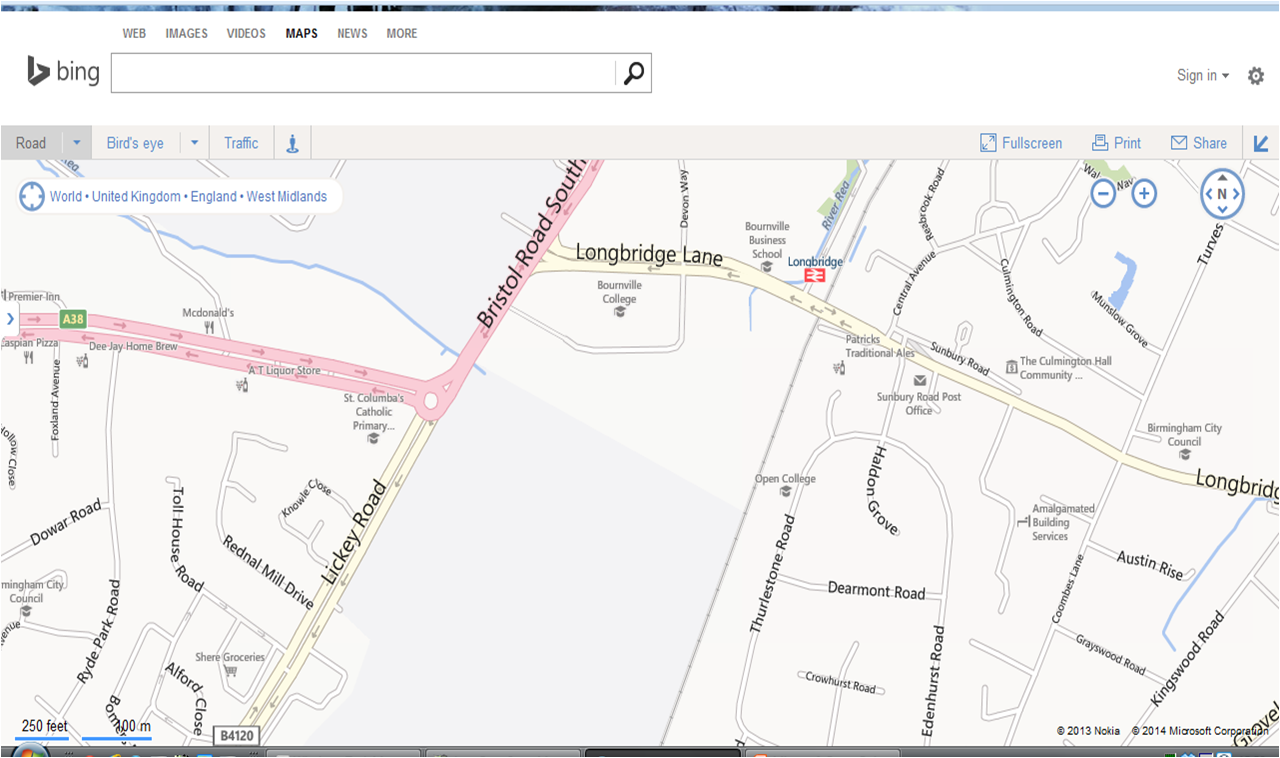
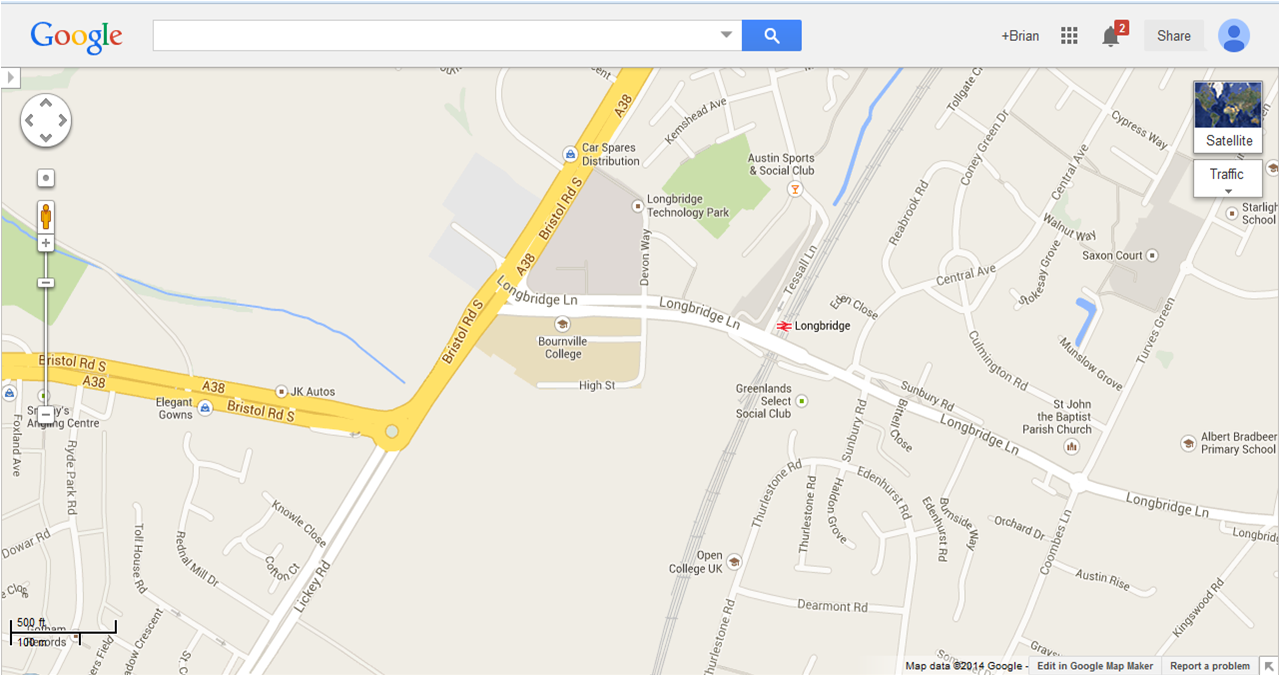
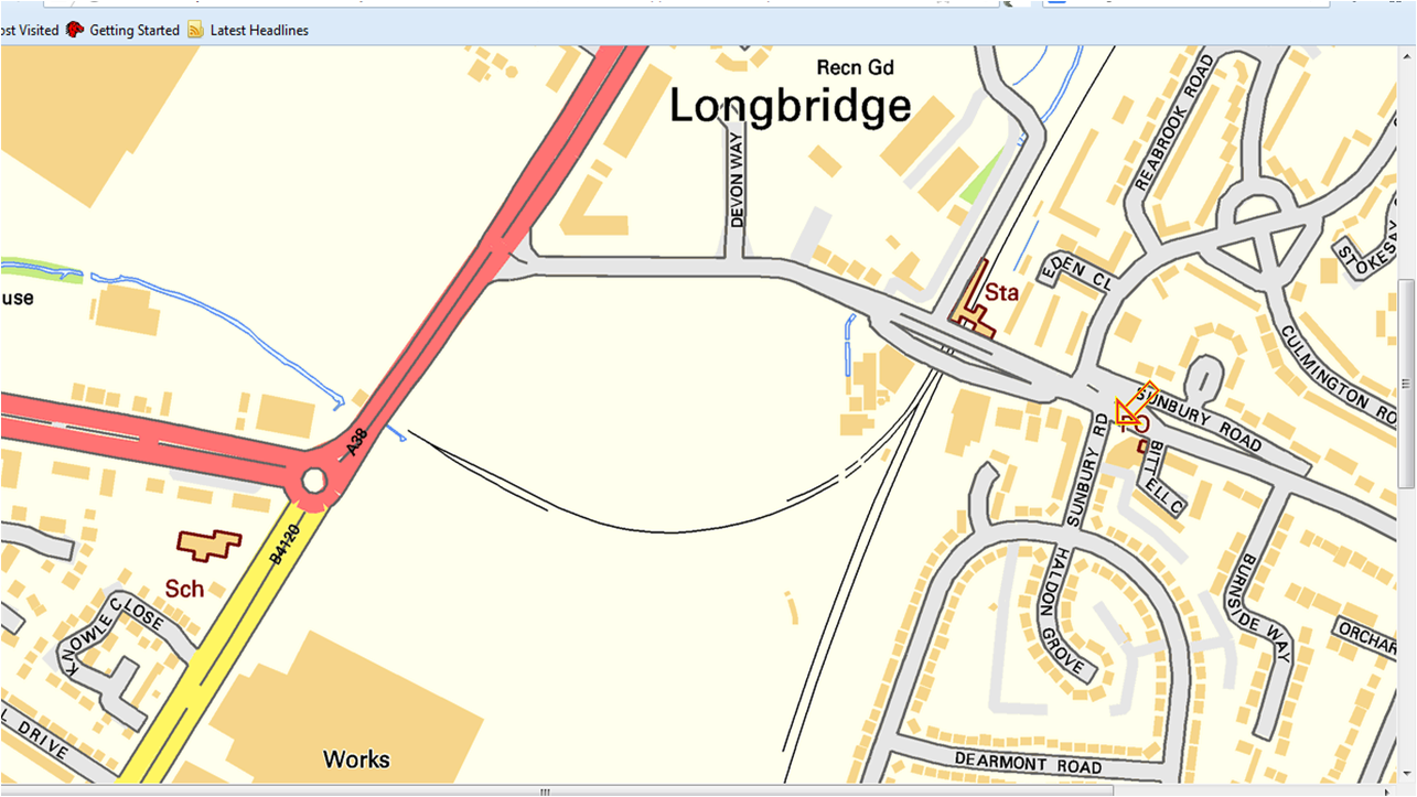
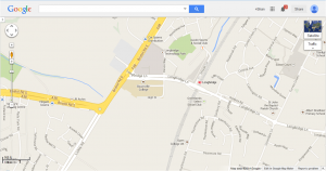
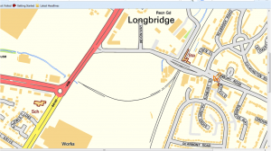
Here are views of Longbridge from Google,Bing, Ordnance Survey and OpenStreetMap (spot the best!):

Longbridge BIng Longbridge GGLe Longbridge OS Longbridge OSM

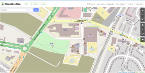
If you want to explore the area more fully  in OpenStreetMap  start here

So the methods, tools and volunteers of OpenStreetMap once again demonstrate that for keeping pace with the organic development of urban environments there really is no competition. If we can develop better  links with urban planners and developers then perhaps we can become their  natural go-to partners.