Have you been following our UK quarterly project to fix road names in OpenStreetMap and been wanting to contribute but don’t know how? If yes, then read on to find out how.
Firstly OpenStreetMap is a volunteer driven project that aims to build a free map of the world. The first 10 years of this project have been extremely successful – our contributors have collected data that is so rich and diverse that OpenStreeetMap now powers map data on hundreds of web sites, mobile apps, and hardware devices. Welcome to our community!
There are two ways to contribute to OpenStreetMap: you can notify the community of something that needs changing, or you can jump in and make the change yourself. Notifying the community is the easiest option but it may take some time for the change to be made. To add a note head over to openstreetmap.org and click “Add a note to the map” (the icon just above the question mark on the right hand side). You will need to drag the pointer to the correct location and type a comment in the text box.
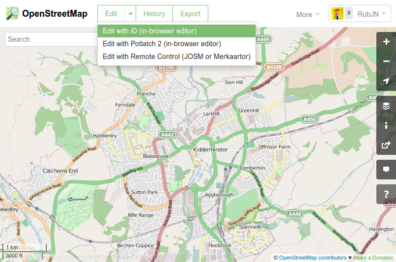
Editing the map data requires a few more steps but the guide below will help you to fix a road name. We will be using the iD map editor but this task can also be accomplished with other map editing software such as Potlatch 2.
To check for incorrect road names in your local town move the map to the area of interest and click the “Edit” drop down arrow, then “Edit with iD”. This opens the iD map editor. If this is the first time you have used iD you will get a walkthrough guide that shows you how to edit OpenStreetMap. This guide can be restarted at any time by pressing “h” to bring up the help menu and then clicking “Start the Walkthrough”.
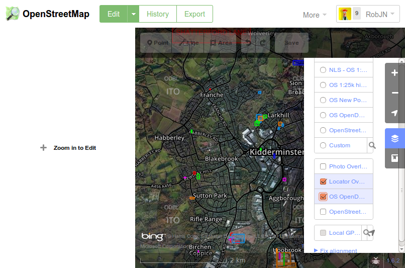
To see which road names need checking in your area click on the background settings icon on the right (or press “b”), then tick “OS OpenData Locator”. This brings up any brightly coloured squares on the map which indicate where the Ordnance Survey has a different road name than that of OpenStreetMap.
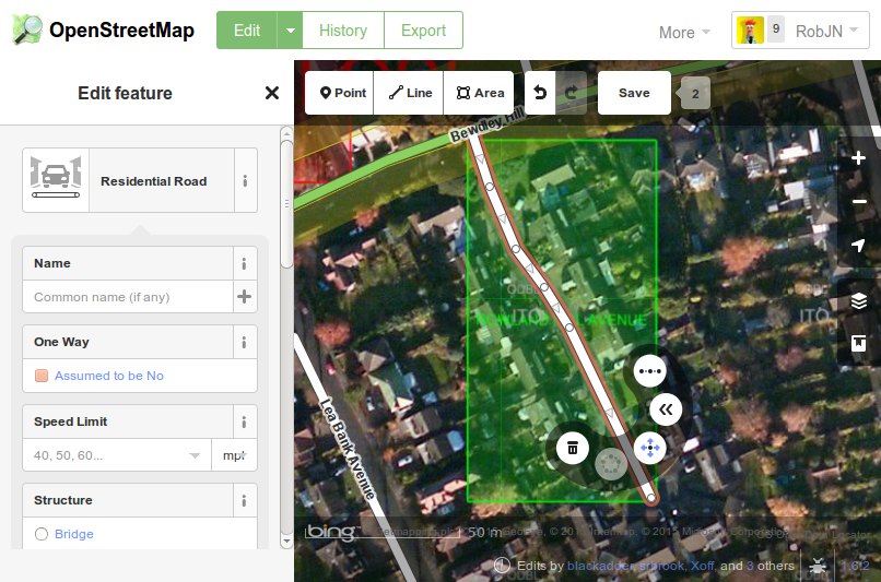
Once you confirmed the correct name (for example, by seeing what the road sign itself says) the you can enter this in OpenStreetMap by clicking on the road and then typing the name into the “Edit Feature” panel that opens on the left. Once finished don’t forget to click “Save”.
Congratulations, you are now part of a community of mappers that contribute and maintain data about roads, trails, cafés, railway stations, and much more, all over the world.
weekly 240 – 17.02.–23.02.2015 | weekly – semanario – hebdo – săptămânal – haftalık – 週刊 – týdeník
[…] RobJN describes in his blog the easy approach for locating and removing incorrect street names in the UK. […]
Getting Started with OpenStreetMap – Geospatial
[…] A tutorial to Edit Street names. […]