Greg Swinford has developed some tools for visualising Food Hygiene Rating Scheme (FHRS) and OSM data, finding possible matches between it and importing useful tags into JOSM.
FHRS data is a useful source of postcodes and addresses, and it can also be a helpful reminder of local establishments to add to the map. The tools will help us to efficiently add and verify data in our local areas (rather than importing large amounts of data automatically).
FHRS is a central government scheme run by the The Food Standards Agency: the inspections are carried out by local authorities.The food hygiene rating or inspection result given to a business reflects the standards of food hygiene found on the date of inspection or visit by the local authority. The food hygiene rating is not a guide to food quality.
Greg has created a set of maps (one per OS Boundary Line district) for the West Midlands and uploaded them here: https://dl.dropboxusercontent.
Greg doesn’t have the time or computing resources to update the data very regularly or to widen the geographical area beyond the West Midlands, but the code is freely available at http://github.com/gregrs-uk/
The tools are a fantastic resource, enabling you to find estbalishments that haven’t been mapped and also for adding addresses and postcodes for thos that have already been mapped
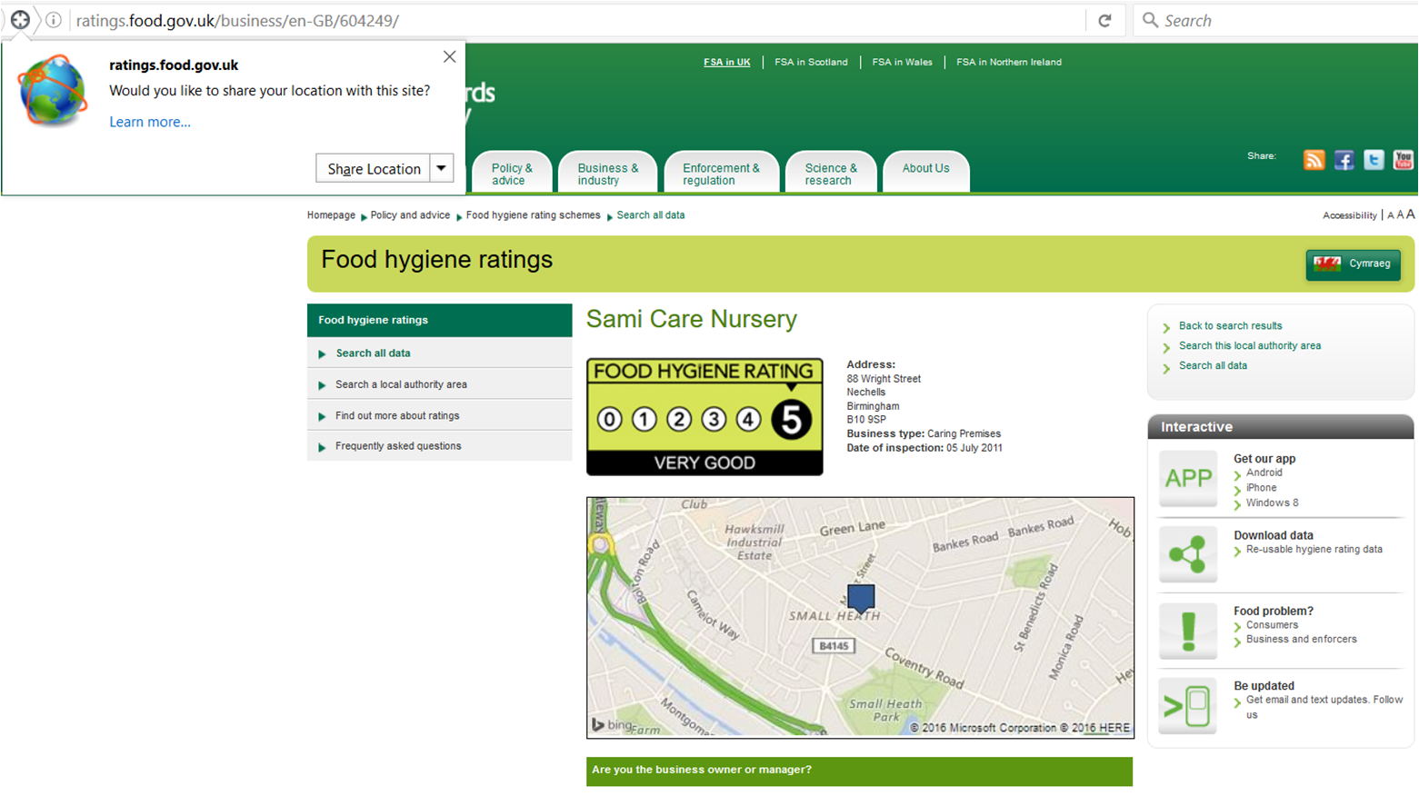
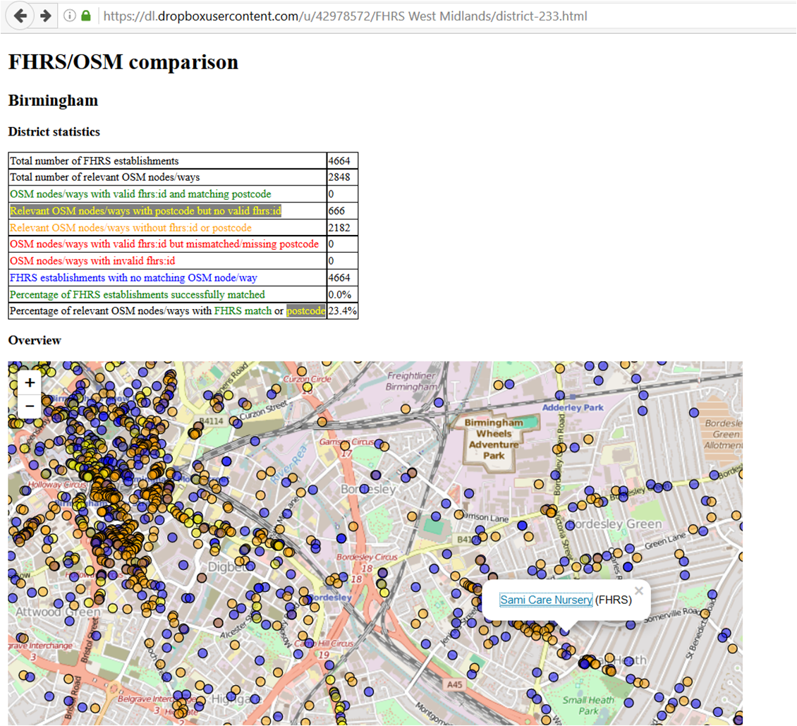 When you click on a POI you get the FHRS data:
Leave a Reply
You must be logged in to post a comment.