This is a mini-tutorial presented as part of the UK Quarterly Project to fix road names.
There are occasions when along a long stretch of road the name changes several times. In the absence of a survey confirming that the local authority precisely defines where the name changes by placing road name signs adjacent to each other, you need some method of determining where the name changes. If you don’t have a helpful placement of road signs then a change in the house numbers is a good indication.
However, armchair mapping can make use of the OS Locator data layer whilst editing. In the example shown, there is a stretch of road with 3 names. The geometry of the OS Locator blocks is a good indication of where the road name changes.

East Side (at the foot of the image above) shouldn’t be added because it’s already named something else in OSM and needs a ground survey, but it’s likely East Side is correct , given the nearby roads running from it, named South Side and North Side.
Hutton Bank and Rudby Bank can be named as OSM has no name for them. There’s a slight added complication that the road name seems to change in the middle of a bridge. So we can split the bridge and add the names up to where the OS Locator boxes indicate, not forgetting to add the tag source:name= OS_OpenData_Locator.
Result: one small improvement to OSM road name data.
There are occasions when the OS Locator data just throws up something that is unresolvable! Is this OS adding a sense of humour to its data? Were the staff just bored? Or is there really a road with no name called No Name Road? This has to be the special case of all special cases!
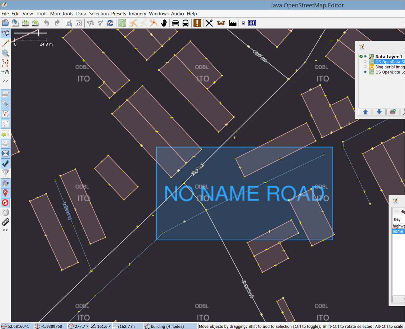
Gregory Williams
In Sandwich, Kent, there’s a road that’s genuinely called “No Name Street”:
https://www.openstreetmap.org/way/27214970
Katie Urey
OSM friends,
I stumbled upon this discussion while looking for mapathon planning inspiration. I live in Portland, Oregon, US. Our group, http://wiki.osgeo.org/wiki/PDX-OSGEO runs the local OSM mapathons.
About fixing road names…. I do not know OS Locator and will look that up. Have you looked at spiderosm.org?
Our regional transit agency, TriMet.org has been using OSM and Conveyal.com/openplans for transit routing and has put some effort to validate and complete streets. In a round about way this project inspired a project that might interest your group. It’s called spiderosm… “SpiderOSM is an open source python package for matching segments in one path network (e.g. streets and trails) to corresponding segments in another, based on geography and network connectivity. “…The documentation is easy to follow– take a look at spiderosm.org
best regards,
Katie Urey