Switching on the OS Locator imagery in JOSM for missing/mismatched UK road names is a great way to see what needs to be done in any area when you’re editing. You can enable this in JOSM from Preferences, selecting the WMS/TMS button and scrolling down the list of imagery providers to the GB section and choosing OS OpenData Locator
You can then toggle between Bing Imagery and the view you’d see below
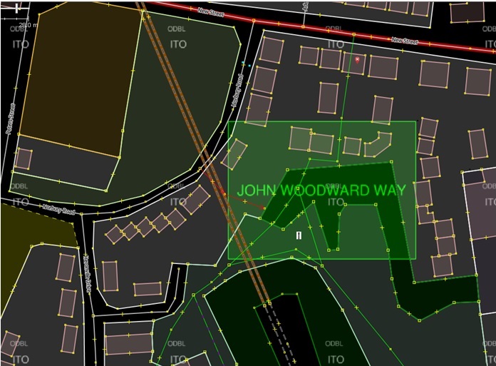
The green box indicates the extent of the missing road named John Woodward Way. Now that can be a good indicator of the extent of the road and if the Bing imagery is up-to-date then a toggle to that could confirm its layout. However in this case the Bing imagery is so heavily shaded that the road was not visible, even though the building outlines were.
So a survey was necessary, but because of the adjacent pylon my GPS trace was rubbish so using the building outlines and some photographs I was able to insert the highway=residential tagged way,with name confirmed from the street sign.
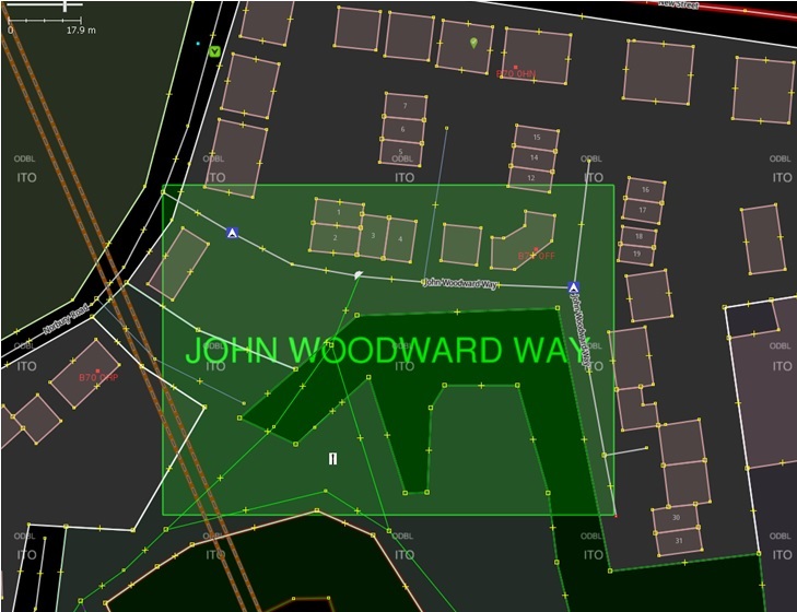
You’ll notice from the end result that I was able to improve the locality’s map by adding some addresses, traffic calming and remove a footpath which no longer exist, which is a great byproduct from fixing road names. The rectangular box is a good fit to the actual layout: but you do need either good Bing imagery or a survey to confirm.
Richard Fairhurst
Nice post. But why restrict this to experienced mappers by saying “in JOSM”? This works in any editor.