For most of the twentieth century Birmingham was dominated by car production, centred at the Longbridge site to the South of the city. Originally Austin Motors, it went through many changes of name before settling on Rover. At its height the factory employed tens of thousands of workers and covered several hundred acres. It was the birthplace of the Mini and at one time Rover had 40% of the UK market.
Birmingham City Council have a good history of the company and site here.
At its collapse in 2005, the company and site were shadows of their former selves, but the closure was still a devastating blow to the local economy. The Nanjing Automotive Group purchased the rights to MG Rover and resumed production in 2010 on a fraction of the original site and with a fraction of the workforce.
The remainder of the site was levelled and stood empty as a stark reminder of Birmingham’s past. The empty space was quickly subject to ambitious plans for massive regeneration. Led by the developer St Modwen Group, a complete new urban centre has been envisaged. It includes a new town centre with retail space, residential areas, a new park, the relocation of Bournville College, a new transport interchange and large industrial and office parks for local employment.
So lots of work for mappers as the site development rolls forward! Bournville College relocated there in 2011, there’s a Technology Park (opened 2007), an Industrial Park (opened 2008), hotel, bars, cafés and a Sainsbury’s supermarket (opened August 2013) already open. A new park aptly named Austin Park runs through the centre of the development. Housing is going up at a rapid rate.
Luckily local mappers have the co-operation of St Modwen Group which makes it easy for us to gain access and stay abreast of the development schedule. It also gives us an insight into the issues associated with assigning new road names and new postcodes and the ensuing mayhem for delivery drivers waiting for satnav systems to catch up.
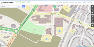
Naturally we’ve been busy and have the most detailed and up-to-date maps of the new town centre, and we are able to keep pace with the development as it progresses. Needless to say we have NOT used any copyrighted plans or maps – we’ve done it all by survey and observation.
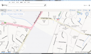
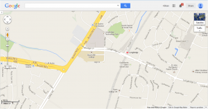
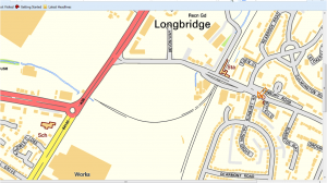
Here are views of Longbridge from Google,Bing, Ordnance Survey and OpenStreetMap (spot the best!):
If you want to explore the area more fully in OpenStreetMap start here
So the methods, tools and volunteers of OpenStreetMap once again demonstrate that for keeping pace with the organic development of urban environments there really is no competition. If we can develop better links with urban planners and developers then perhaps we can become their natural go-to partners.


http://epicshoe.Com
Nice post. I learn something totally new and challenging
on websites I stumbleupon every day. It’s always interesting to read
articles from other writers and practice a little something from other sites.
Also visit my blog post http://epicshoe.Com