I’ve meaning to visit Boscobel House and the Royal Oak for some time. Rationale: it’s relatively nearby and it’s an essential visit for anyone interested in in English History. Boscobel House sits on a 615 mile long distance path known as the Monarch’s Way. The Monarch’s Way attempts to match the route of the flight of Prince Charles ( later to become King Charles II) after his defeat at the Battle of Worcester in 1651, which marked the decisive end of the Royalist campaign in the English Civil War and the ascendancy of Oliver Cromwell and Parliament.
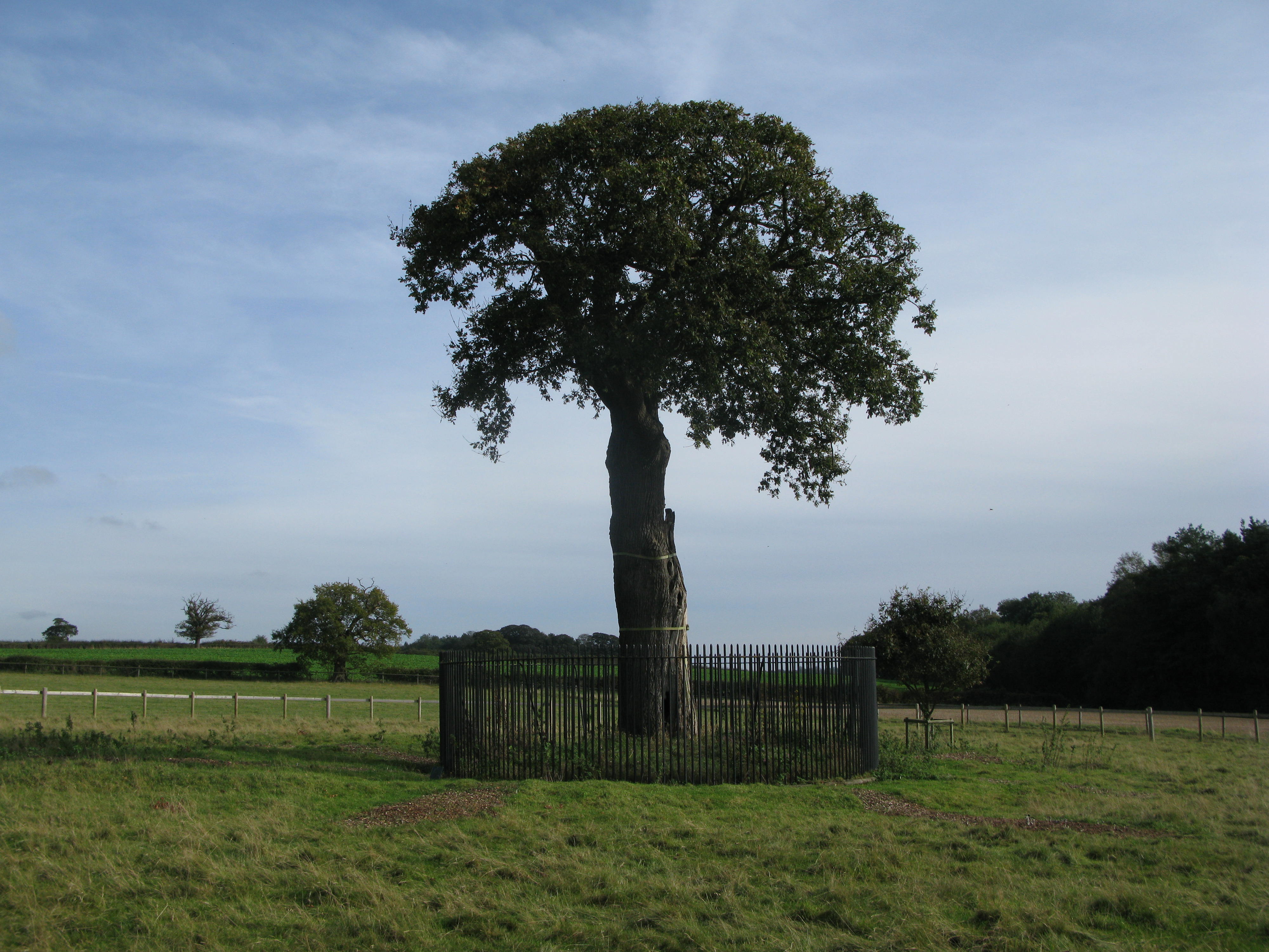
Boscobel marks the furthest point North on Charles’s flight to France and exile. Initially, Charles was led to White Ladies Priory just a mile down the road; and after a failed attempt to cross the River Severn he ended up at Boscobel, aided and abetted by the tenants, the Penderel family. Charles had to spend a day hiding in the branches of the tree before spending the night in a priest hole in the nearby Boscobel House. Hence the name: Royal Oak.
There’s a great summary of the adventures at Boscobel House here. Upon the restoration of the monarchy, Charles II awarded the Penderels a pension in perpetuity, which their descendants still receive today.
So famous did the tree become in the folklore of England that Royal Oak became a favourite name for pubs and ships of the navy. Using taginfo I found over 500 pubs named Royal Oak and over 100 roads/streets also named Royal Oak.
Souvenir hunters gradually wore away the original tree down the centuries, so what you see today is a sapling which is a direct descendant of the original. The original eighteenth century iron railings have also been supplemented with another fence some 20 metres out from the tree to make sure this one survives.
There is a backup tree which was planted from an acorn of the original tree in the year of Queen Victoria’s Golden Jubilee, 1887, which stands in the gardens of Boscobel House. Needless to say, both house and tree are protected by statute
The house and site are managed by English Heritage and are open to visitors