Fix road names with iD editor

posted in: Participate | 2

Have you been following our UK quarterly project to fix road names in OpenStreetMap and been wanting to contribute but don’t know how? If yes, then read on to find out how.

Firstly OpenStreetMap is a volunteer driven project that aims to build a free map of the world. The first 10 years of this project have been extremely successful – our contributors have collected data that is so rich and diverse that OpenStreeetMap now powers map data on hundreds of web sites, mobile apps, and hardware devices. Welcome to our community!

There are two ways to contribute to OpenStreetMap: you can notify the community of something that needs changing, or you can jump in and make the change yourself. Notifying the community is the easiest option but it may take some time for the change to be made. To add a note head over to openstreetmap.org and click “Add a note to the map” (the icon just above the question mark on the right hand side). You will need to drag the pointer to the correct location and type a comment in the text box.

Editing the map data requires a few more steps but the guide below will help you to fix a road name. We will be using the iD map editor but this task can also be accomplished with other map editing software such as Potlatch 2.

To check for incorrect road names in your local town move the map to the area of interest and click the “Edit” drop down arrow, then “Edit with iD”. This opens the iD map editor. If this is the first time you have used iD you will get a walkthrough guide that shows you how to edit OpenStreetMap. This guide can be restarted at any time by pressing “h” to bring up the help menu and then clicking “Start the Walkthrough”.
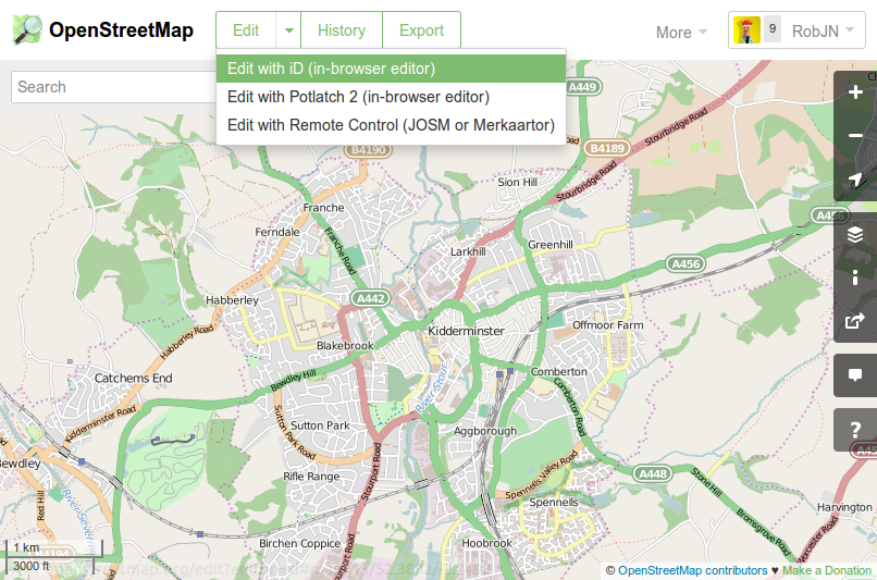
Opening the iD map editor

To see which road names need checking in your area click on the background settings icon on the right (or press “b”), then tick “OS OpenData Locator”. This brings up any brightly coloured squares on the map which indicate where the Ordnance Survey has a different road name than that of OpenStreetMap.
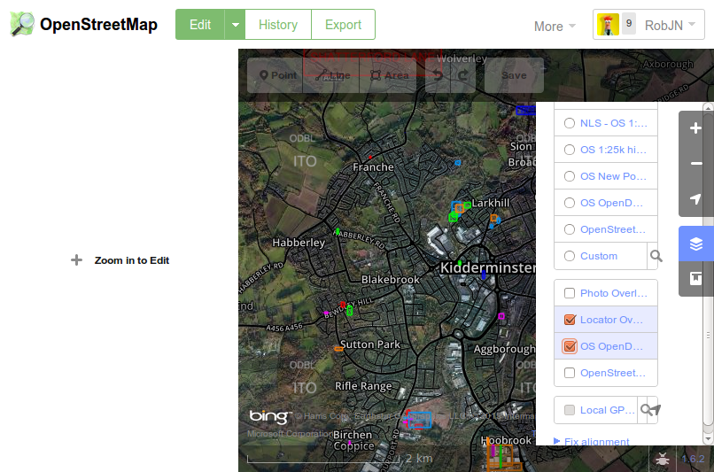
Show potential road names that need fixing.

Once you confirmed the correct name (for example, by seeing what the road sign itself says) the you can enter this in OpenStreetMap by clicking on the road and then typing the name into the “Edit Feature” panel that opens on the left. Once finished don’t forget to click “Save”.
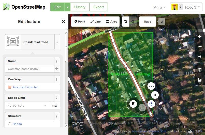
Edit the road name.
Edit the road name.

Congratulations, you are now part of a community of mappers that contribute and maintain data about roads, trails, cafés, railway stations, and much more, all over the world.

Data update for UK Quarterly Project: road name fixing

Now that Itoworld have resolved their technical problems we can see if the Road Name Quarterly Project is having an effect. Here are the top 20 local authorities from Itoworld’s OSM Analysis service:

Rank Area
Roads in
OS Locator
Road missing from
OSM
Percentage
Complete
Missing Change
Last Day
Missing Change
Last Week
Missing Change
Last 30 Days
256 Manchester 6,941 152 97.74 0 -46 -46
369 Rochdale 3,666 164 95.44 0 -31 -31
267 South Staffordshire 2,092 47 97.56 0 -17 -18
355 Knowsley 2,268 82 95.72 0 -17 -17
273 Cannock Chase 1,514 36 97.42 0 -16 -16
122 Blaby 1,598 5 99.69 0 -13 -13
139 Bromsgrove 1,693 8 99.53 0 -9 -9
400 South Northamptonshire 1,581 63 94.81 0 -9 -9
214 City Of Nottingham 3,601 42 98.56 0 -8 -8
297 Bedford 2,213 48 96.93 0 -8 -17
105 Bournemouth 1,766 2 99.83 0 -6 -6
321 Lichfield 1,738 54 96.43 0 -6 -11
103 North Wiltshire 2,249 3 99.87 0 -5 -4
159 County Of Herefordshire 2,723 15 99.34 0 -5 -6
340 Daventry 1,625 62 96.06 0 -5 -5
3 South Gloucestershire 3,629 0 100.00 0 -4 -4
113 Ashford 1,893 4 99.79 0 -4 -4
142 Ellesmere Port And Neston 1,395 7 99.50 0 -4 -4
157 West Somerset 914 6 99.34 0 -4 -4
357 Horsham 2,167 81 95.71 0 -4 -4

Thanks to all the mappers who have participated, including those not in the top 20: if you’ve only got a couple of roads left to check you’ll never appear in the top 20 but your contribution is just as valuable.

Congratulations also to those who’ve got their local authority area to the 100% mark recently: Torfaen; Dover; Gwynedd; Powys; West Lothian; Wolverhampton; and South Gloucestershire.

It would be nice to personalise this but I don’t have the necessary skills to identify the users programmatically, or the time to do it manually. Maybe privacy concerns suggest it’s not a good idea but the whole idea behind a quarterly project is to build more community engagement and co-operation so we do need to get to know each other (especially those who aren’t veteran mappers or denizens of mailing lists and chatrooms)

Currently we don’t know whether our quarterly project experiment has incentivised people to go out and tackle this problem or whether it would have happened anyway. Any feedback would be appreciated.

Reaching a new audience in the UK

At our monthly mappa-mercia pub meeting we were chatting about new ways of encouraging participation in the current quarterly project to fix street names. It seems that there are people who both contribute Notes and comment on them who might not be on talk lists nor be aware of the OS Locator data which highlights name problems. So we thought that adding Notes about road names that need fixing on the standard OSM map, asking for confirmation of the correct name might elicit some response via a comment indicating the correct name. This could then be edited by a mapper.

Potentially, by using this method we would address a new audience who are prepared to add data occasionally but don’t want to be hard-core mappers.

This method would work best for situations where OSM and OS Locator have different road names.

We’d like to try this in an area with a high density of road name fixes and few active mappers. Liverpool, Rotherham and Manchester look to be likely candidates (258, 225 and 198 road name fixes respectively). If there are active mappers in these areas who don’t want this to happen please let us know soon and we’ll keep away. You could of course volunteer another area, either for us to pilot or to do it yourself.

If we don’t get a sufficient response to our Notes we would follow up with web searches for local community groups who have twitter or facebook accounts and ask for their participation via those media.