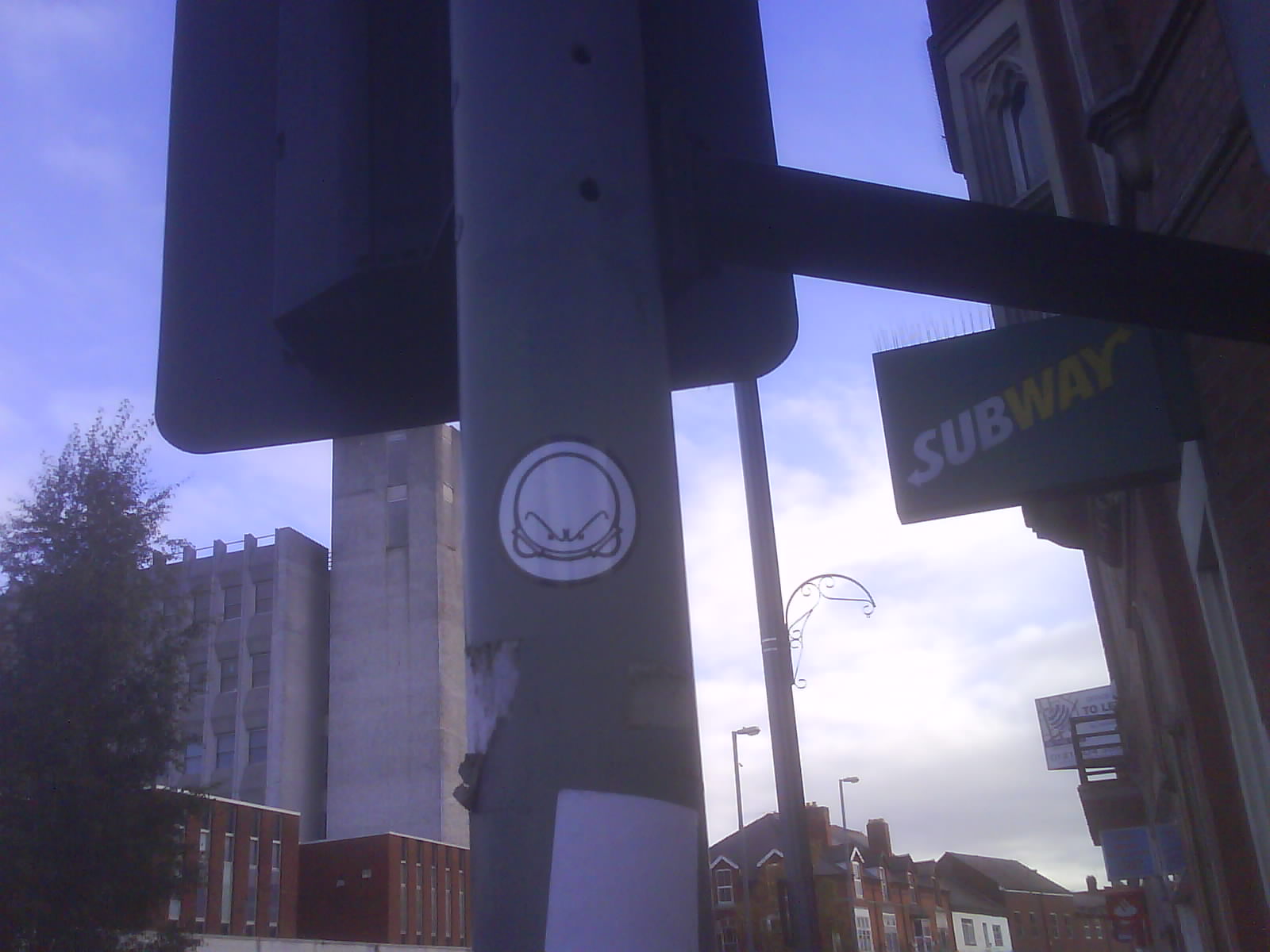
Who’s this little fella? I see stickers of him pasted up in all kinds of urban locations around Birmingham. Is he local? I’m obviously too old to be aware of urban youth culture, whence I assume he originates.Can anyone help me?
Supporting OpenStreetMap in the West Midlands.
Who’s this little fella? I see stickers of him pasted up in all kinds of urban locations around Birmingham. Is he local? I’m obviously too old to be aware of urban youth culture, whence I assume he originates.Can anyone help me?
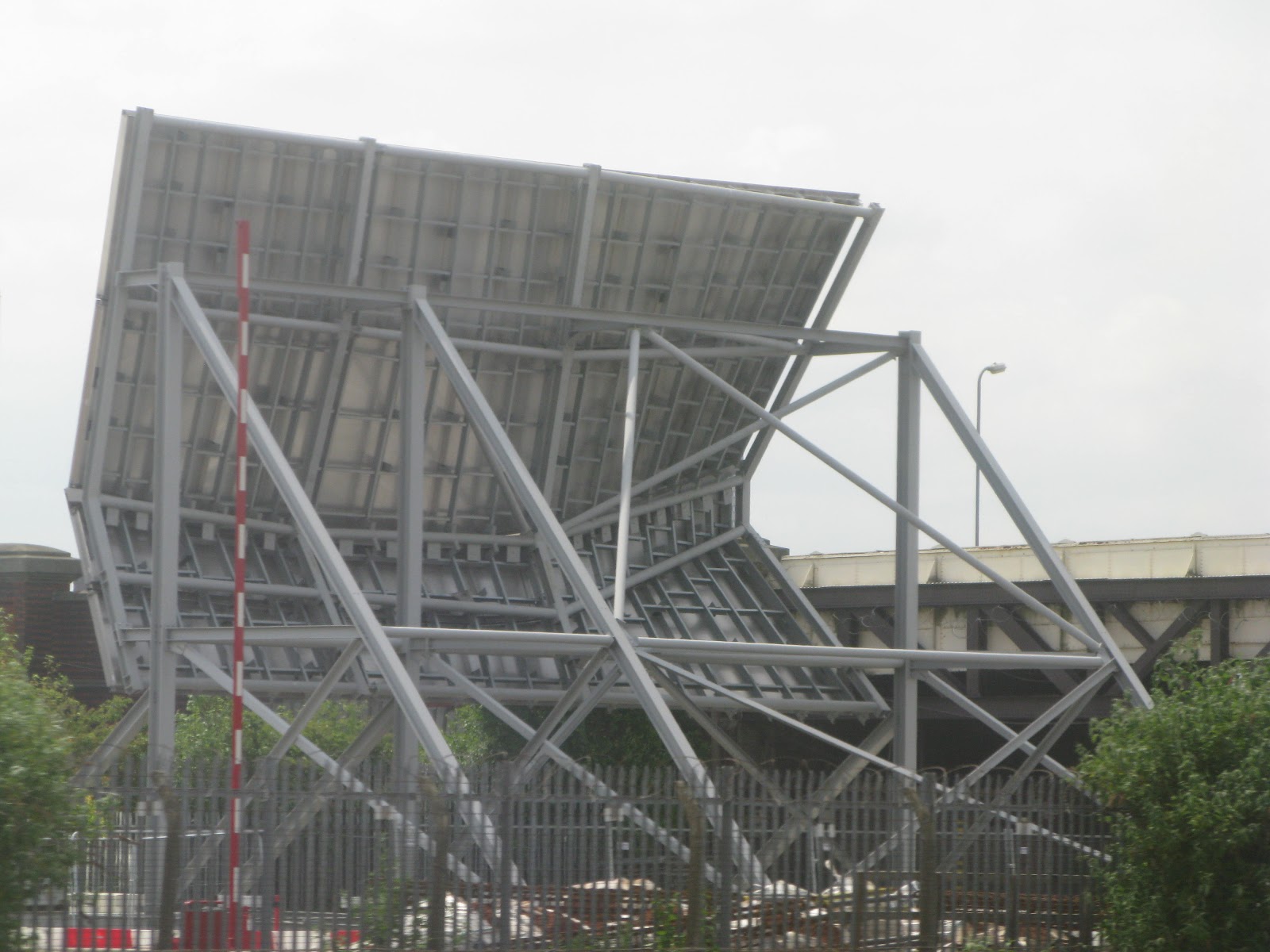 This object has been a puzzle for a couple of years. It’s been constructed on land alongside an old railway siding adjacent to Small Heath Bridge Birmingham B11. This picture was taken from a train on the way into Birmingham Moor Street.
It’s pointing vaguely westwards, i.e which is the direction the camera is pointing in. The reverse side is a highly polished surface (stainless steel?). It looks like it might be a solar collector of some kind but there are no power cables or fluid/gas pipes that I can see so it remains a mystery.
Any offers of what it might be?
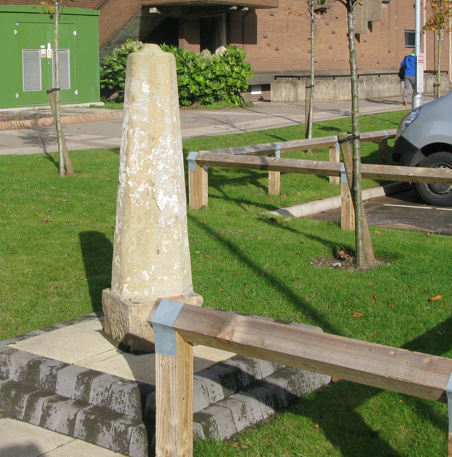
Can anyone help in identifying this object which has been lovingly placed on Aston University Campus. It’s not mapped yet: what do you tag this as? Perhaps they just haven’t got round to placing a label or information board there. Any help gladly accepted
We had a good turnout last night in the Spon Gate in Coventry – nine people, including three new faces. A special welcome to Florian who’s just arrived from France for a long stay, working in Coventry. It was a good choice of pub with some excellent choices of beer made tastier by their low cost – well done Wetherspoons!
Our discussions ranged widely and randomly as usual, including: aerial photography, postcodes, quadrocopters, bridge relations, postcodes, listed buildings, footpaths, blue plaques, postcodes, SOTM, memorials in cemeteries and parks, postcodes, tagging businesses, public bodies’ open data, plans to improve our building definition inside the Ring Road in Coventry, Natural England open spaces and all the other topics at the other end of the table I couldn’t hear.
We didn’t just idly chat, we also made some plans:
If I’ve missed anything apologies and let me know so I can add it.