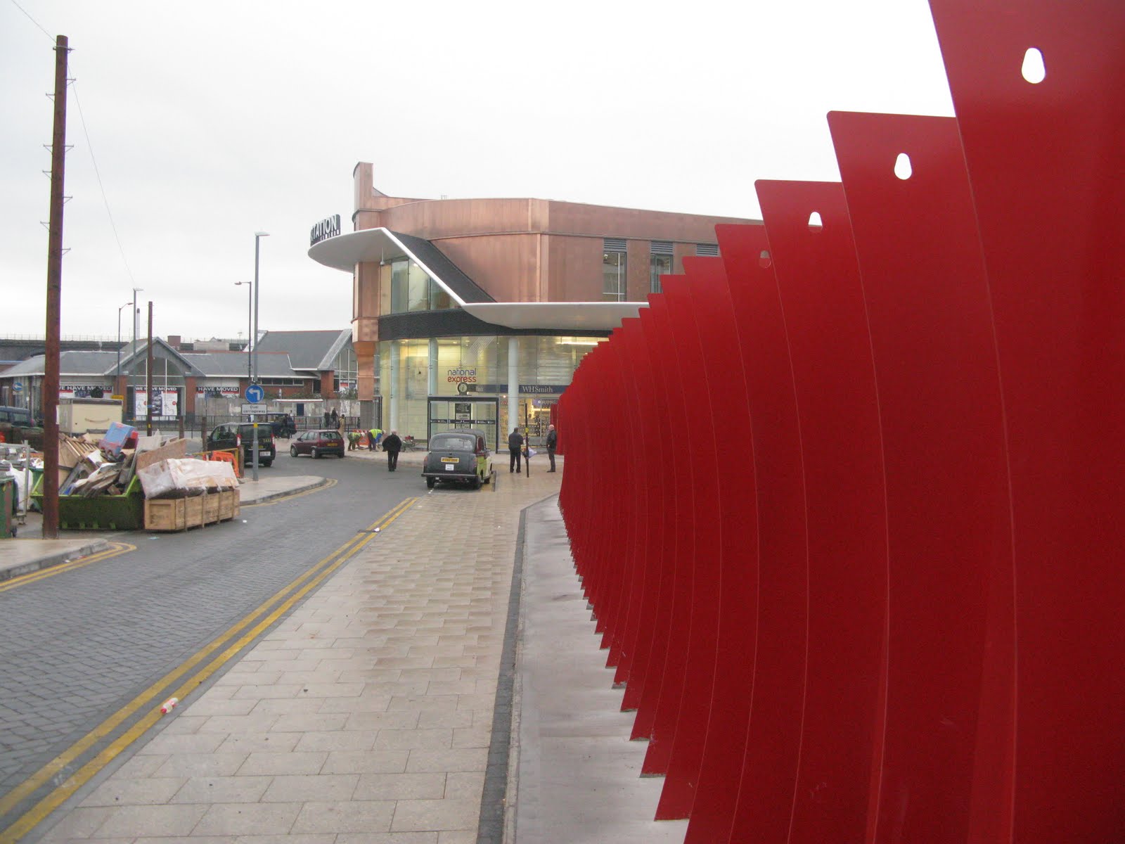
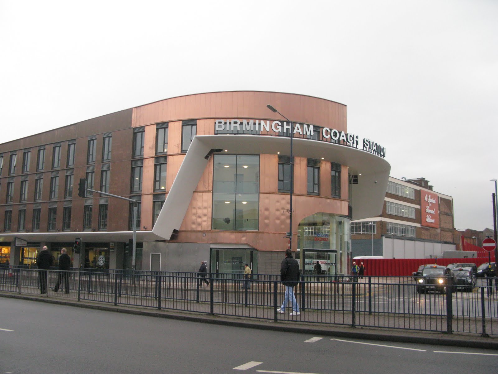
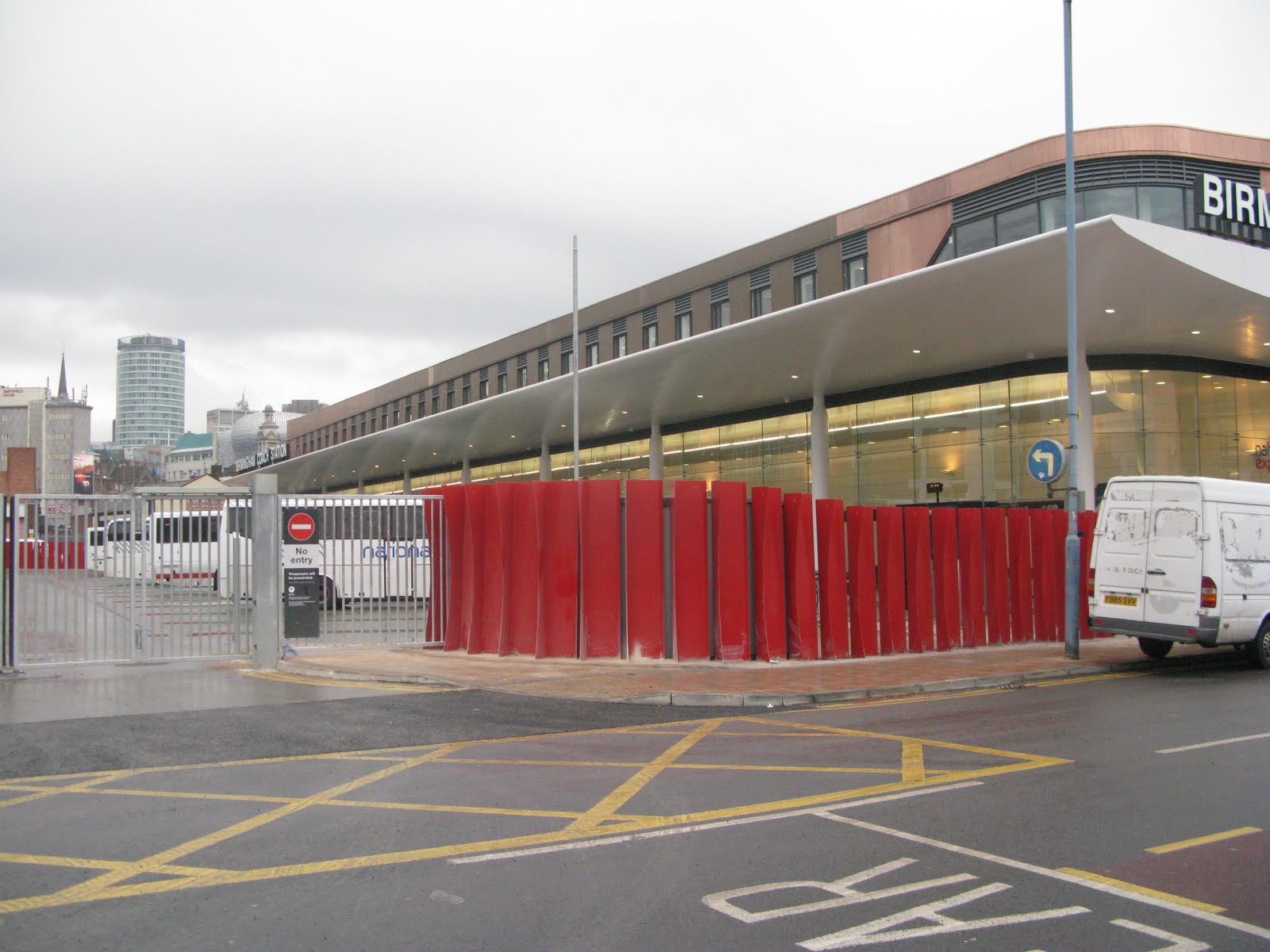
This august institution re-opened today after several years refurbishment and a temporary location in Coventry Street. Notice the change of name from Digbeth Coach Station. I did a survey this morning: check it out here. There are 16 bays tagged as bus-stops but the only renderer to pick them all out is our very own Christoph’s NOVAM. The red barrier around the bus roads is a work of art. I don’t know how long the copper cladding will remain nice and shiny. National Express sold the building two months ago for £16m in a sale-and-leaseback deal. It’s a couple of months late because the main contractor went bust. The taxi drivers I spoke to weren’t too impressed with only 4 spaces in their taxi rank.
Picturesque view of the Black Country
 To encourage us and new members that mapping the black country is not just about grim housing estates, brownfield and derelict areas and industrial sites that are barred by security gates, here is a view to stimulate us that beauty can be found in this region.
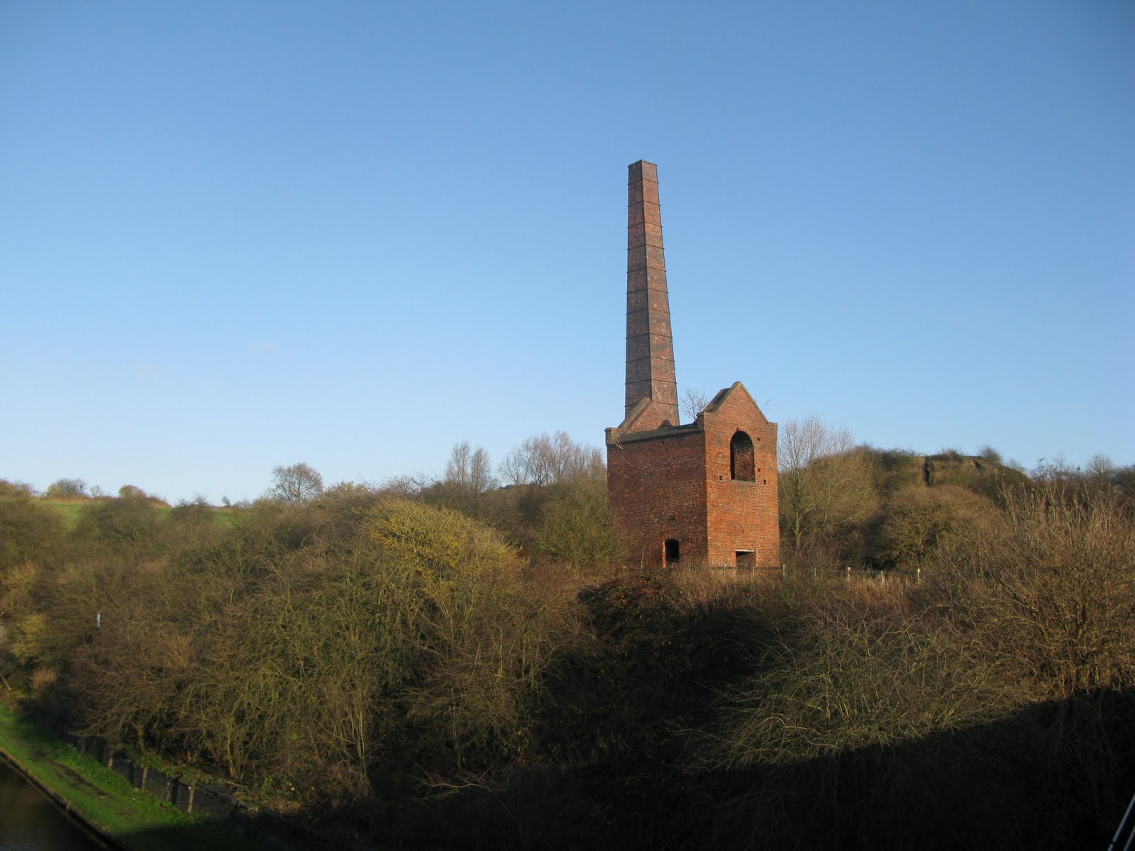
Cobb’s Engine House stands in the midst of a large nature reserve with extensive views over the region. It is situated at the confluence of a number of canals and above the entrance to the Netherton tunnel (2.5 miles long) which was the last canal tunnel to be built in Britain. There are still lots of cycle paths and footpaths to be surveyed here.
Pelsall pleasure
 As time ticks by more and more villages within the West Midlands conurbation get completed. This time its Pelsall, a 1000 year old settlement that is now part of Walsall Metropolitan Borough. It’s another old mining village though there is little sign of its earlier industrial past other than the canal that meanders peacefully around its western and northern fringes.
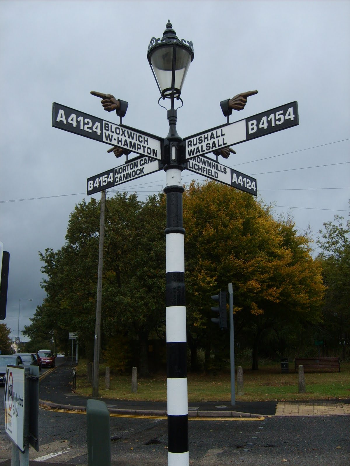
Pelsall is the home of one of the oldest Finger Posts in the country. Recently restored to its former glory it stands at the main principal road junction to the north-east of the village. Naturally such a fine monument has a road named after it; Finger post Drive.
Where the bus shelters get made
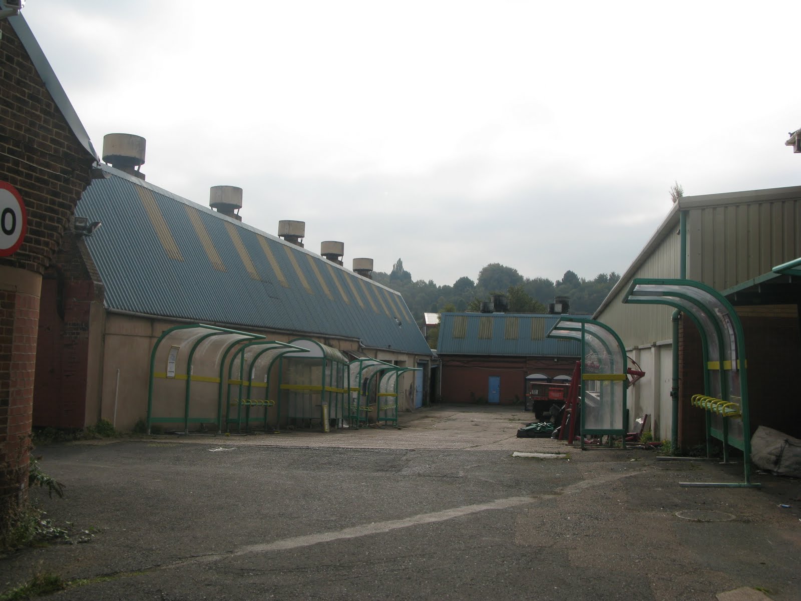 Passed by this small engineering works near Cradley Heath station and couldn’t resist taking a snap of a stock of bus shelters (didn’t tag them all though!) A pint of beer to anyone who discovers where the bus stops are made! However the picture shows the older style of bus stops so this might just be a recycling centre so I’d better do a more thorough survey next time I’m out there.
Brownhills Jigger
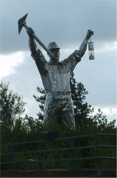
Brownhills is the most northerly town of the West Midlands; a former coal mining centre that used to be in Staffordshire. Its recent claim to fame is the creation of a 30 foot statue of a coal miner know as “Jigger”, a tribute to Jack jigger Taylor, a miner that died in the local pit in 1951. It dominats the centre of town.
Its been an interesting place to map. A real mixture of housing types, landuse and the remnants of the industrial revolution; canals and railways, some of which have been abandonded and now have a second life as footpaths or cycleways.
Tyseley Locomotive Works
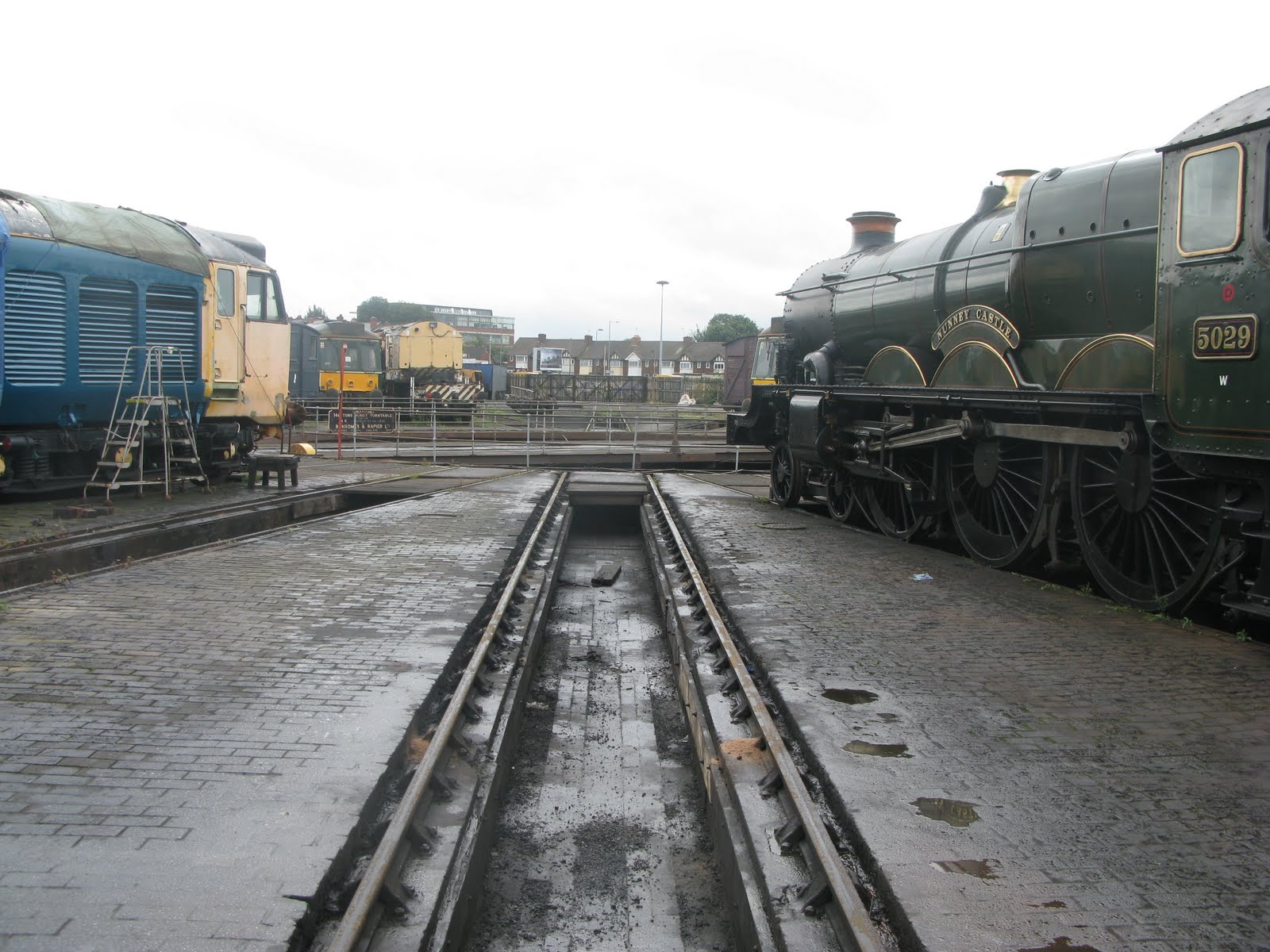
I was kindly invited in to map this area in East Birmingham following a request I made to the speakers at a presentation about the Shakespeare Express which runs from here. The Shakespeare Express is a scheduled steam service from Birmingham Snow Hill to Stratford and back every Sunday during the summer months. Walking along railway tracks makes a change from normal mapping!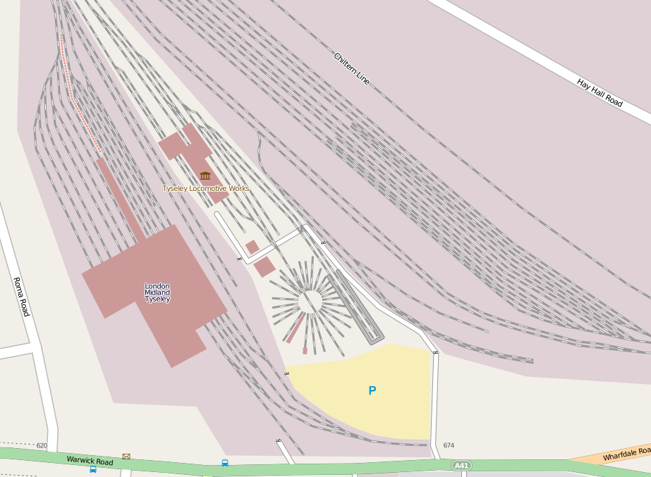
Turners Hill
After months of mapping in the Black Country and avoiding this hill I finally managed to map this (location).
It is the highest point in the West Midlands at 265m and the views from there are very extensive. It is marred by a growth of communications towers of some complicated design. Somehow, whilst taking a photo of the man-made environment I forgot to get some snaps of the views (mapping’s getting to my brain!)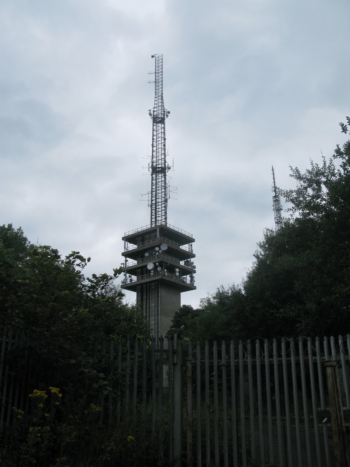
Warwick Social and Mapping
Thanks to everyone who braved a gloomy drizzly August evening and the vagaries of Warwick’s scant provision for parking. We have certainly made Warwick look a little more cared for. Here are the results.
Before: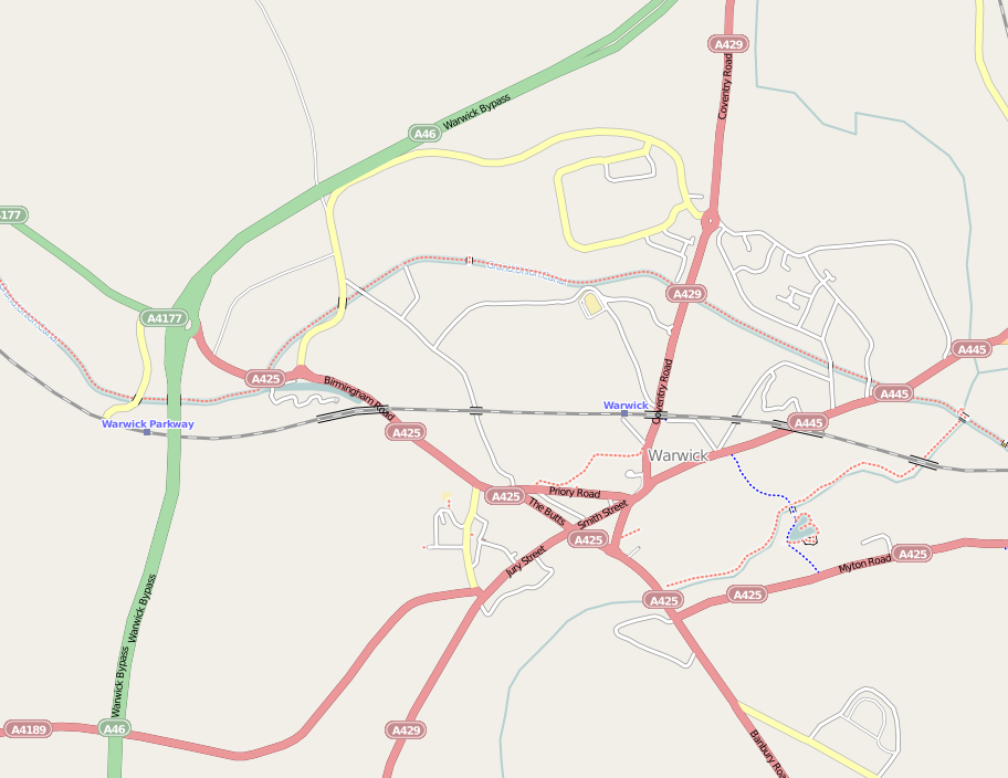 After:
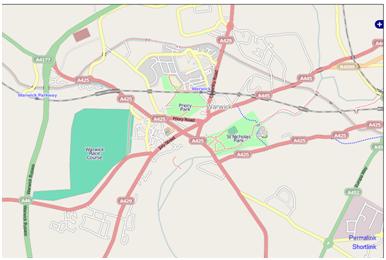 And here’s us in the Roebuck pub afterwards – you can’t see Mary cos she’s behind the camera.
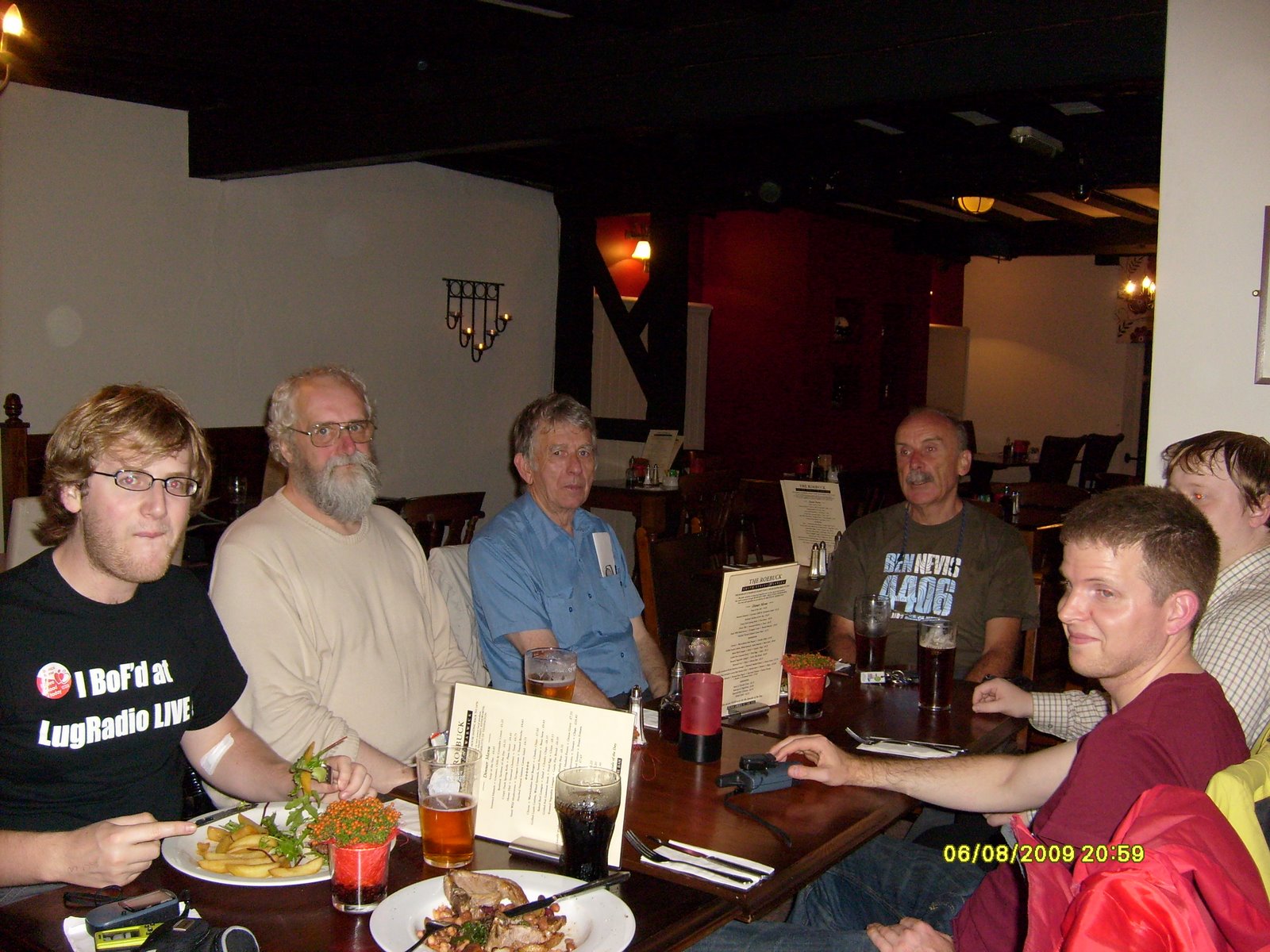
Is this the shortest bus journey in Birmingham?
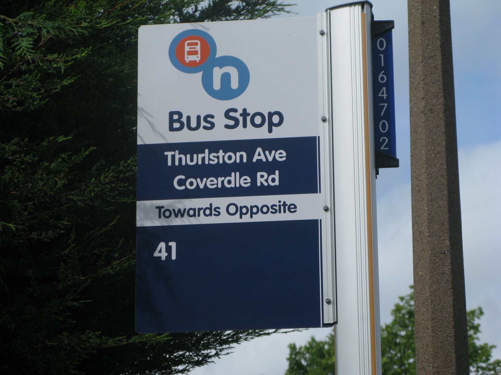
I just wonder if anyone bothers to go and check the work before they pay the invoices? And if anyone bothers to read the signs before they send them out and before they erect them? Not only is the sign nonsensical, one of the road names is misspelled too!
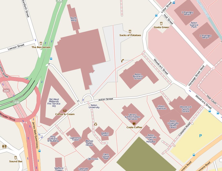
Aston Uni almost complete
Had a series of meeting last week in Aston Science Park so I took the opportunity to walk around the campus improving the map. It was graduation ceremony time so there were lots of happy graduates and families around. I was still surprised not to be challenged by security given all the CCTV cameras there are. One of my hosts opined that I probably looked like a typical Aston Uni lecturer and the security bods thought they’d better not challenge me as they might be upsetting some research project!
The observant night notice that the Astroturf Pitch has disappeared to be replaced by a construction site. The Main Building is still providing some challenges! Students Guild and the City University Bdgs to the North of the campus are still to be surveyed and I might have missed some other bdgs back of Bishop Ryder House. Would you Edgbaston boys like some help with a micro-mapping party some time?